

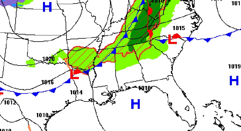
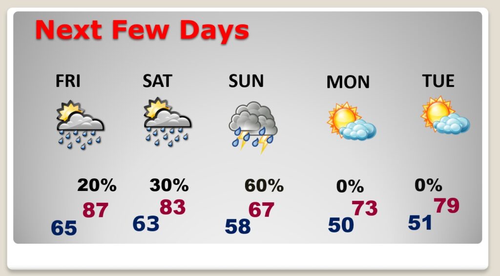
Good morning! Today will be another warm day. Normal high 79. Today’s high mid 80’s. Friday’s high in the upper 80’s could flirt with the record of 89. Toady I have the rain chance locally at 20% or less. Widely scattered showers will return to the radar screen Friday. Scattered showers Saturday. The best chance of showers and storms will be Sunday. Sunday will be much cooler with highs only in the 60’s. Here’s my brief forecast discussion.
TODAY: Mostly Cloudy through tonight. Rain chance 20% or less High 86. Southwest wind 5 to 10 mph. Low tonight 65.
.
NEXT FEW DAYS: Widely scattered showers will return to the radar screen Friday. Scattered showers Saturday. The best chance of showers and storms will be Sunday. Friday’s high will be in the upper 80’s and could flirt with the record of 89. Sunday will be much cooler with highs only in the 60’s.
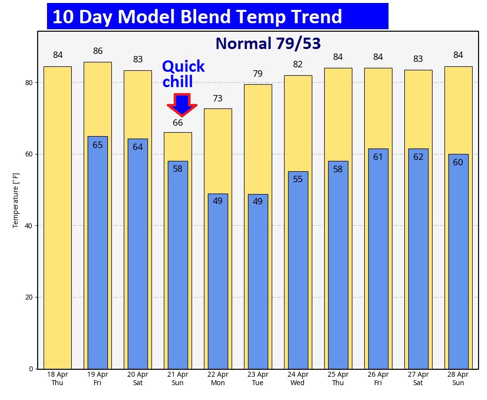
Here’s the 10 day temperature trend. Brief big chill Sunday.
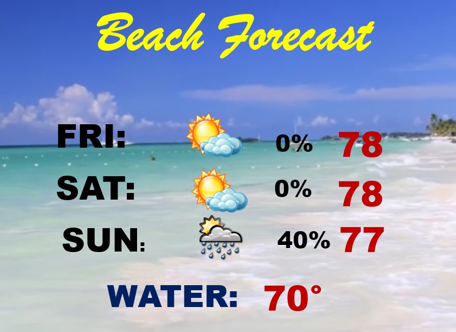
BEACH OUTLOOK: Friday and Saturday should be dry and comfortable. Scattered showers and thunderstorms return Sunday. Gulf water temperature is 70.
Thanks for reading the blog. There will be another complete Blog update and video forecast discussion tomorrow morning. This morning, everything is normal including LIVE on the Radio from 6 to 9AM on NewsTalk 93.1 – WACV. Have a nice day!
–Rich