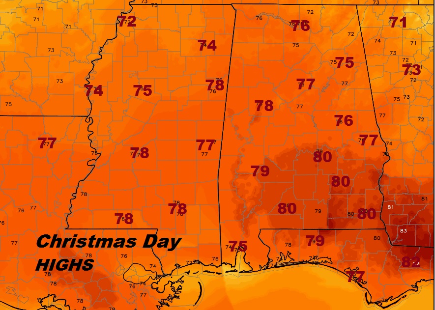
Merry Christmas! Get out the shorts. For the second year in a row temperatures will soar to near 80, close to the record of 81 in 1987. This, after a record high 79 on Christmas Eve which broke the record of 78 in 1987. This year, however, we are not dealing with any flooding, and we are expecting a dry, sunny holiday.
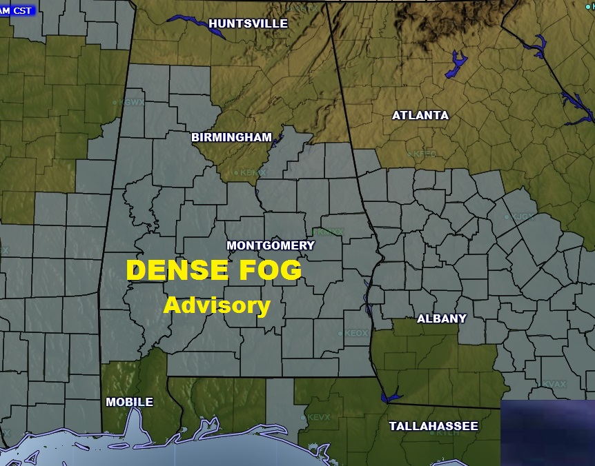
DENSE FOG ADVISORY: Dense Fog will get us started this morning. Dense Fog Advisory is in effect until 9. Take it easy if you will be traveling.
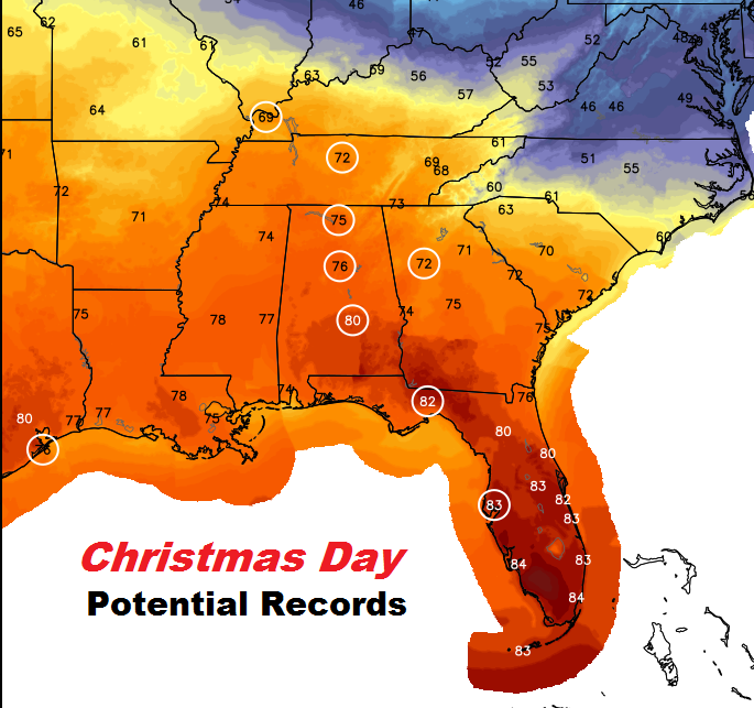
RECORD’S TODAY: Today’s warmth extends far and wide across the southeast. And, more records could fall, like yesterday, from Tennessee to Florida.
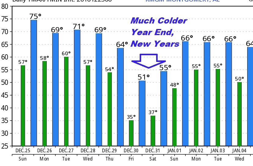
THE WEEK AHEAD: The warmth continues well into the middle of next week. Monday should be mainly dry, with low 70’s Spotty showers return Tuesday and Wednesday with highs in the low 70’s Rain chances get better Wednesday night into Thursday as a cold front sweeps across the state, bringing in much colder air for New Years weekend. Here’s a snapshot of model numbers from the GFS model showing the dramatic temperature plunge at the end of the week.
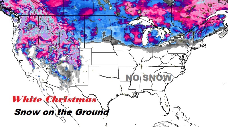
WHITE CHRISTMAS?: Ok, no White Christmas for us. Remember the snow in 2010? Or, the pipe-busting bitter cold 5° in 1983? Nothing like that this year. For snow, you need to go to the Northeast, the Great Lakes, the Upper Midwest and the Rockies. Here’s snow on the ground this morning.
Have a wonderful, Merry Christmas! Download our new advanced weather App. It’s the only weather app you need. Push alerts for all watches & warnings. 10 Day and hourly forecasts. Radar. Future radar. Plus, all these blog posts and all my tweets and videos are at your finger tip. It’s free in your app store for your smart phone and tablet. Videos will return on Tuesday morning!