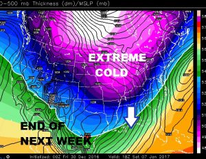
FRIDAY VIDEO UPDATE (5:00AM 12/29/16) Good Morning! It’s roughly 40 degrees colder this morning than yesterday! On this video I’ll bring you up to date on a New Years storm system (Sat Nt. – Monday) that will bring some drenching rainfall totals and maybe even some severe weather. Could affect your Midnight plans New Years Eve. Plus, hang on. The next 10 days will involve some more wild temperature swings. Apparently, we are in for a real dose of winter roughly 7 or 8 days down the road. Your Friday morning, New Years weekend weather briefing.
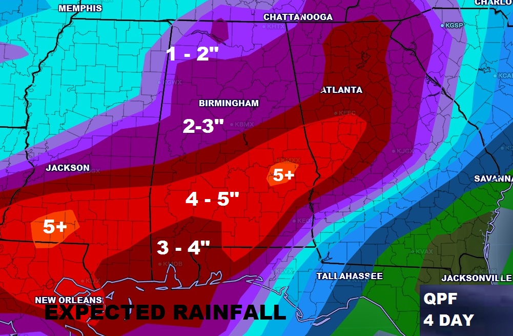
Excessive rainfall totals Saturday night through Monday. Many places receiving 4 to 5″. Some spots more. Maybe even some strong to severe storms by Monday evening.
Euro model shows an active 10 days ahead. Wild temperature swings. At least a couple of storm systems. A big Winter Blast about a week away. And, maybe some winter mischief too? Not out of the question.
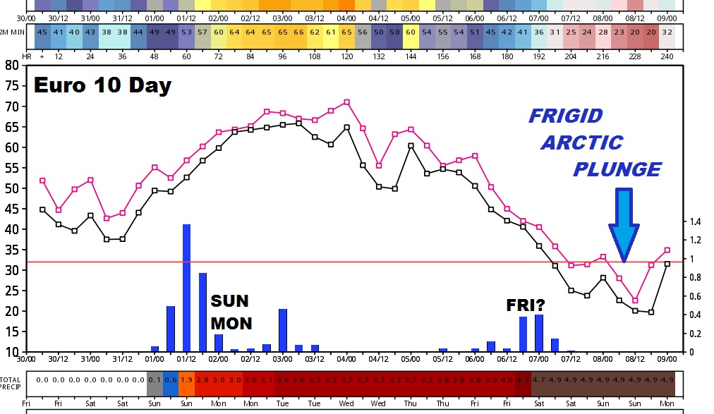
The Big Winter Blast is about a week away.