
Go with me to Publix or Costco or the Laundry. People are stopping me. There’s only one question on their mind. Is it going to snow? Up until now, I have been rather noncommital on the answer. Only because of model data, which is very much NOT in agreement on the sequence of events.
THE SET-UP: Friday will be a cold day. Our high will struggle to reach 45. So, cold air will be in place. That’s one check mark. Low by Saturday morning 29. Classic for us, a low pressure area will be moving out of the western Gulf and along the coast. The exact track the low takes makes all the difference in the world.
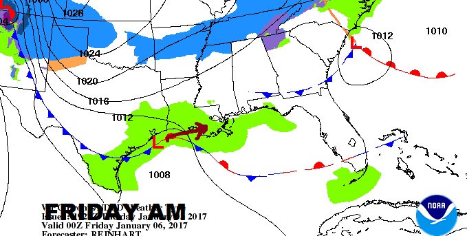
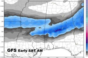
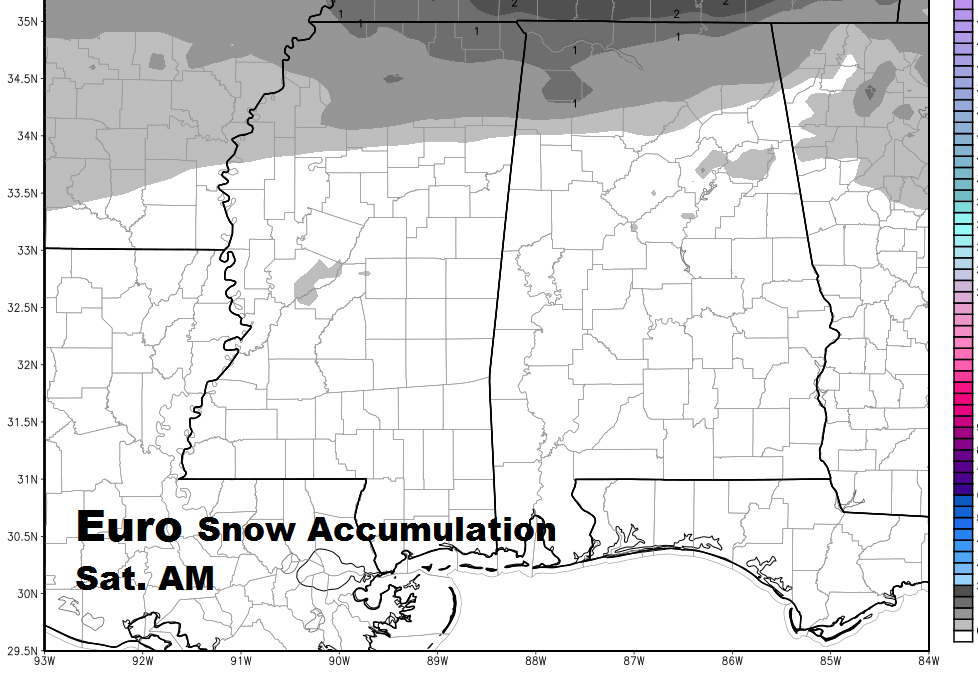
TWO GLOBAL MODELS: Both the GFS and the Euro models bring a rain into central Alabama Friday night. Both models suggest it will become a wintry mix: rain/sleet/snow perhaps changing to snow. But the models vary greatly on possible accumulation. The GFS has been bullish and consistent for a couple of days, suggesting accumulating snow in central Alabama, while the highly respected Euro model says NO accumulation. The NAM model is in between the two. The NWS is now hinting at possible light accumulations north of a line from Alex City to Demopolis. How much? It’s too early to speculate.
MY FRIDAY NIGHT FORECAST: For now, I’m saying: 50% chance of rain, becoming mixed with a little sleet/snow and perhaps briefly changing over to snow before ending the first half of Saturday morning. No accumulation expected. Low 29.
MORE IN THE MORNING: There will be new model data overnight and I’ll have the latest information on possible accumulation, if any, for you on my morning video, online by 5. Have a good night!