
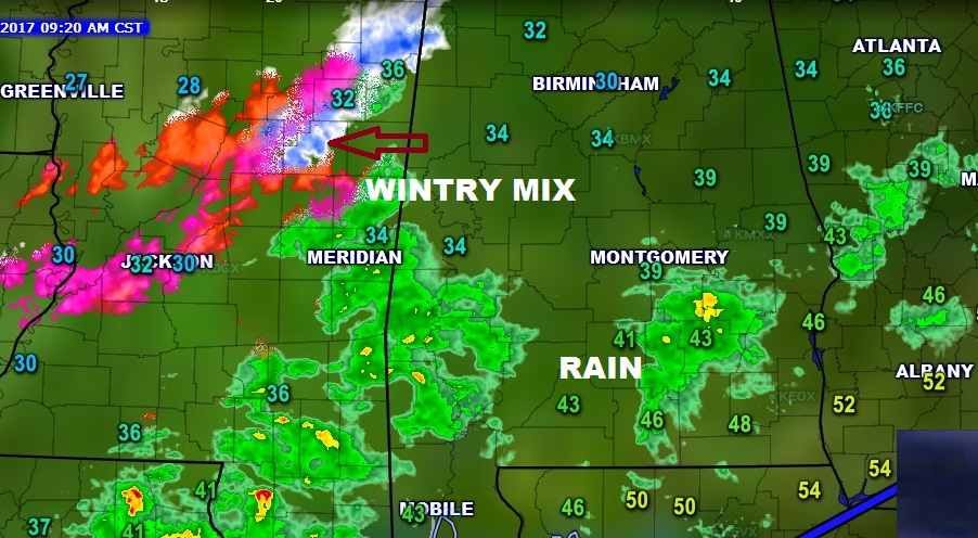
NOWCAST: Temperatures have been slowly falling since Dawn. Montgomery is in the upper 30’s, but it’s already 34 in Shelby county and Birmingham is holding steady at 30. We’ve recently heard reports of sleet in Deatsville. Rain continues across much of central & south Alabama, but look to the west. A big band of Wintry Mix over Mississippi is approaching Alabama and will move in this afternoon. Temperatures in the Montgomery area will reach the mid 30’s by mid to late afternoon, and below freezing later tonight, well before Midnight. Full forecast details below. Here’s regional radar at 9:30AM.
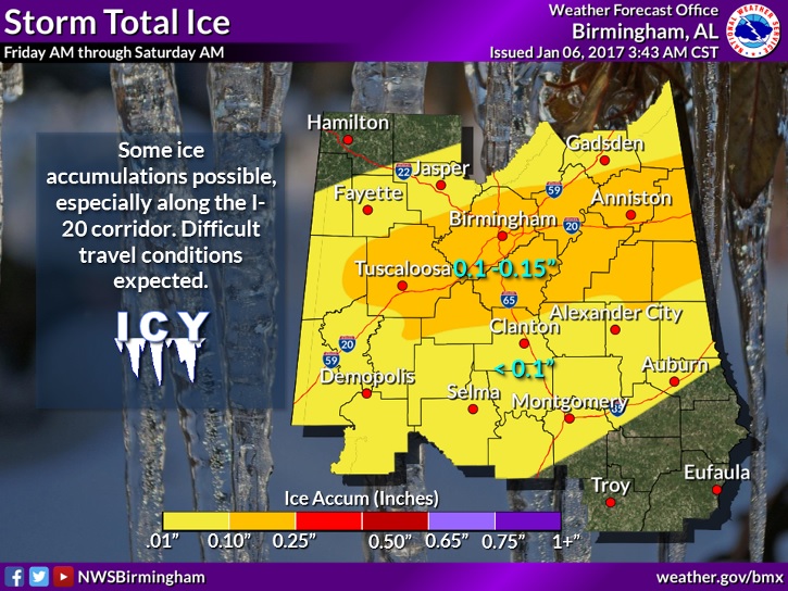
ICE ACCUMULATION: Concern is growing for icing accumulation from freezing rain/sleet. The greatest concern area has shifted northward to the I-20/I-59 corridor where .10 to .15” could accumulate. Father south in the I-85 corridor, accumulations of up to .10” ice is possible. This will lead to extremely hazardous travel.
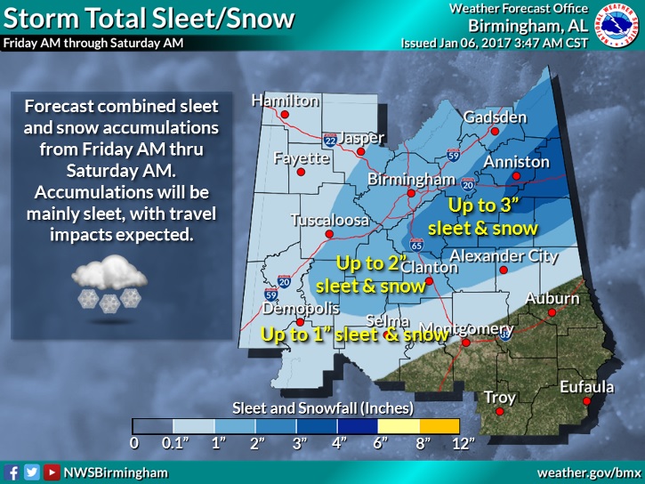
As for the accumulation of sleet & snow, which is totally different ballgame, the biggest accumulation is expected in the Winter Storm Warning area from Perry, Chilton, Coosa, Tallapoosa and Chambers county northward where 2-3” and in some cases 3+” are possible. Travel will become extremely hazardous.
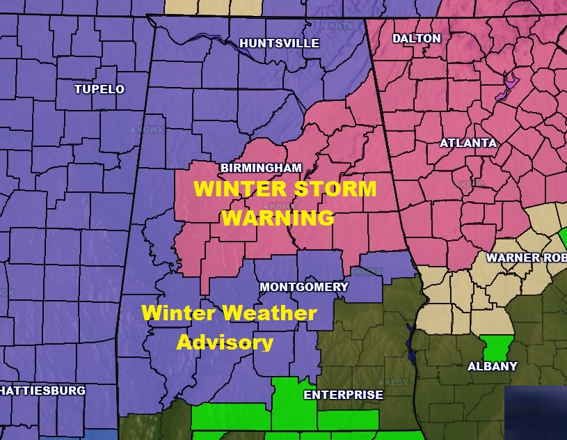
No changes to the Winter Weather Warning and Winter Weather Advisory Map
MONTGOMERY AREA FORECAST DETAILS: Winter Weather Advisory today until Saturday AM. Rain today. Temperatures falling to mid 30’s by Mid to Late afternoon. Tonight: Rain mixes with sleet. By Midnight a sleet/freezing rain mix likely. Then, in the wee hours a sleet/snow mix, before ending. Little or no snow/sleet accumulation, but ice accumulation of up to .10 possible. Low by Saturday morning 25. High Saturday 36 with Clearing skies. Low by Sunday morning 21, wind chill factor 10-12°. High Sunday 41.
STAY WEATHER AWARE: We will have additional Blog updates as needed today and tonight. They will appear on your Weather App, on Facebook and on Twitter. There will be a LIVE update from the Bluewater Weather Center at 11:00AM.