
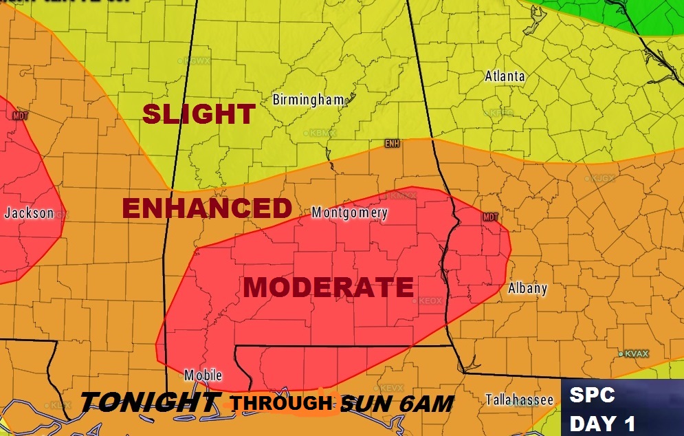
Our afternoon lull in the weather has allowed for the atmosphere to recharge, and the ground to heat, which will add additional instability for tonight’s next round of storms. A vigorous disturbance in the upper atmosphere will sweep into the lower Mississippi valley tonight, providing powerful dynamics for severe weather . Bottom line, we may have a much more dangerous situation. And, in fact, the Storm Prediction Center has upgraded the threat level to Moderate Risk for all of south Alabama as far north as Montgomery. The Enhanced risk is north to Clanton. North Alabama is in the Slight Risk.
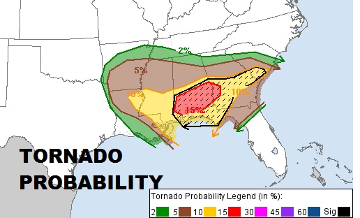
THREAT TONIGHT: Powerful energy will allow supercell thunderstorms to develop. The storms will be rotating storms. Some could produce tornadoes. A few strong tornadoes can not be ruled out. Besides the tornado threat, expect damaging wind gusts 70+ mph and golf ball size hail in some of the storms.. The updated outlook from the Storm Prediction Center shows the greatest risk, roughly from the US 80/I-85 corridor southward. Storm Prediction Center has indicated a pretty high 15% hatched Tornado Risk area for most of south Alabama. That means a 15% chance of tornado within 25 miles of any given point. Pretty significant. Raises eyebrows. Be weather aware through the night.
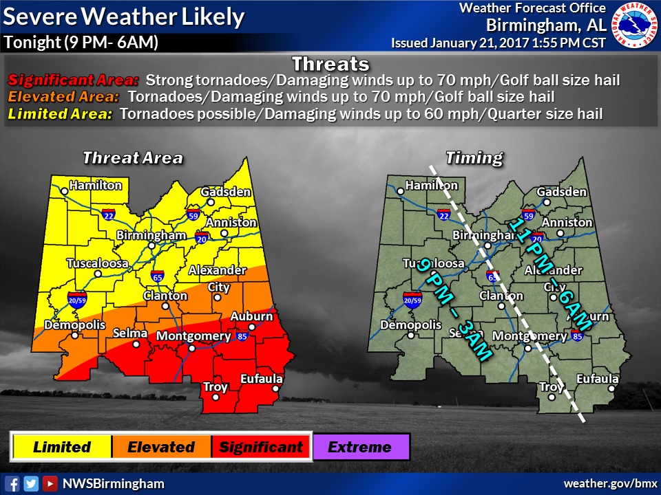
TIMELINE: It’s going to be rather long severe weather threat window tonight from about 8PM in the west to about 6AM in the far eastern counties. Keep in mind…that’s just an estimate for now and the time line could be refined.
FUTURE RADAR: Future Radar is very active indeed. This loop takes us through 7am Sunday morning. Although the precipitation will not be as concentrated and widespread as this morning, it’s likely to more scattered, promoting the chance of discrete supercell thunderstorms, capable of producing stronger tornadoes.
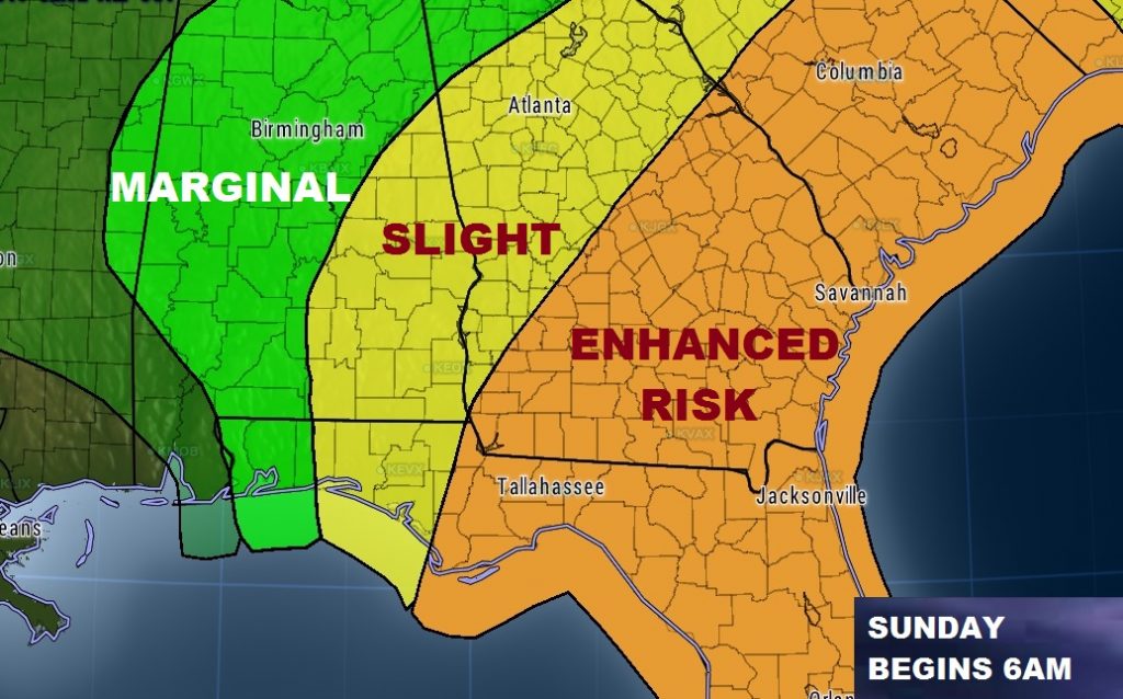
By Sunday morning at 6AM, the latest Day 2 outlook from SPC shows a morning “slight” risk covering much of east and southeast Alabama. But late morning, or perhaps around lunchtime, the threat will have shifted east into Georgia and Florida.
NWS: "There is a low chance of another wave of storms across the southeast tomorrow afternoon,
but that is dependent on how storms evolve overnight and how/if
the airmass can recover ahead of another upper level jet expected
to move across that area in advance of the approaching upper level
trough. Confidence is very low in whether this threat materializes."
STAY WEATHER AWARE: Make sure your weather radio is on, with fresh batteries, in the alert mode so it can wake you up during a warning. Our weather App will also sound a verbal alert and show you the warning for your location. This morning, many of you watched our LIVE streaming coverage the App’s You Tube tab. Many of you told us you were able to watch our LIVE stream with our app in your safe place. On your computer that Live stream is also available on You Tube at Rich Thomas Weather and on the web at richthomasweathernetwork.com. Make sure your smart phone is charged, in case the power goes out. We simulcast weather coverage for 2-3 hours during the worst of the weather this morning on the entire family of Bluewater Radio stations and we will be ready to do it again if the severe weather materializes. Stay weather alert. Have a plan of action. Have shoes on during a warning. If you have helmets, like bike helmets, etc., they could save lives during the tornado warning.