Good Morning! It will get a little warmer, before it gets colder. Cold front is approaching that will bring some more showers. But, cold weather fans, the cold will come in stages, and we’ll update the numbers and the timetable as we look toward the weekend. Are we done with major storms for a little while? We’ll scan the horizon for what comes next. Here’s your Tuesday morning personal weather briefing. Have a great day!
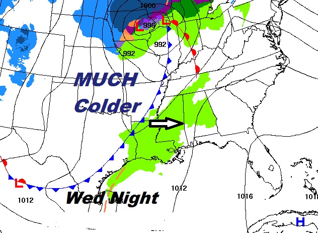
Current Map…shows cold front in the plains states heading our way. Showers by Wednesday night and Thursday AM, followed by colder.
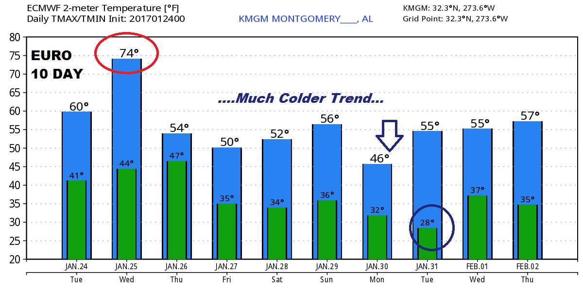
Wednesday will be the warmest day…but look at the Euro model graph for the next 10 days, some of the coldest air won’t arrive till the start of next week.
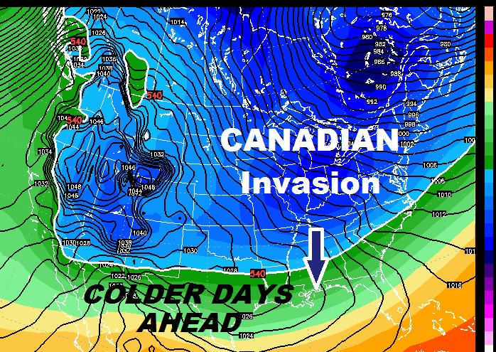
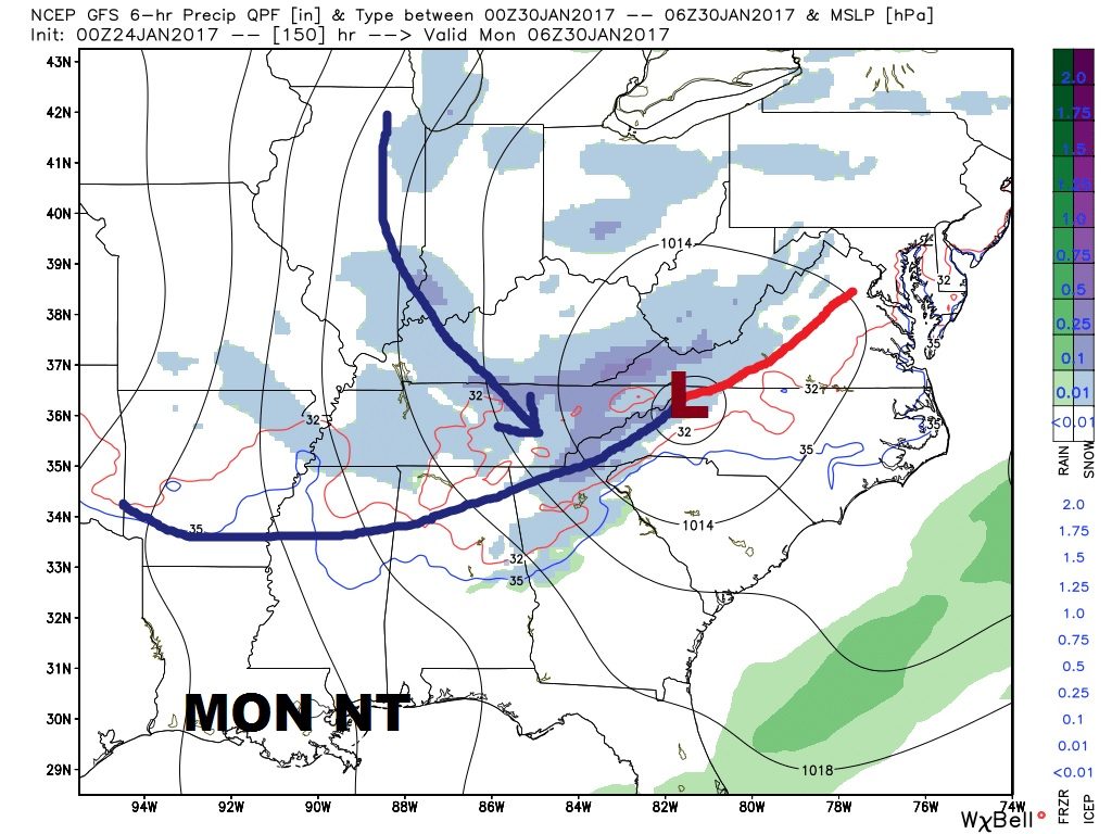
An “Alberta Clipper” delivers a shot of some even colder air by Monday and Monday night.. Maybe even snow flurries in north Alabama