
Big weather changes on the way as sharply colder air approaches. I’ll update the rain chances and timetable. How long will the colder air be around and how cold? We’ll take A peek 16 days down the road on temperatures. And, I’ll tell you about a truly excellent space station flyover coming up, on your quick Wednesday morning weather briefing.
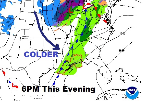
Cold front enters the state early this evening. Scattered showers with the front over night. The Line of showers, and the front, may reach Montgomery by about Midnight or so. Cold Front reaches Dothan by Dawn Thursday. Sharply colder behind it.
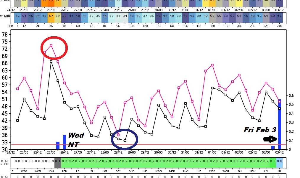
Euro Model shows the sharp temperature change from a warm day today to much colder air with chilly mornins this weekend. This graph also indicates the showers tonight and the next storm system around Friday February 3.
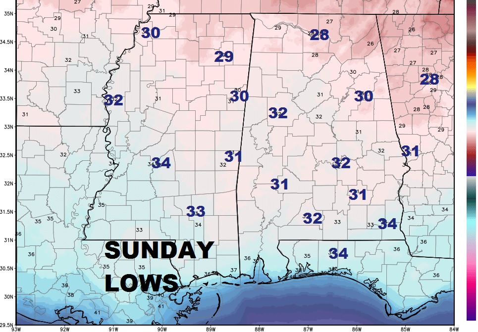
Here’s a peek at some Sunday morning expected lows.
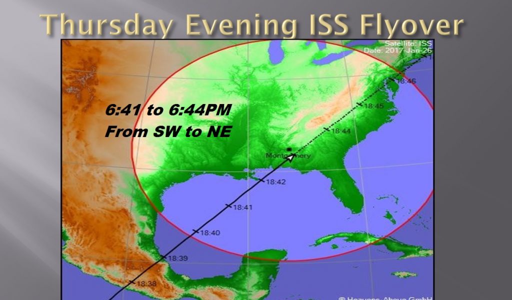
Great Space Station Flyover Thursday evening from 6:41 to 6:44PM, from the southwest to the Northeast…very bright. It’s worth your time.
Sky should be clear.
Have a great Day today! –Rich