Clear skies, freezing temps and a heavy frost greeted many of us this morning. Get ready for a cool, but quiet Super Bowl weekend. But, changes will be quick to occur, as the new week begins, with temperatures soaring back into the 70’s, with a developing severe weather threat across much of the state by Tuesday evening & Tuesday night. Details below.
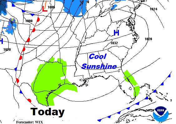
TODAY: Sunny and cool. High in the upper 50’s. Low tonight near 40.
SUNDAY: Mostly cloudy. (a few sun breaks) Spotty showers possible. High near 60. Low Sunday night 48.
MONDAY: Much warmer. High in the mid 70’s 20% chance of showers.
TUESDAY: Upper 70’s. Chance of showers and storms by afternoon. Thunderstorms become likely Tuesday ngiht, Some could be strong to severe.
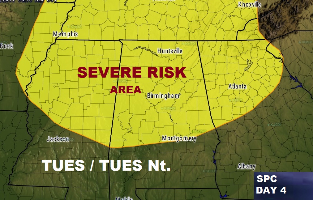
SEVERE THREAT BY TUESDAY NIGHT: The models do not agree on the details yet, but it appears about the northern 2/3 of Alabama may see some strong/severe storms by Tuesday evening and Tuesday night. We will be watching future model runs as the threat level becomes clearer. The Storm Prediction Center has outlined a large area of the state from the US 80/I-85 corridor northward. This threat area will be refined as we get closer to Tuesday.
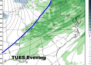
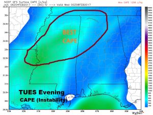
POWERFUL STORM SYSTEM: A frontal system approaching from the northwest will approach the area by Tuesday night and sweep through the state during the night. Several ingredients are necessary. One ingredient, instability of “CAPE” will be highest Tuesday evening/night, with the highest values across the northwest and northern counties. The powerful, parent low pressure system, with the best dynamics , fortunately for Alabama will be far to the north over the Great Lakes. We will continue to monitor. We have a few days to watch this.
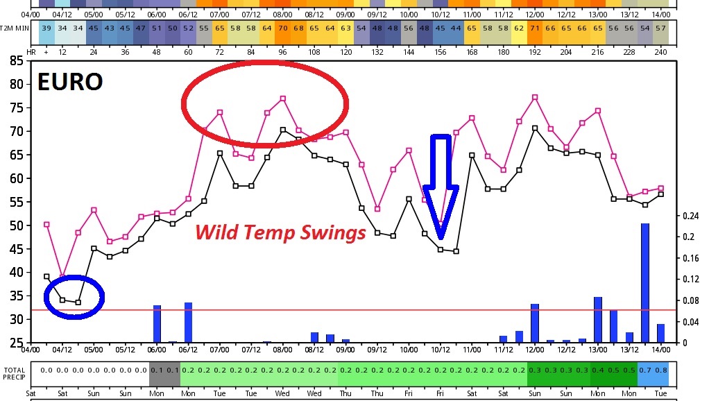
WILD TEMP SWINGS: From freezing this morning to upper 70’s Tuesday to another big plunge late next week. Be ready for a wild ride over the next 10 days.