
Good Morning! Severe weather threat today and again tomorrow as a powerful storm system approaches the state. I’ll walk you the timeline and what to expect for round 1 and round 2. Plus, a look ahead to the big cool-down after the storm, followed by another temperature surge. There’s much to talk about this morning, on an important Tuesday morning weather briefing.
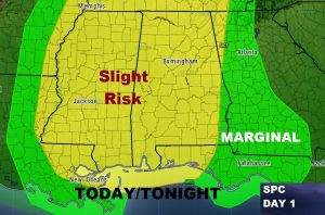
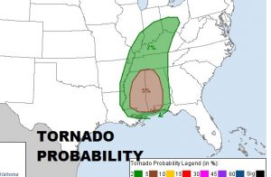
Today’s Severe Weather Outlook from SPC. Greatest risk window from about Noon in the west to about 8 in the far east and southeast. Damaging wind gust is the main threat. Tornado probability is relatively small but not zero.
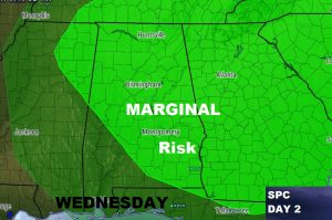
Much of the state is also included in a Marginal Severe Risk for tomorrow, Wednesday, for the afternoon & evening. Damaging winds are the main threat.
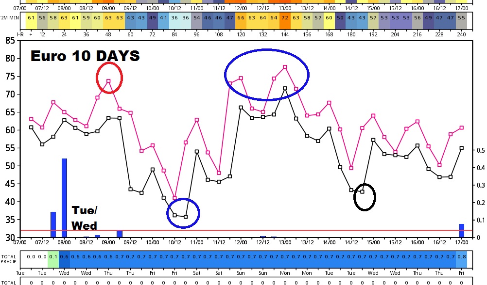
Wild Temperature swing over the next 10 days. Behind this storm system, we will fall back to the mid 30’s by Friday AM.
SPECIAL 10AM Weather Briefing from the Bluewater Weather Center. We will be streaming LIVE. It’s easier than ever to see that LIVE stream, especially with the APP. Go to the You Tube Tab and click on the Live stream. Online you can also see the Live stream on You Tube at Rich Thomas weather and on our website at richthomasweathernetwork.com. Latest future radar trends and new update from the storm prediction center, too. PLUS, that same LIVE stream will stay up all day…frequently with RADAR up. From time to time, when necessary, I’ll come on the screen with video and audio to update warnings.