Lots of twists and turns in our future. Showers and thunderstorms will sweep across the area today. Latest future radar shows the eastward progression of the rain Today & tonight. More warm days later in the week. After a record high yesterday we could see another record before this week is over. Sharply cooler air will arrive by the weekend. We’ll take a peek into some early March trends. Some active weather and maybe a big cool-down ahead.
Decent rainfall amounts are possible as the storm system moves through. Perhaps more than an inch in central Alabama and maybe 2+” in south Alabama. A little heavier on the coast. No severe weather is expected.

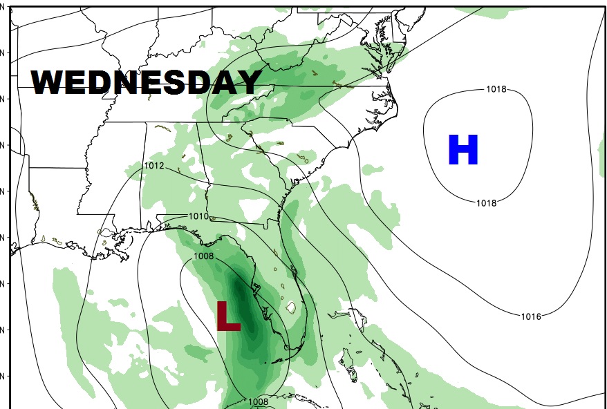
Tomorrow, the storms system takes aim on Florida. There could be a leftover shower or two perhaps in the area.
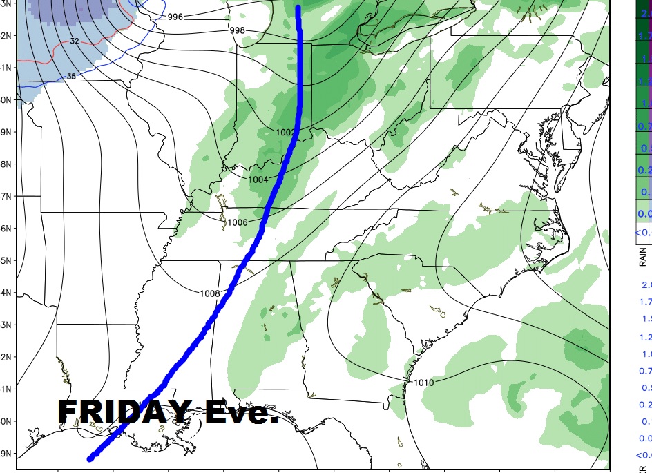
A cool Front Friday evening will bring sharply cooler air in just in time for the weekend, and perhaps a brief shower with the front. Before the front moves in, we could have a record high Friday. The record is 78. We could easily make it to 80 degrees.
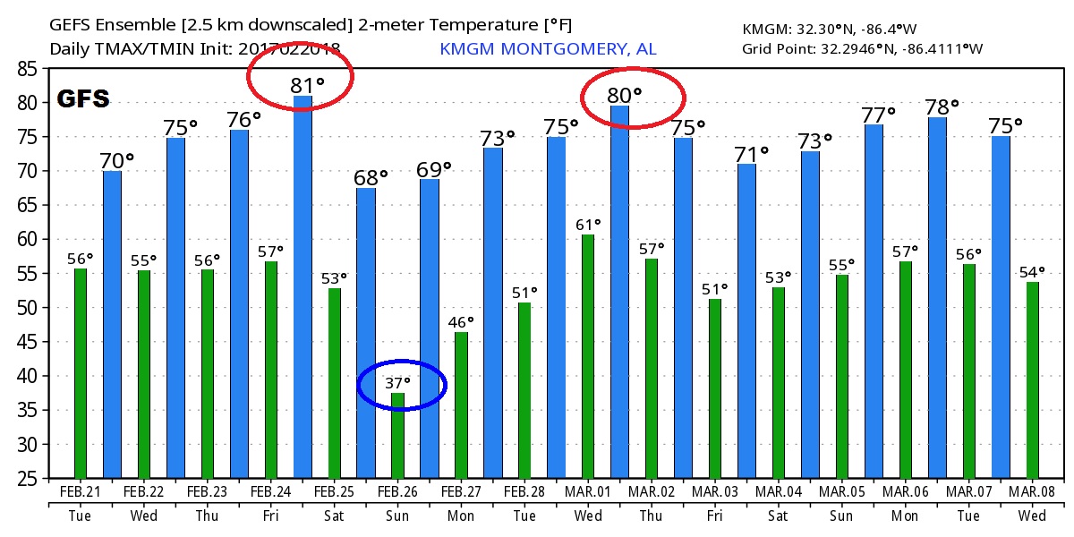
GFS Temperature guidance for the next 16 days. Wild swings, again.