
Good Morning! Much cooler air is sweeping into the state. Some chilly nights ahead. We’ll look ahead and update the weekend details. We’re monitoring some active weather early next week and perhaps another severe weather threat, too. More twists and turns over the next 7-10 days. Here’s your Thursday morning weather briefing.
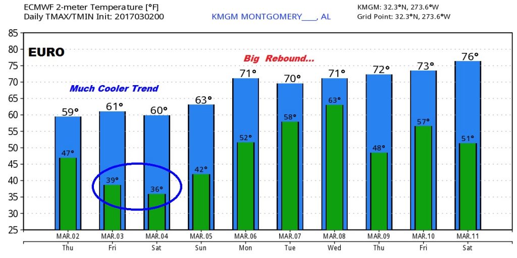
The Euro model Temp trend for the next 10 days shows the sharp cool-down. Coldest mornings Friday and Saturday. Big temperature rebound next week out ahead of another potent storm system.
Next ‘big deal” storm system affects us by Tuesday night into Wednesday. Powerful frontal system. Severe weather? Not certain yet. Probably. Here’s the GFS solution for early Tuesday evening as the strong front enters the state.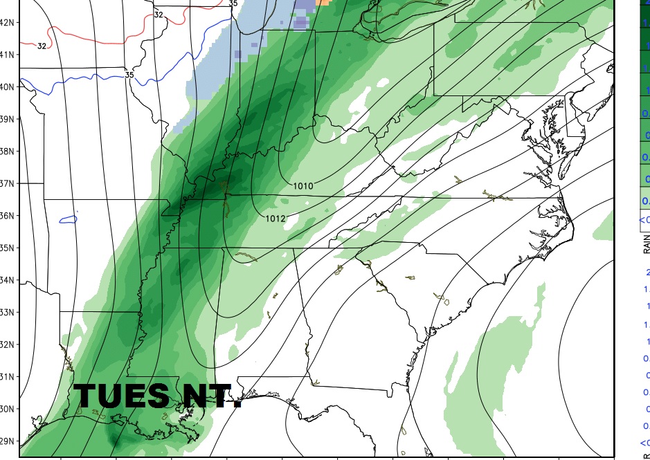 .
.