Good Morning! Active weather day ahead. A Band of rain and thunderstorms will cross the state. Some of the storms could be strong. I’ll have the latest future radar. We’ll look at the timing, the severe threat, and rainfall amounts. Plus, the latest on the weekend, which is now coming into better focus. Some showers could affect your plans. Here’s your Tuesday morning weather briefing.
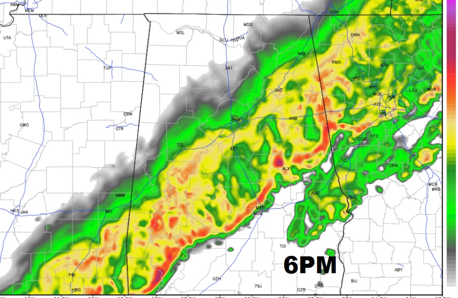
Future Radar at 6PM shows the leading edge of the band of showers/storms very close to the I-65/I-85 corridor, moving southeastward.
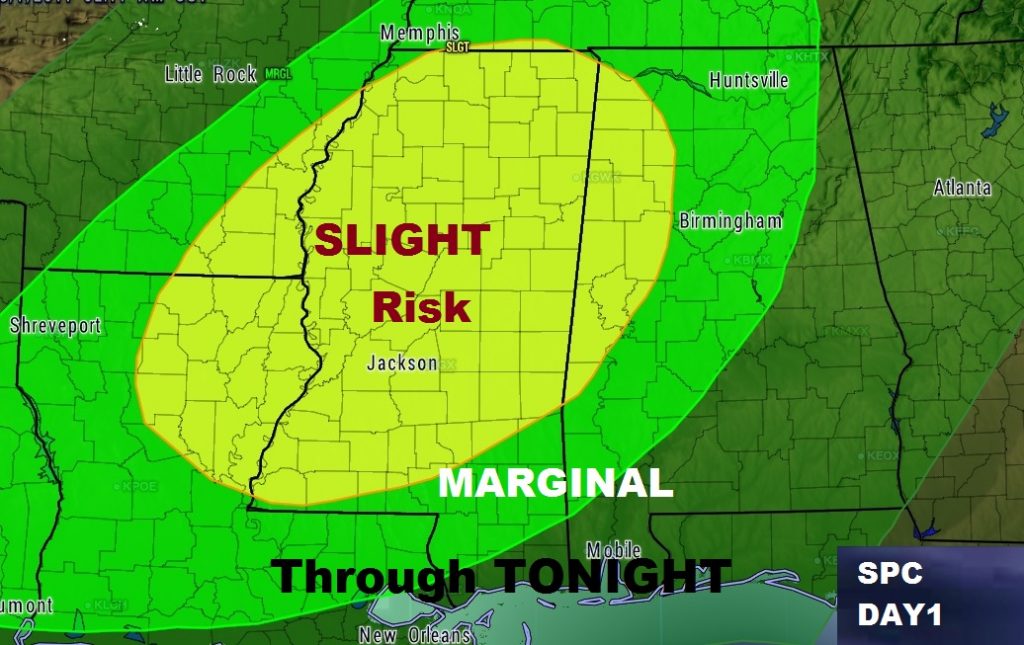
The Storm Prediction Center have parts of west and central Alabama in a severe weather risk today/tonight. This risk area will be updated 3 different times during the day today and the area could be expanded. The greatest risk will be damaging wind gusts. Strongest risk is over the far western counties in the Slight Risk area. A spin up tornado or two can’t be ruled out.
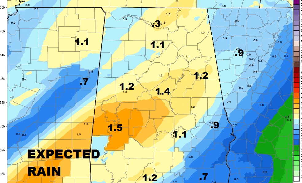
Rainfall amounts could be close to or exceed 1 inch in central Alabama.
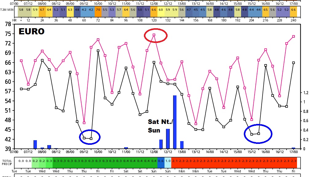
The Euro model out 10 days shows a cool Thursday morning, a warm-up Friday & Saturday before the next frontal system brings in another round of showers towards Saturday evening and night into early Sunday.
Don’t forget. We Spring Forward this weekend.