
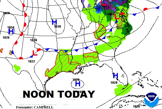
A weak cool front moving southward through the state today, with a weakening line of showers and perhaps a thunderstorm or two, will bring a risk of showers today, which could affect your plans. It will turn a little cooler behind the front tonight, but Sunday’s high may only be a coupe degrees cooler than today.
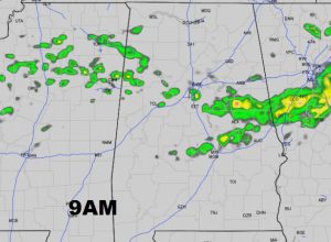
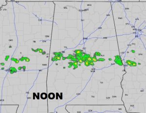
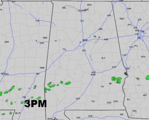
But, future radar shows how the line of showers weakens and falls apart, as moves southward into central & south Alabama. Best risk of showers, for most of us will be from about 9AM to 2PM. But, not everyone will get wet. Here’s a few Future radar snapshots.
TODAY: Risk of a few showers. (mainly late morning/early afternoon) Can’t rule out a thunderstorm. High today 72.
TONIGHT: Clearing, a little cooler. Low 44.
SUNDAY: Sunshine. Nice day. High near 70. Close to normal for mid March.
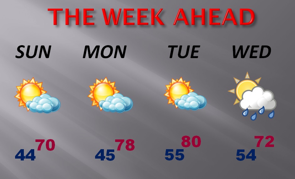
SPRING BEGINS MONDAY: Spring officially starts Monday morning at 5:28AM. The Vernal Equinox. And, right on cue, a warm-up in on the menu. We’ll be near 80 Tuesday. Maybe some spotty showers Wednesday. Here’s a peek at the next few days.
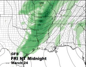
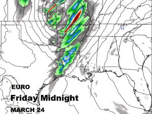
NEXT SIGNIFICANT FRONT/STORM SYSTEM: The models still disagree on timing an details, but it appears that the next front will bring showers and thunderstorms into the state, perhaps by Friday or more likely next Saturday, March 25th. Still too early to say if the storms will be severe, but that possibility is on the table. Here’s a snapshot of the 2 global models…the GFS and the Euro.
Have a great weekend! Next video update Monday morning. Blog updates as needed.
-Rich