
Special Movie update outlining what looks like a possible Significant Severe Weather Outbreak Wednesday, with damaging winds, extremely large hail and long-lived destructive tornadoes possible. I have some new information and new graphics to share on this quick video. I hope you have time to watch it, and please stay weather aware all day tomorrow and stay close to our weather app.
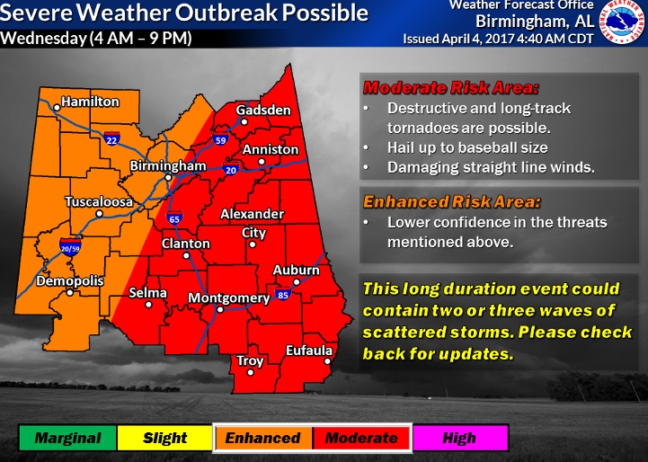
The Moderate risk area was expanded to include areas farther west. This is a significant threat level with long-lived destructive tornadoes possible, baseball size hail and damaging winds 70+mph. Long term event from 4AM to 9PM
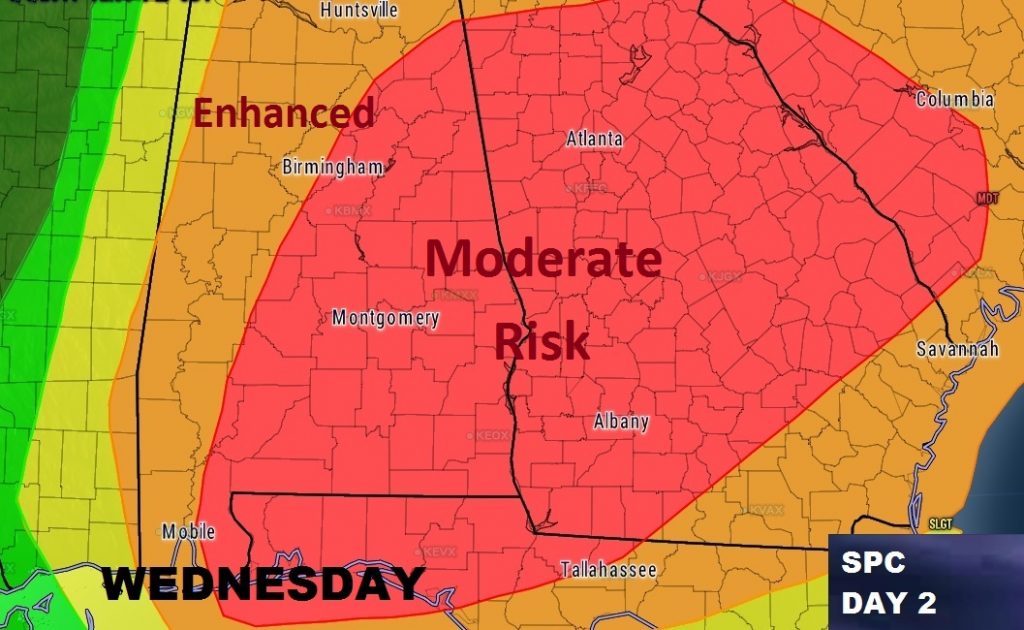
Multistage area will see what could be a significant tornado outbreak Wednesday.
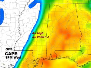
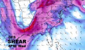
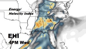
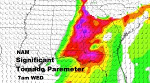
Key severe weather ingredients will be in abundance tomorrow, including instability (CAPE) and directional shear with altitude, or spin needed for tornadoes.
I will try to get out a video in the morning if possible, weather permitting. Otherwise we will LIVE streaming all day, with updates as needed. Stay weather aware all day with our app.