Good Morning! Our early summer preview continues today. Today will be at least 10 degrees warmer than normal for Mid April. In fact, we could be at or close to 90 by late week. Spotty pop up showers will be rather scarce. Our attention turns to an important cold front over the weekend which could bring a line of some strong/severe storms, followed by sharply cooler air. I have the latest on timing, strength, and the cool down that follows the front.
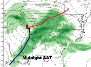
The next big deal front will affect Alabama this weekend. The cold front is a strong one. There could and probably will be a line of strong to severe storms ahead of the front. Right now it appears Saturday night is probably the most likely time for the possible severe risk, with a squall line. Damaging winds will be the strongest threat. Right now, the tornado threat with this system appears low.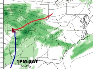
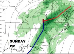
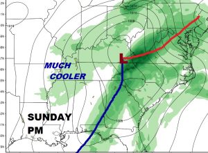
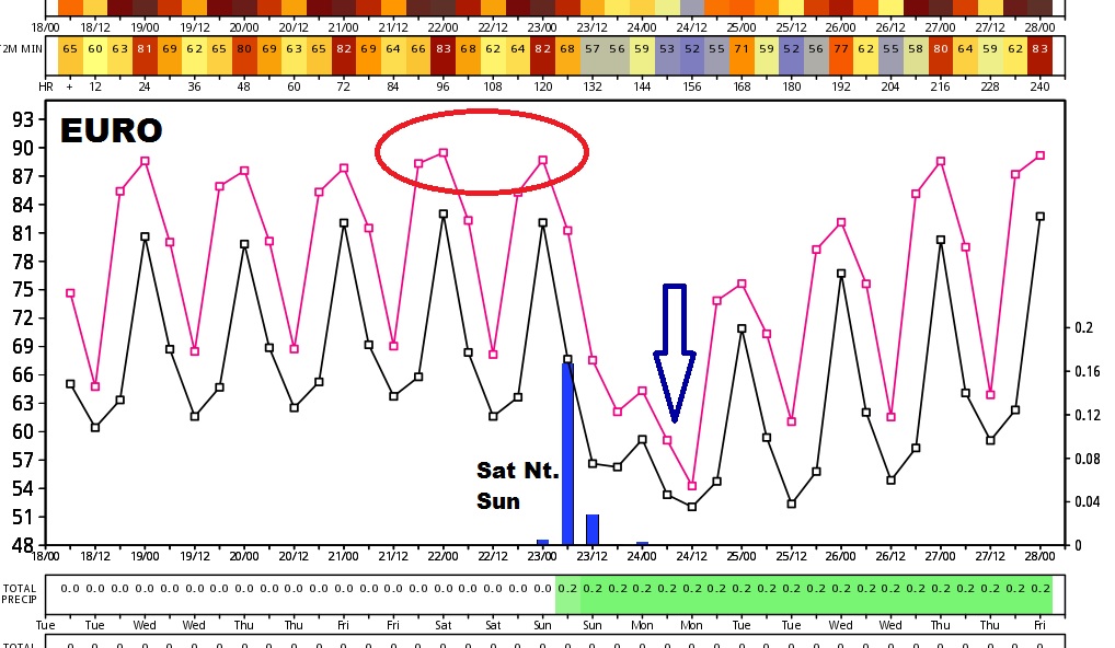
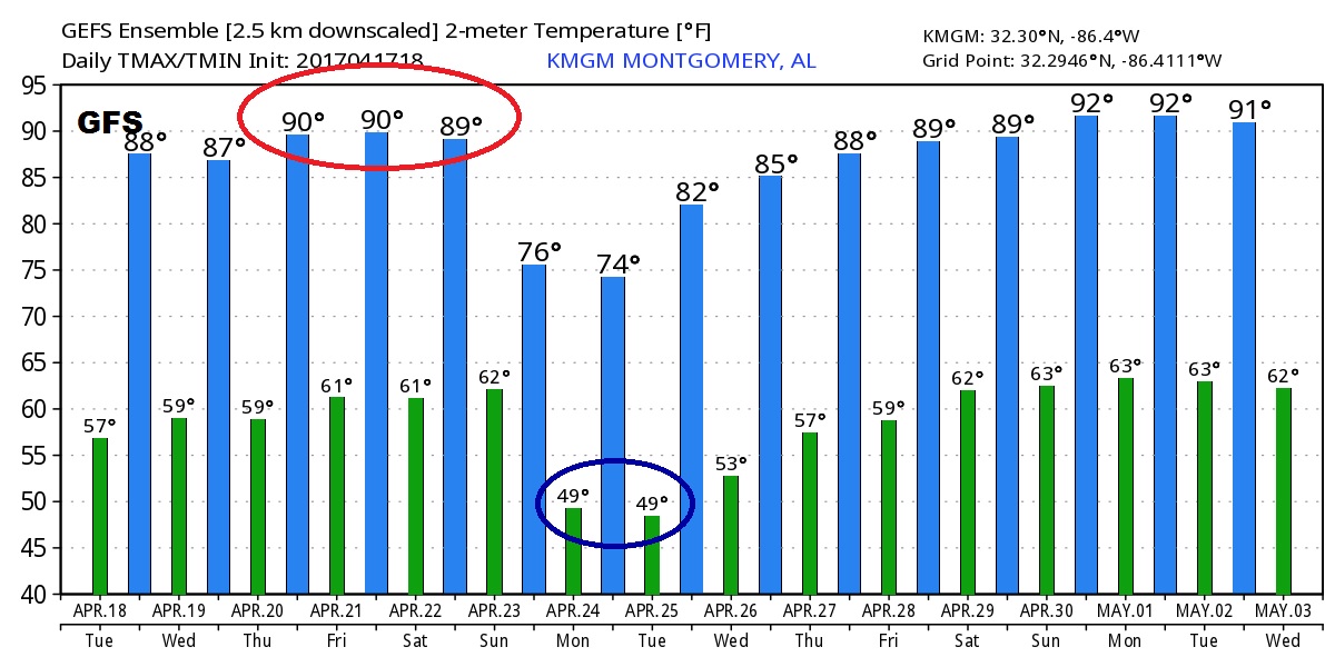
A dramatic change to much cooler air follows the front. Here’s a peek at 2 global models, the Euro and the GFS.