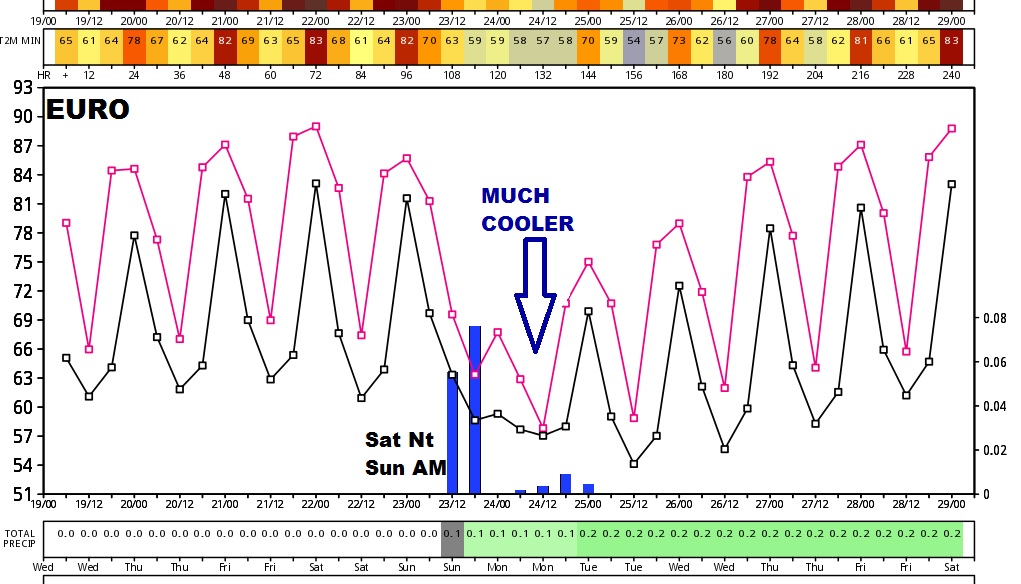
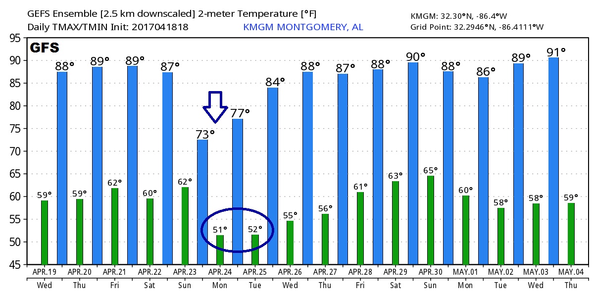
Good Morning! Our Summer Preview pattern continues. We’ll be flirting with 90 next 3 days. We’re getting dry and looking for raindrops. All eyes on a important frontal system this weekend. Will bring severe weather to the state? And, how much rain can we expect? The latest details on a front which will usher in some much cooler air, for awhile, on your Wednesday morning, 2 minute personal weather briefing.
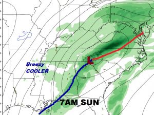
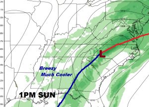
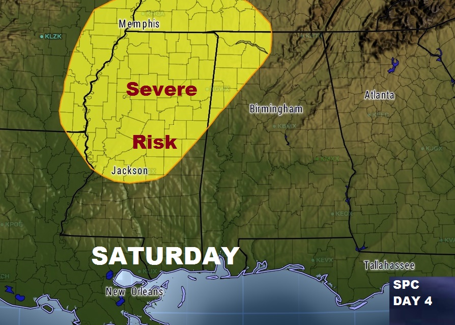
Still monitoring an important cold front which will affect the state this weekend. Ahead of the front, a line of strong to severe storms Saturday night into Sunday morning. The main threat would be damaging wind gusts. the tornado threat appears to be rather low with this system.
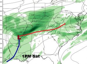
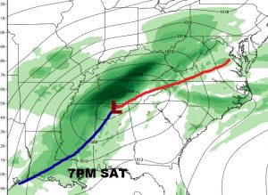
The strongest severe threat with this system will be across the northwest counties, where a low end tornado threat also exists Saturday night.
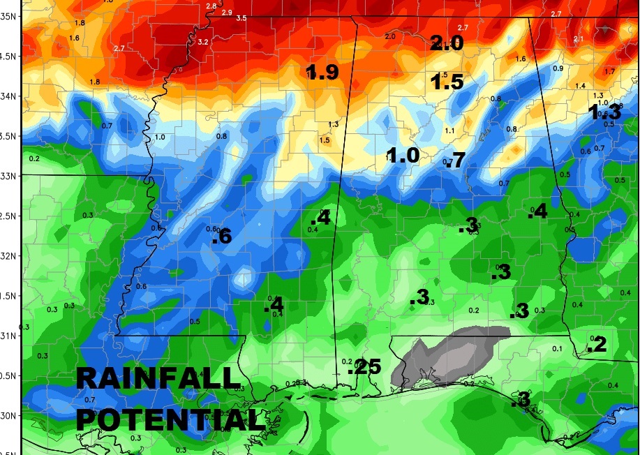
We are getting very dry across the area, so there’s at least hope for some decent rain with this front, but according to the GFS, not enough rain in central and south Alabama.
Look for a significant cool down behind the front. Here’s a look at two important global models.