Happy Friday! Just like summer again today. We may fall just short of a record high again today. But, significant changes are fast approaching. Strong cold front moves in this weekend. Best chance for the stronger storms Saturday night. More than half the state is in the severe weather risk, which has been adjusted. Plus, I’ll update you about the dramatic cool-down after the front, and what we can expect for the week ahead. Here’s your Friday morning personal weather briefing.
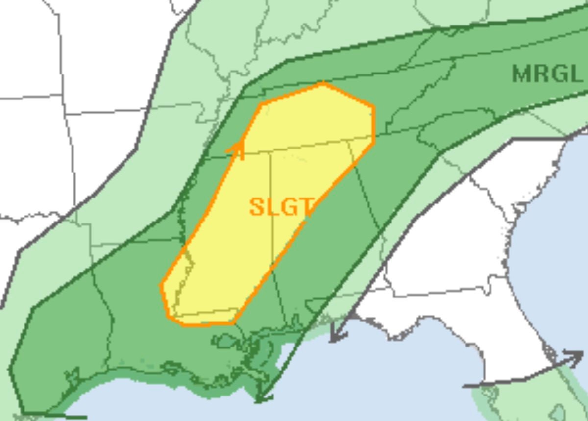
Here’s the adjusted severe weather threat from the Storm Prediction Center. A slight Risk has been added for NW Alabama. That’s new. Also, the marginal risk has been expanded much farther southeast in the state and now includes Troy and Andalusia.
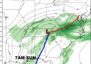
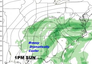
The strong cold front will sweep across the state Saturday night/Sunday morning, with dramatically cooler air behind it. In fact, Sunday, we may not make it out of the 60’s. We will be just above 50 degrees by Monday morning. Big change.
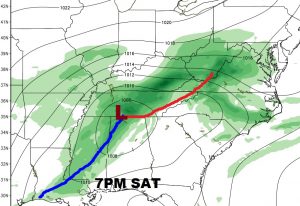
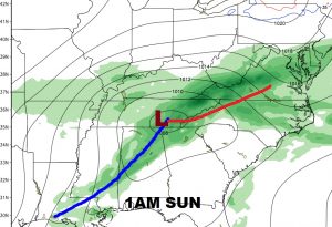
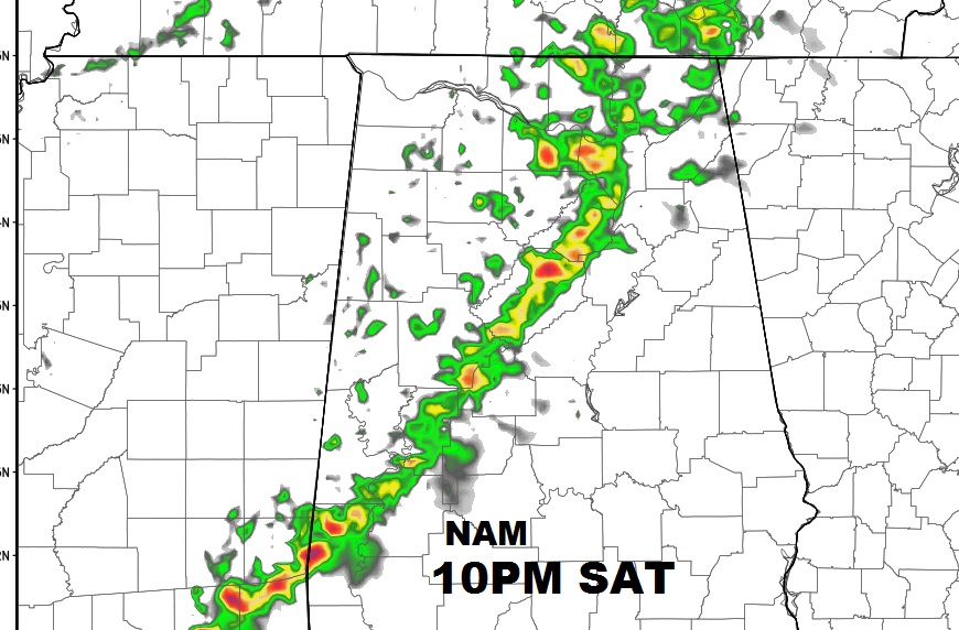
Here’s a Future Radar snapshot from the NAM model. It shows a line of storms approaching central Alabama around 10PM Saturday night. Don’t take this literally. It’s just a model idea. Timing could change.
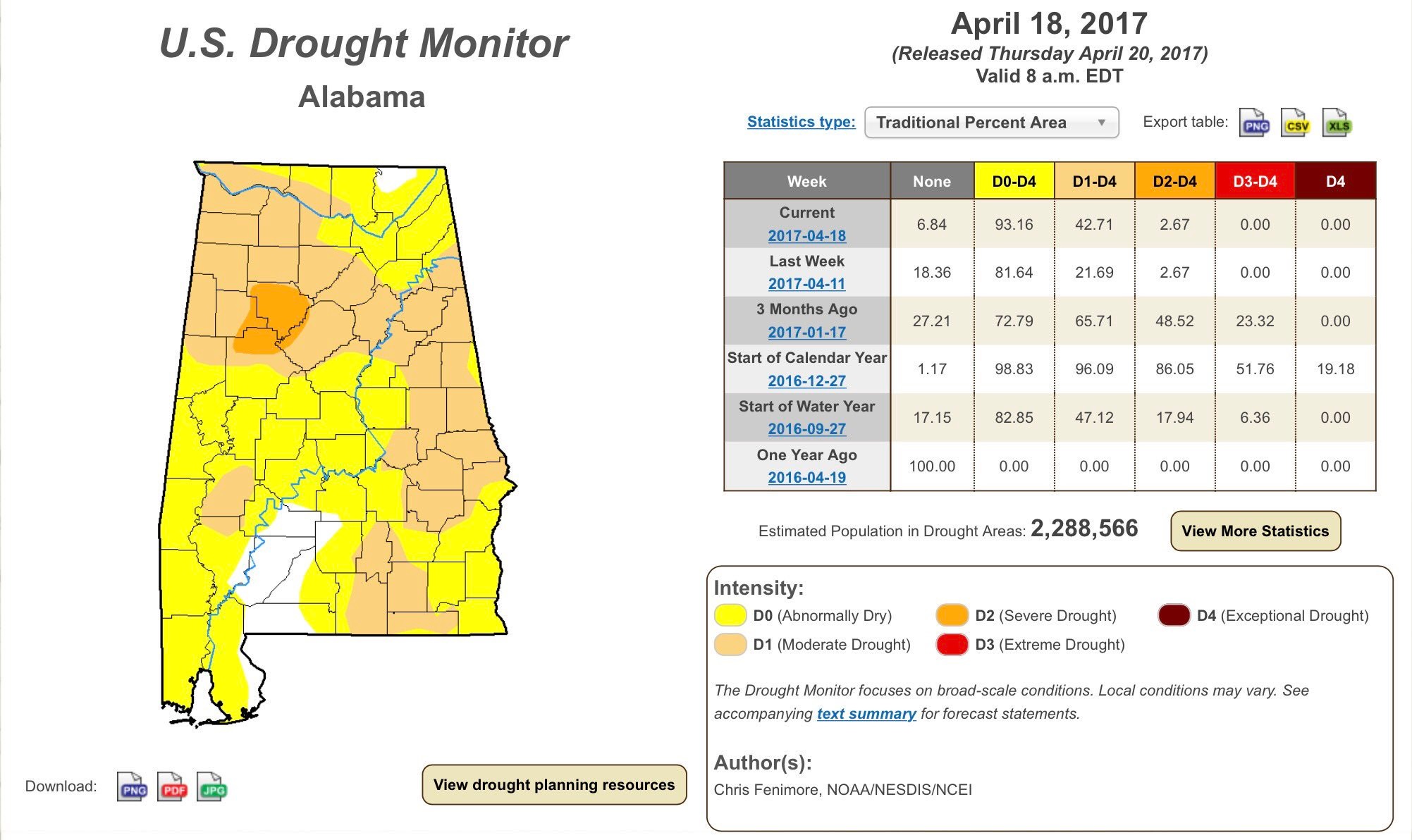
New Drought Monitor Map came out yesterday and it is a little disturbing. Moderate drought has now re-appeared in much of east andf southeast Alabama…41% of the state. Our expected weekend rainfall will be too light to help.