
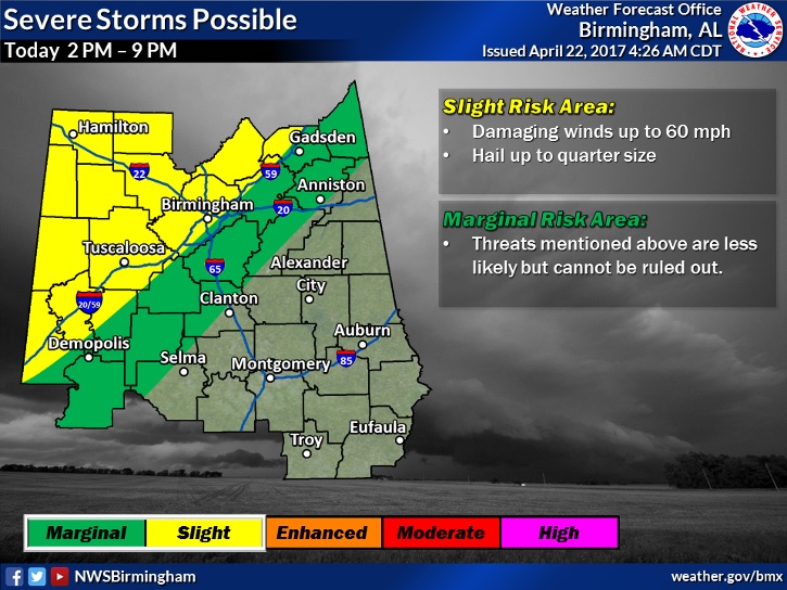
Get ready for a big change. A cold front will sweep across the state tonight. Ahead of the front a potent line of storms will bring a severe weather threat. However, right now, the primary threat for strong/severe storms is across the northwest counties, mainly in time window from 2PM to 9PM. The primary threat will be damaging wind gusts and maybe some hail.
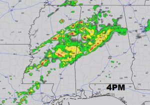
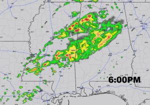
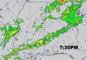
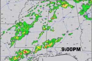
Future Radar show a line of strong line of storms in NW Alabama sweeping southeastward. Notice how the line of storms tens to diminish in intensity as it moves into central & south Alabama this evening. This should help you plan your evening. Keep in mid this is just one model and timing will change. Future radar on our weather app will keep you updated with latest on timing later in the day as new model data arrives.
Behind the front, much cooler air moves in late tonight. The overnight low will fall to the low 50’s by morning. Sunday’s high will only be near 70, after upper 80’s again today. Can’t rule out a few leftover showers on Sunday.