
Happy Friday! We are in between storm systems for a couple of days. But, another severe weather threat is looming for late Sunday / Sunday night. And, all indications are, some big ticket weather may be in our future next week. New drought monitor map, is out, as we anticipate what could be some decent rain ahead. Are ready for a couple of hot & humid days today & tomorrow? I have an action packed Friday morning personal weather briefing for you.
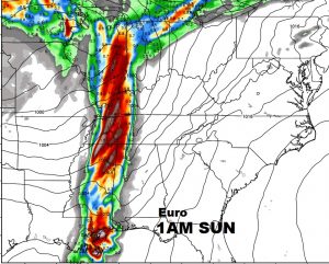
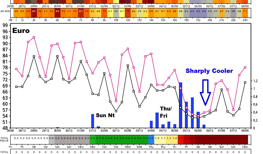
All eyes on the next significant storm system to affect by late Sunday, Sunday night, through Monday morning. It will be producing a lot of severe weather today and tomorrow out in the nation’s mid-section. Timing of this system is about 6 hours slower on the Euro model.
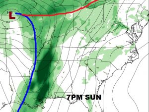
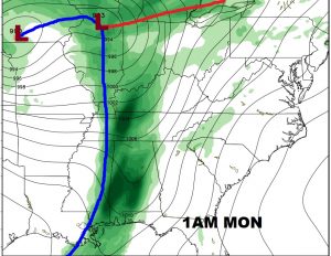
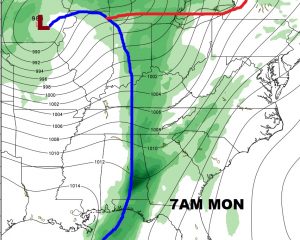
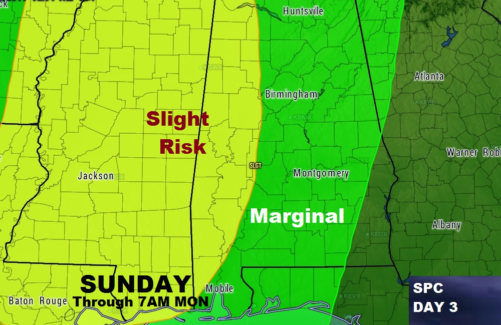
The Storm Prediction Center already has almost all of the state in a Severe Weather Risk Sunday night. The strong risk will be over the western half of the state. It is very likely the risk area and risk levels will be adjusted as we get closer to this event.
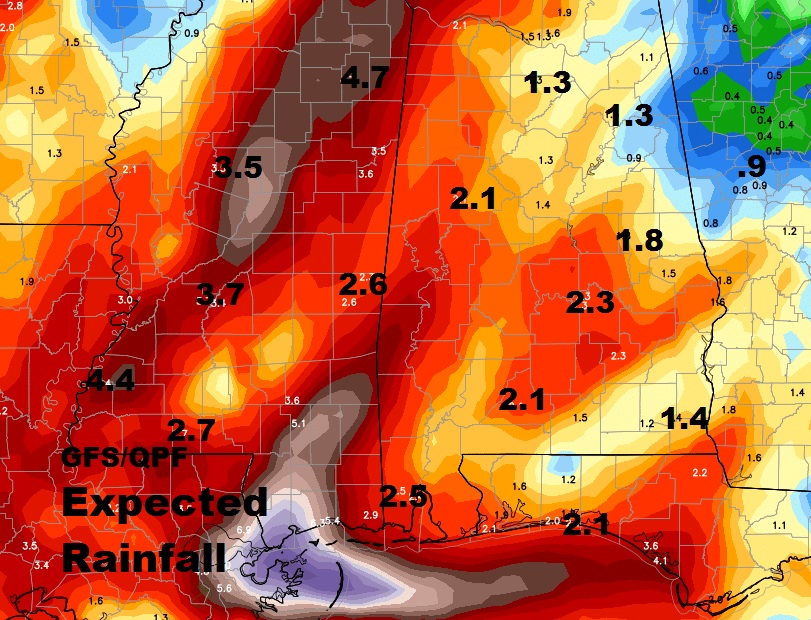
We could see some beneficial rainfall from this next storm system. Here’s just one model (The GFS) estimate at possible rainfall from this Sunday night/Monday system.
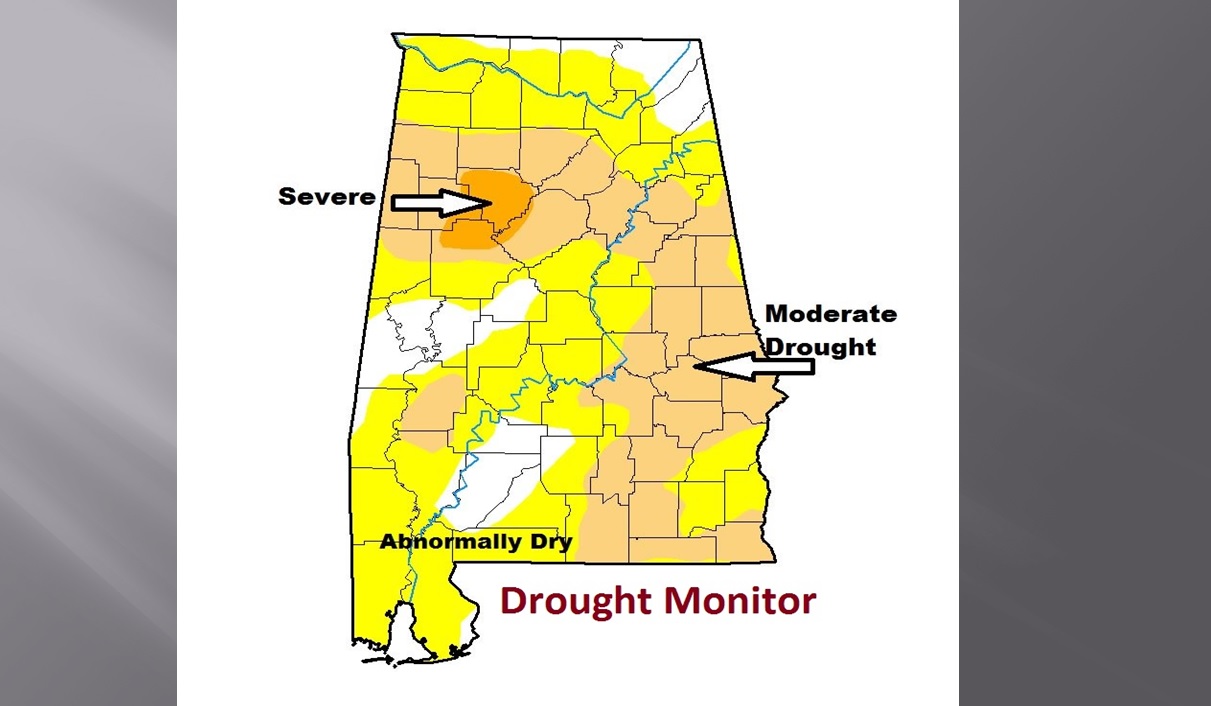
Hopefully that will help put a dent in our growing drought. A new Drought Monitor Map came out yesterday, showing much of eastern and southeast Alabama in a moderate drought.
Wild ride next 10 days, according to the Euro model. 2 significant storm systems, followed by a sharp drop in temperatures.
No video tomorrow, but there will be a blog update on Saturday morning, and a Special Sunday Video is planned, too. Have a great weekend! Bailey and I hope to see you at Bark in the Park tomorrow at Cooter’s Pond Park.
Rich