Good Morning! We have a lot of ground to cover. Hot day today, but a storm system will affect us tomorrow, which could have some strong to severe storms associated with it. I have the latest outlook from the Storm Prediction Center, and we’ll check Future Radar to see how this storm system could play out. There’s a lot at stake with some many festivals & events going on. Plus, I have updated the Mother’s Day weekend details, on your Thursday morning weather briefing.
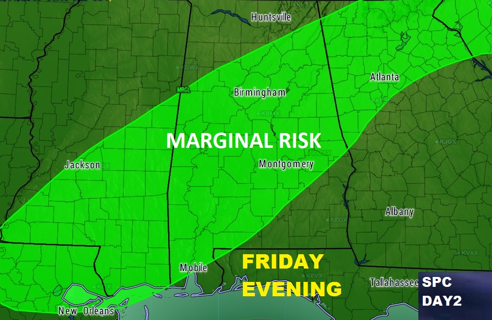
Storm Prediction Center has most of central and much of south Alabama under a Marginal Severe Risk for Friday evening/Friday Night. Damaging wind gusts is the main threat.
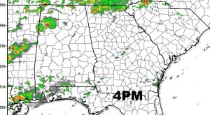
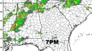
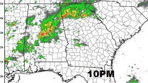
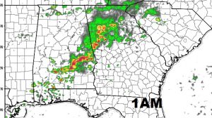
Here’s just one of the hi-res model’s Future Radar. This is how the NAM model indicates how the Friday afternoon/evening/overnight storms could play out. There will be random storms in the afternoon & evening, but it shows the concentrated showers/storms later in the night and into the wee hours of the morning. This is just one model idea.
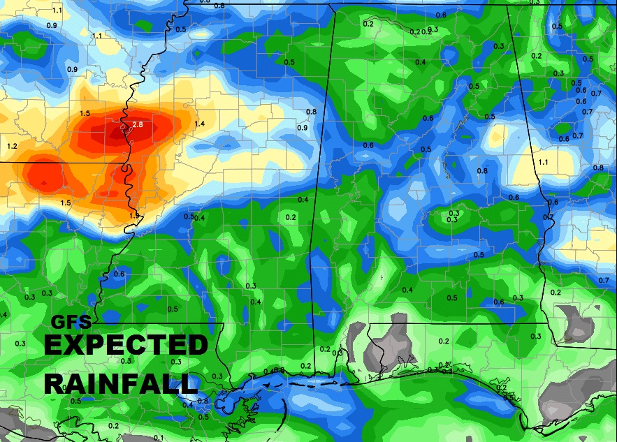
Unfortunately the model trends show that there won’t be a lot of rain associated with this storm system, as far as expected rain totals. Here’s a peak at the GFS. Many areas may see .5 inches at best.
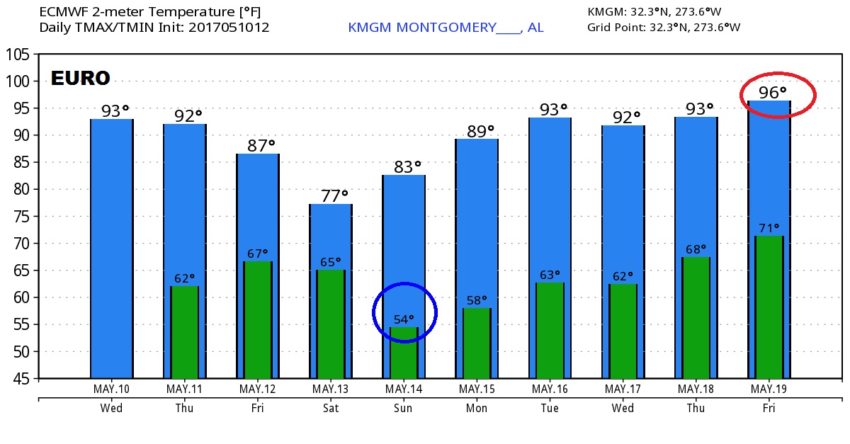
Here’s a look at the Euro Model temperature guidance for the next 9 days.
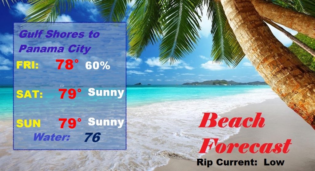
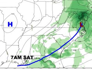
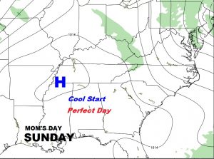
The Weekend Beach forecast. Best chance for showers and storms from Friday afternoon/evening until first thing Saturday morning.