
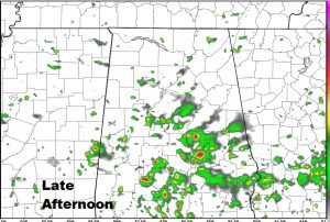
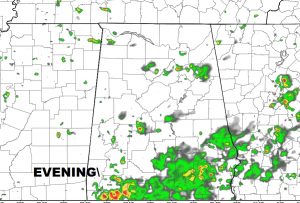
No big surprises in the weekend forecast, except those PM showers & storms will be a little more numerous than they have been lately. A southward moving front in north Alabama will be one of the factors for the increase in showers across our state today. For most of us, coverage on the storms will be about 50% this afternoon & evening and closer to 60% on Sunday afternoon/evening, as the weak front sags south, then stalls, and eventually fades.
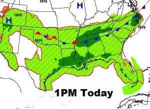
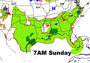
Here’s a couple of Future Radar snapshots to give you a feel on coverage later today. Don’t take these literally. Use them as guidance.
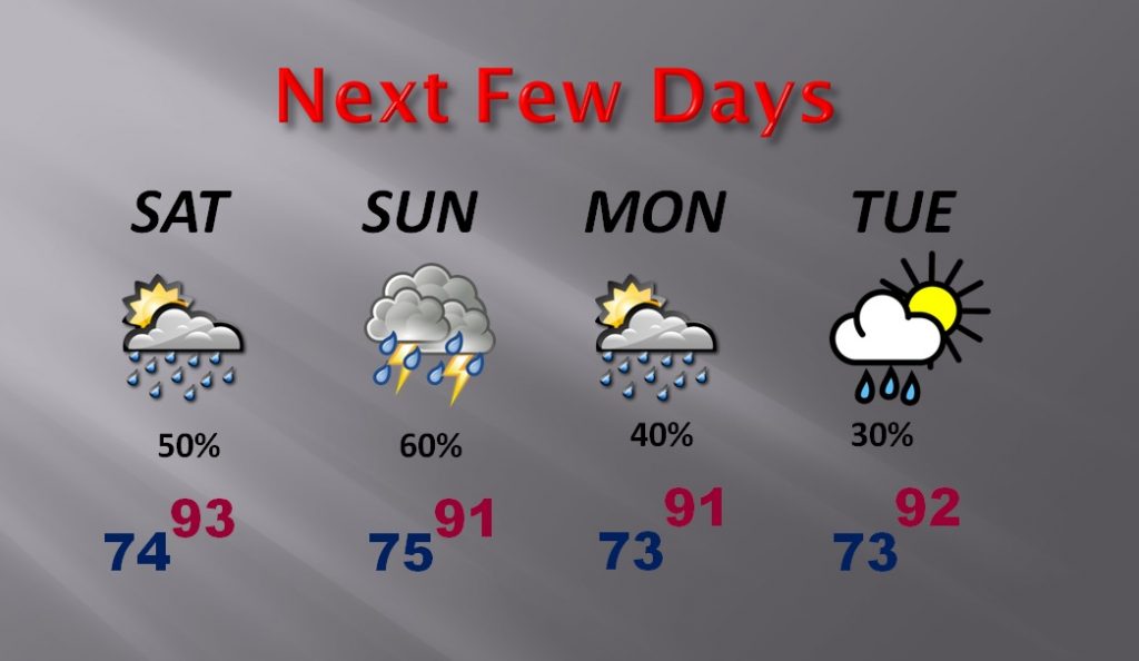
NEXT FEW DAYS: With the increase in showers today and Sunday, the high temperatures will ease down a notch or two, closer to normal for this time of year, but still extremely humid, with no relief in sight. Showers will start to thin out a bit by Monday & Tuesday as the front fades.
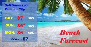
BEACH FORECAST: It’s not what beach goers want to hear. The better than normal rain chances will continue over the weekend. Not a wash out, but be ready to exit to a seafood restaurant when storms pop up.
NEXT WEEK: Once again, another heat ridge will be building over us. By Wednesday and into late week, highs will edge back into the mid 90’s and heat indices will be back in triple digits. But, the showers & storms will thin out in coverage, with more sun and fewer storms.
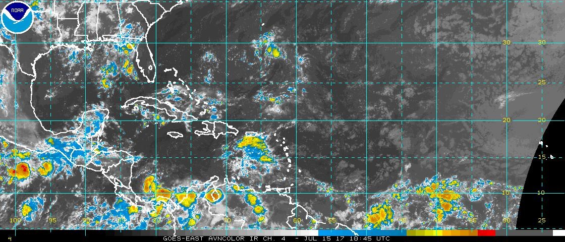
TROPICAL WEATHER: I’m happy to say there are no systems in the Atlantic basin that are forecast to develop intio a tropical cyclone over the next 5 days.
—
Your next video will be online Monday morning at 4:45AM. Don’t forget you can stay on top of the weather all weekend on our Free Weather App. Go to the App store and search Rich Thomas Weather, Plus, you can hear my forecast anytime you want, across the radio dial on 8 stations, twice an hour…the Bluewater family of stations. Have a nice weekend!
-Rich