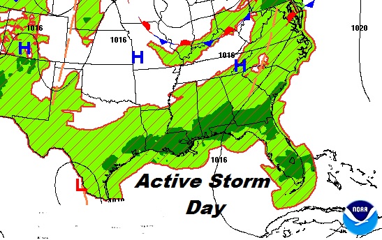
Good Morning! Another generous supply of random showers and storms will dot the radar screen today. I’ll show you how it should play out on Future Radar. The big story of this week will be the massive heatwave that will grip much of the nation. It will have big impact on our forecast, apparently for several days. I’ll walk you through the details. Some of the numbers are excessive. Plus, there are two systems in the tropics we are tracking. Here’s your Monday morning personal weather briefing.
Another active thunderstorm day today across the region. Storms will be random, but rather numerous.
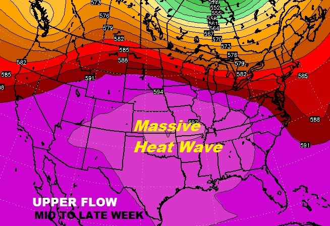
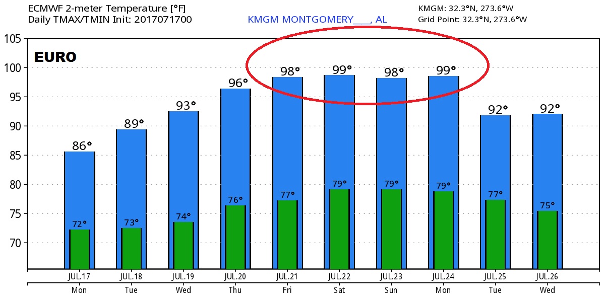
This week’s big story will be the massive summer heat wave that will spread east from the center of the nation and will grip much of the country by late week into the weekend.
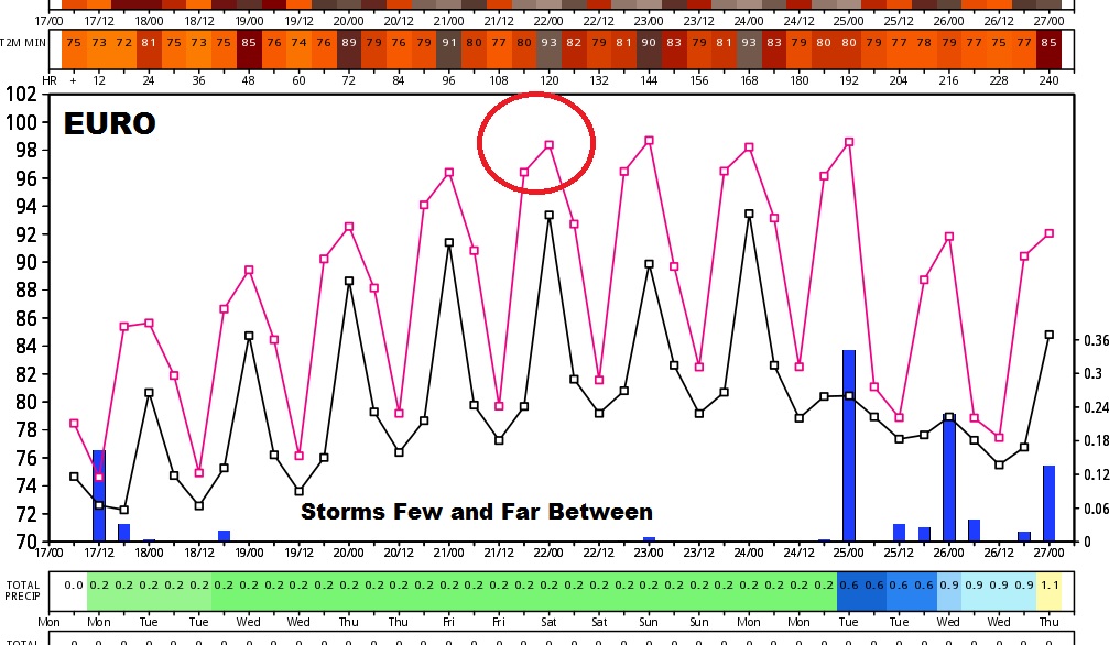
The Euro model trend for the next 10 days shows that storms will be scarce mid week, late week and this weekend, as temperatures soar to excessive levels for several days.
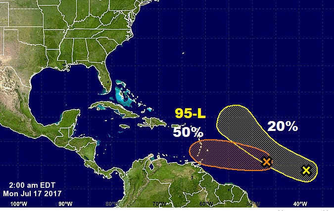
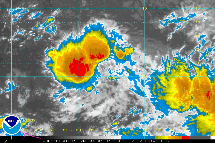
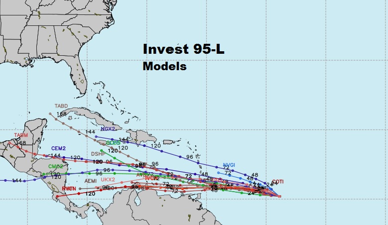
In the tropical Atlantic, NHC currently tracking 2 systems: Invest 95-L, and an area to watch right behind it.