
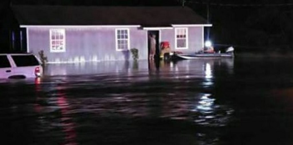
Talk about feast or famine. Flooding was a problem in spots overnight, especially in Crenshaw county, while there were some towns that had not a drop of rain. This is near US 331 between Luverne and Brantley. Part of the highway was closed overnight. Thanks to Elizabeth Sanders for the picture.
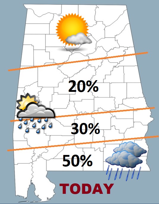
TODAY: The Best rain chances shift into the southern strip of counties today. For many of us, showers will be rather isolated, or widely scattered. Highs will be 90-92°. With dewpoints in the lower 70’s, making it feel tropical. There will be a good bit of sunshine in central & north Alabama, while the southern counties will be mostly cloudy.
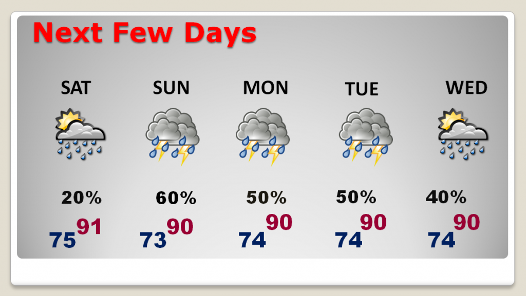
NEXT FEW DAYS: Showers and storms make a big comeback area-wide tomorrow. In fact, we’ll see decent rain chances every day through mid week. Very little day to day changes.
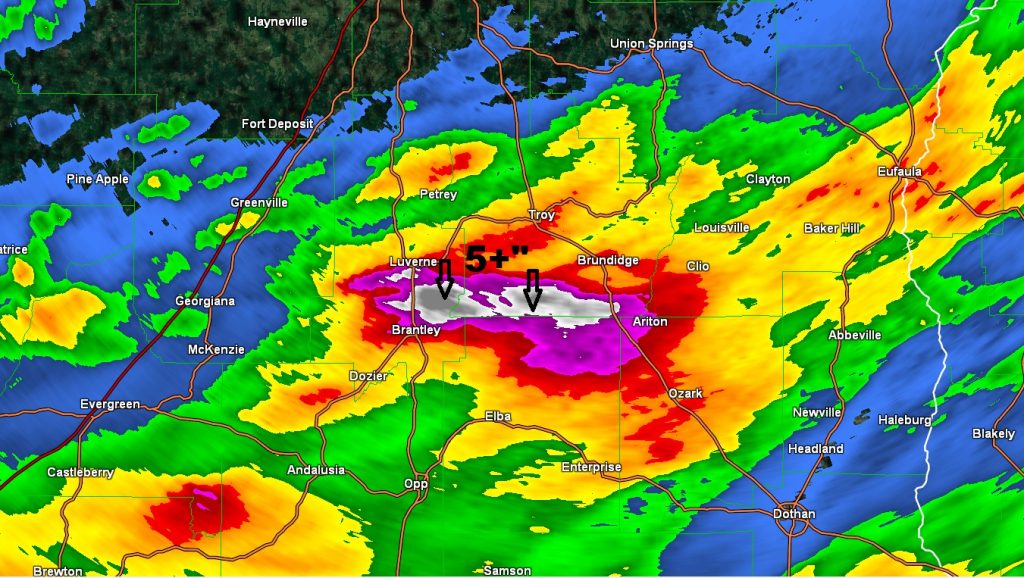
WHO GOT RAIN?: Literally feast or famine yesterday. In some towns it rained all day Friday and Friday night. Therev was local flooding, especially in Crenshaw county. Pike county got a lot, too. And, yet some towns did not have a drop of rain. Doppler radar storm total rainfall, gives you a “flavor” of who got rain and who didn’t.
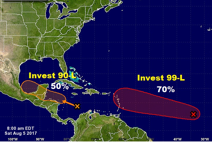
TROPICS: There are two “Invests” the NHC is monitoring. Invest 90-L in the west Caribbean, heading toward the Bay or Campeche this week. The more interesting of the two is invest 99-L with a 70% chance of development. This one could have future implications for the southeastern United States in the next 10 days or so. Spaghetti models below.

—
Have a nice weekend! I’ll have additional posts over the weekend as needed. Next video Monday morning at 4:45.
–Rich