Good Morning! ..Great American Solar Eclipse Monday! Clouds may hide the sun from time to time. I’ll give you a sense of what to expect, updating a very important forecast. Plus, intense heat will be a big part of the story. I’ll show you the increasing rain chance, day by day for the week ahead, including a late week front. And, we’re still monitoring several systems out in the tropics. Lots of great information to share on this Eclipse Day edition of your morning weather briefing.
Best viewing weather out west and in parts of the northeast, today. Marginal is the heartland and parts of the Midwest. Here in the southeast, and specifically in our area there will be a sun/cloud mix. The sun will be in and out of the clouds.
This is what the cloud cover looked like Sunday afternoon at 1PM. I think today will be similar…perhaps just a few more clouds. I think cloud cover will average about 55%. All things considered, that’s not bad. It will be a very Hot Day so stay hydrated. High in the mid 90’s Heat index 102-106.

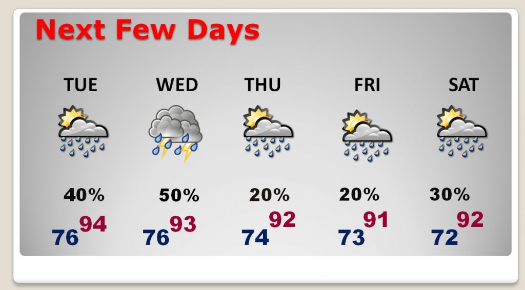
Rain chances increase tomorrow and peak on Wednesday as a front approaches. Behind the front, storms thin out Thursday & Friday.
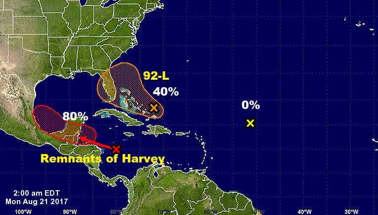
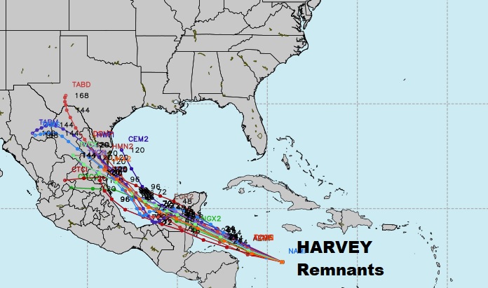
The Remnants of Tropical Storm Harvey could regenerate back to a depression or storm, following and encounter with Belize & the Yucatan, and into the warm waters of the SW Gulf. The other system, Invest 92-L, could still develop when it gets into a slightly better environment over the Bahamas or just east of Florida later in the week.