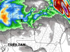
Hurricane Irma marches northward through Florida and will be approaching the SW Georgia border this afternoon, probably a Tropical Storm by then. By evening it will be near the Alabama/Georgia line as a weakening Tropical storm. Tropical Storm Warning in effect. On this video I’ll update you on what we can expect as far wind potential and rainfall and the timetable. Tress and powerlines could cause power outages. The best way to stay updated throughout the day is with our Weather App for the latest watches and warnings. Please watch this special video update, and feel free to share it. Lots of good info here.
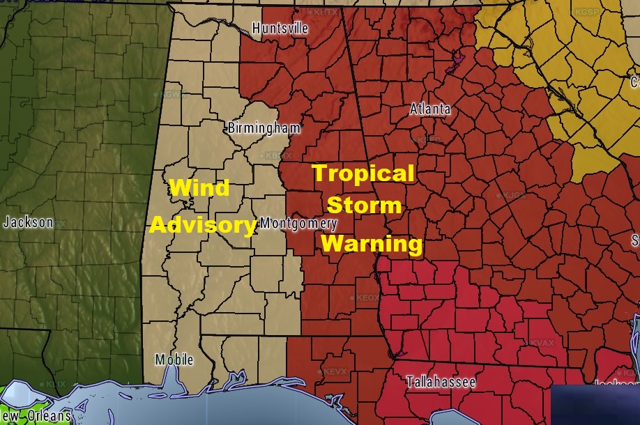
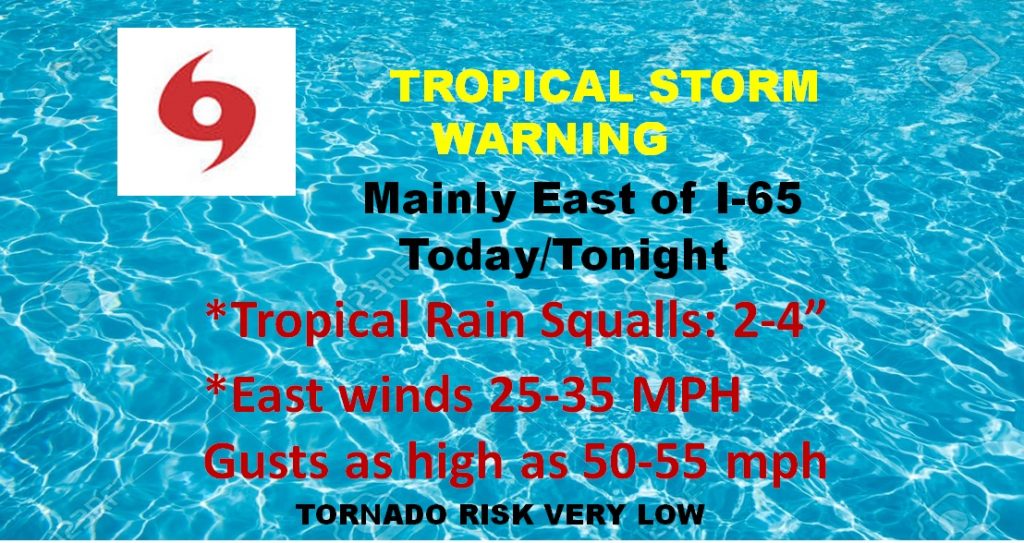
Tropical storm Warning along and east of I-65 today, with a lower threshold Wind Advisory in effect for the rest of the state because of Irma’s winds.
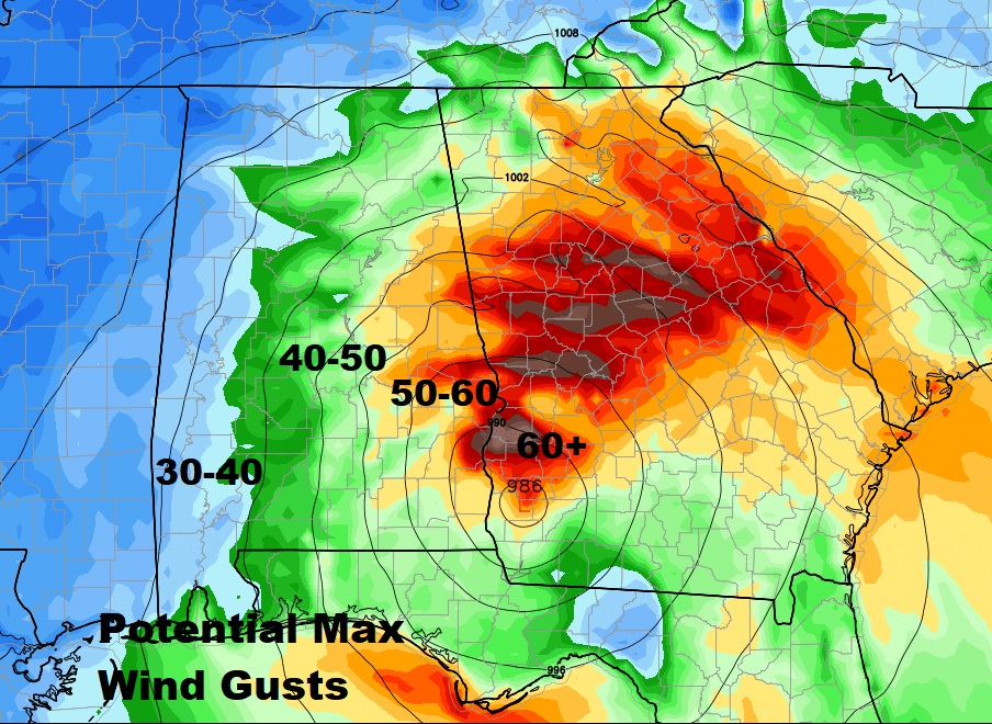
Here’s what most of us in central & east central Alabama can expect today.
This will give you a good basic idea of maximum wind gust potential across our state this afternoon & toinight.
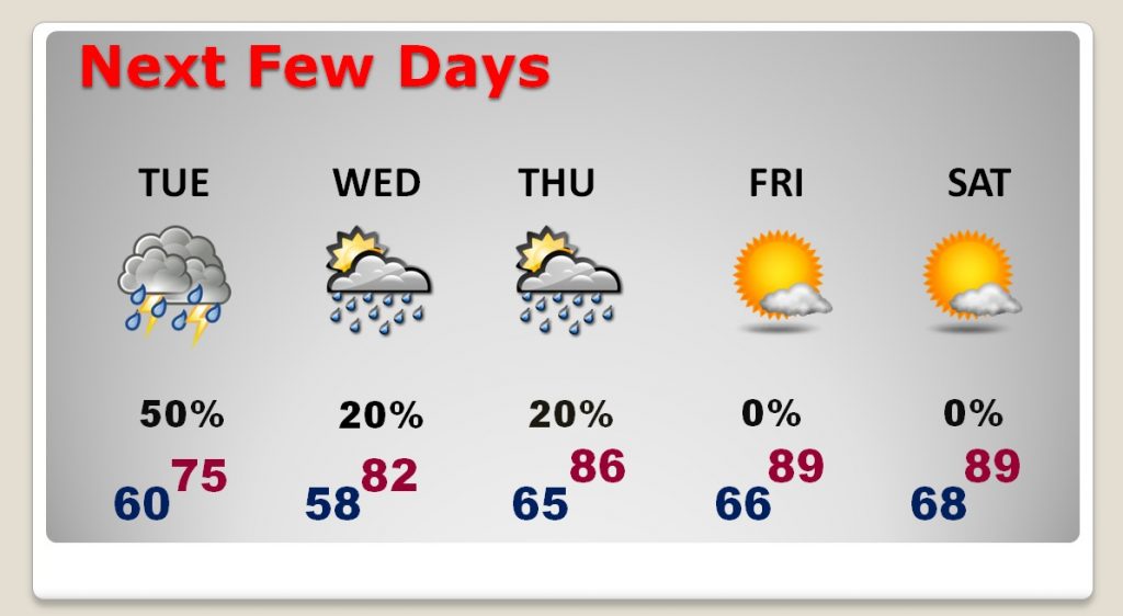
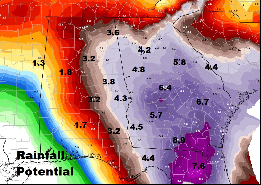
I think a lot of us in central Alabama could see 2-4″ of rain, but there will be locally heavier amounts near the Georgia border.
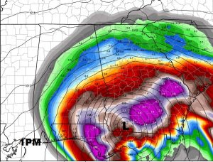
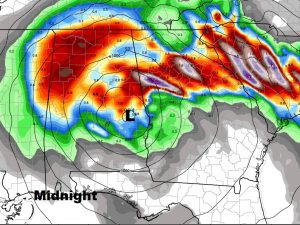
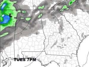
Euro model shows the progress of weakening Tropical Storm Irma as it curves from Georgia into east Alabama by tonight and weakens to a depression in north Alabama tomorrow.
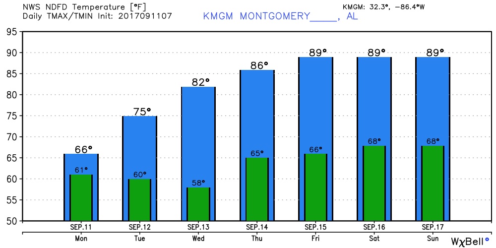
Today’s highs held back to the 60’s because of clouds, winds and rain. 70’s tomorrow and back to normal last half of the week.