Summer heat continues for now. But, hang on, some nice relief is on the way. By the weekend you will feel a nice change. It will feel more like Fall. I have new numbers to show you that you’re going to like. Tropical Storm Warning on the Carolina coast. Hurricane Maria is destined to have an impact on the US coastline by mid week. It’s all in a nice 2 minute package for you…everything you need to know to get your week started on your Monday morning personal weather briefing.
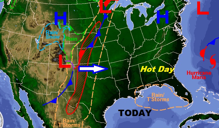
Today will be another hot day with some widely scattered storms in the PM, and highs at least around 90. Tonight’s low 70. Look at that front in the middle of the country heading this way.
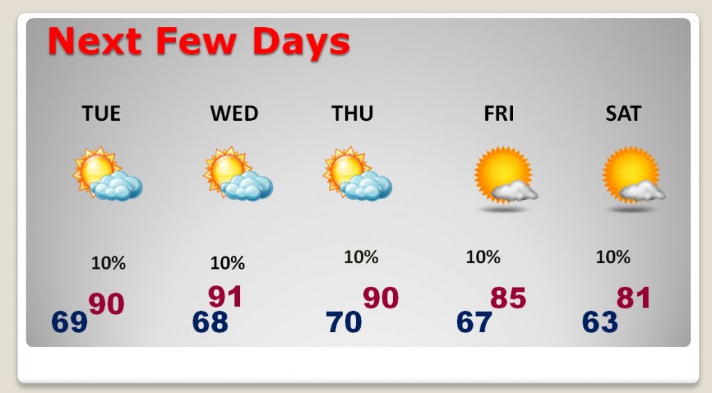
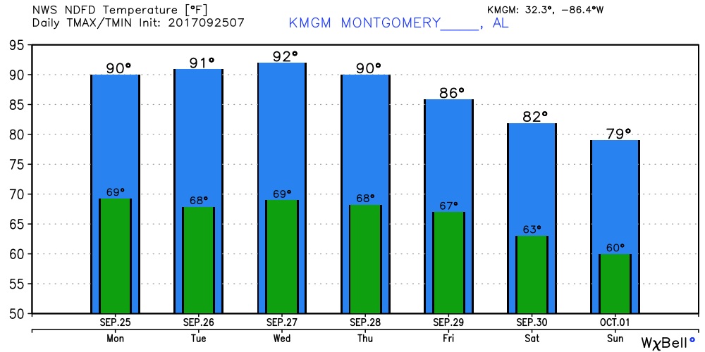
Hot days at least through Thursday. I think Wednesday could be the hottest days of the week. Relief arrives in two stages by end end of the week into the weekend.
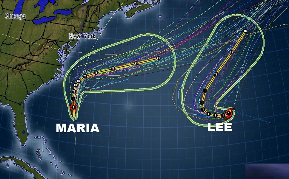
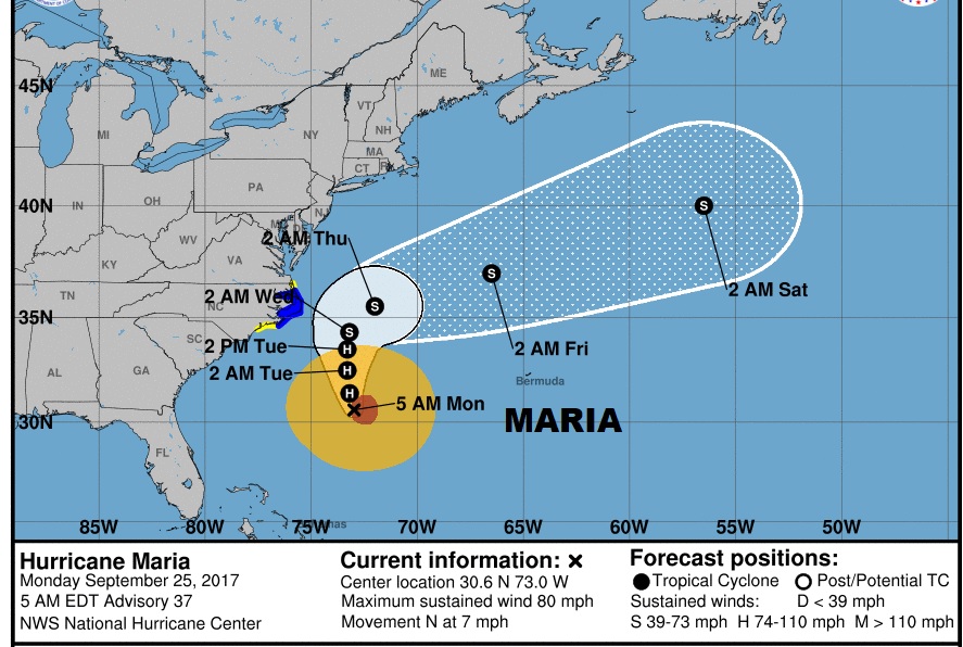
Hurricane Maria will have a close encounter with the United States by mid-week. Tropical Storm Warning now along the Caroiina coast. The same trough that will deliver cool air here by the weekend will be the steering mechanism to take Maria out to sea with a abrupt right turn.
The other Hurricane is Lee. Lee is a “fish storm”.