
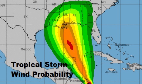
The National Hurricane Center says the threat of “direct impacts from wind storm surge and heavy rainfall is increasing from Louisiana through the Florida Panhandle. A hurricane watch will likely issued later tonight or early tomorrow for portions of the northern Gulf coast.
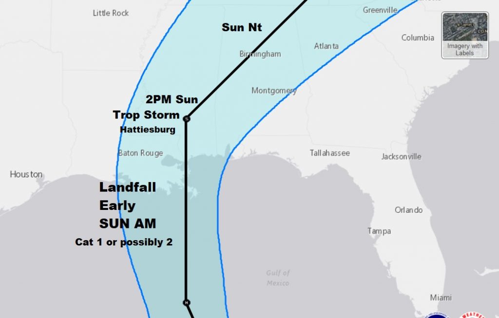
The center of minimal tropical storm Nate is in eastern Honduras. Winds are 40 mph, moving NNW at 17. Nate will interact with portions of the Yucatan tomorrow before entering the warm waters of the Gulf, reaching the northern Gulf coast, perhaps in the wee hours of Sunday morning, as at least a category 1, and possibly a category 2 hurricane, before it takes a northeast curve and accelerates. It will weaken later in the day across western and northern Alabama.
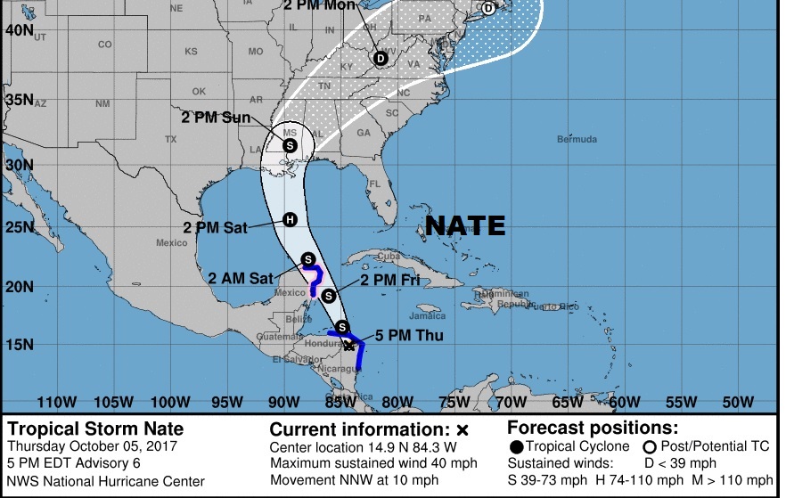
Here’s a closer look at the cone and the track.
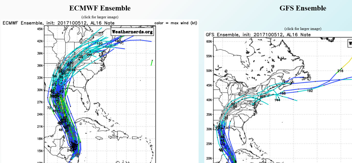
THE SPAGHETTI MODELS: The consensus of the models have made a definitive “nudge” westward. The bulk of the models are bunched over Louisiana and Mississippi. Only a few “members” of the global ensembles are over Alabama.
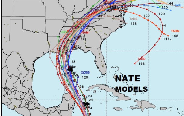
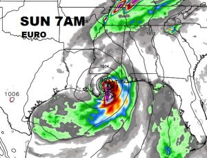
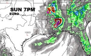
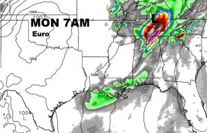
The specific operation Global models…the GFS and the Euro have shifted west. The Euro is still farthest east. It shows a hurricane near New Orleans on Sunday morning, north to Meridian Sunday evening, then racing northeastward.
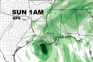
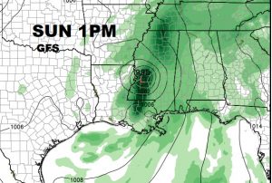
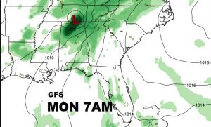
The GFS is about 6 hour faster and much farther westward. It shows a rather strong system coming ashore in western Louisiana just after midnight Saturday night. It keeps the track toward Jackson Mississippi and then up to Tupelo by Sunday night.
WIND AND RAINFALL POTENTIAL: The probability of tropical storm force winds will be increasing in central and south Alabama by Sunday morning, and spreading northward.
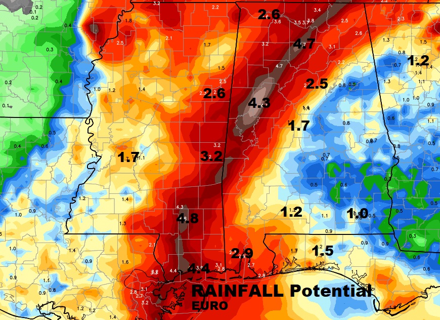
A corridor of extremely heavy rainfall will be located near and just east of the expected track of Nate. This outlook will change and shift, but here’s the general idea on the Euro model.
TORNADO RISK: It’s too early to show you a map, but there will be a rather strong spin up tornado risk along and well east of where the center of Nate comes ashore. Expected tornado watches and tornado warnings from east Mississippi in through most of Alabama and into Georgia on Sunday and into Sunday night.
–
I will have another complete video briefing for you which will be online tomorrow morning by 4:45AM on the latest Nate information. In the meantime, stay in touch with the latest, and adjust your weekend plans accordingly as we prepare for the storm. Have a good evening!
–Rich