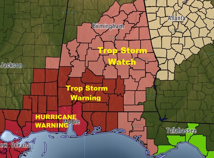
Hurricane Warning continues along the Alabama gulf coast. Tropical storm Watch northward into central Alabama for Sunday.
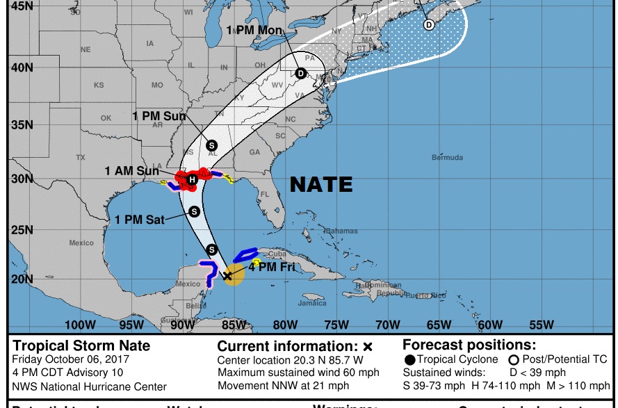
Tropical Storm Nate is now getting stronger. Winds are 60 mph, located 80 miles east of Cozumel, moving NNW at 14 toward the Gulf of Mexico. It is expected to intensify over the Gulf. Nate is expected to be a Category 1 hurricane at landfall along the northern Gulf coast late Saturday night or very early Sunday morning as it moves rapidly northward and then turns northeastward.
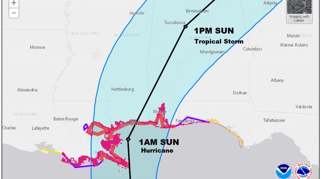
Here’s a close up of the cone.
WATCHES AND WARNINGS: Hurricane Warning from Grand Isle, LA through the Alabama coast to the Florida line. Hurricane watch & Tropical Storm Warning extends eastward to near Destin and a Tropical Storm watch eastward to Indian Pass, FL. including the Panama City area. In Alabama, Tropical Storm Watch for several southern counties continues.
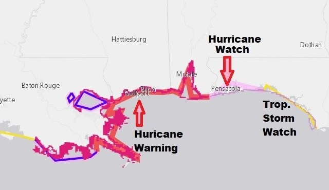
Tropical Storm Watch has been extended northward and now includes most of central and south Alabama for Sunday.
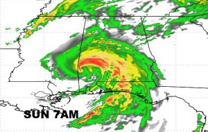
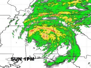
FUTURE RADAR: Couple of interesting future radar snapshots from the hi-res HWRF model. Notice the rapid movement of the storm from coastal Alabama to central Alabama from 7AM to 1PM Sunday. It will be in NE Alabama by Sunday evening.
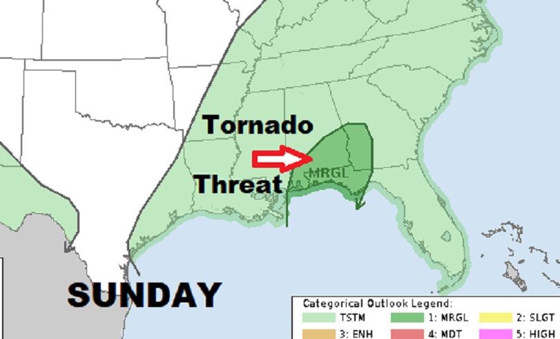
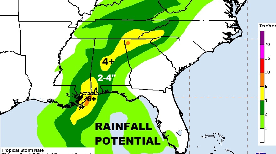
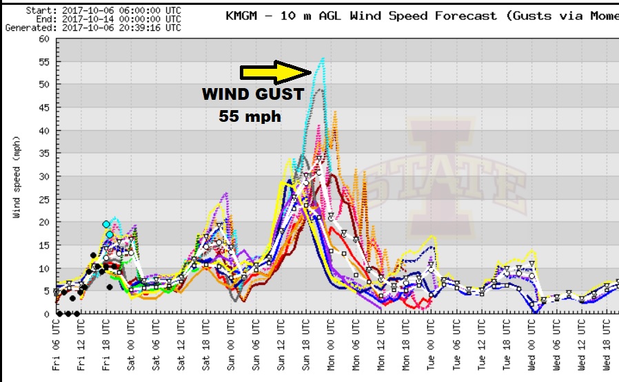
EXPECTED IMPACTS IN CENTRAL ALABAMA: Nate will have high impact across central Alabama. Expect sustained winds of 25-25 mph, wind gusts as high as 50 mph possible. That’s enough to bring down some trees and cause power outages. Expected rainfall, perhaps 2-4” inches, but no flooding expected due to the storm’s rapid movement. Spin out tornadoes are a good bet. That’s routine on the right side of any landfalling tropical systems. Tornado watches and warnings are likely.

Some models indicating wind gusts as high as 50-55. I think that’s the high end.
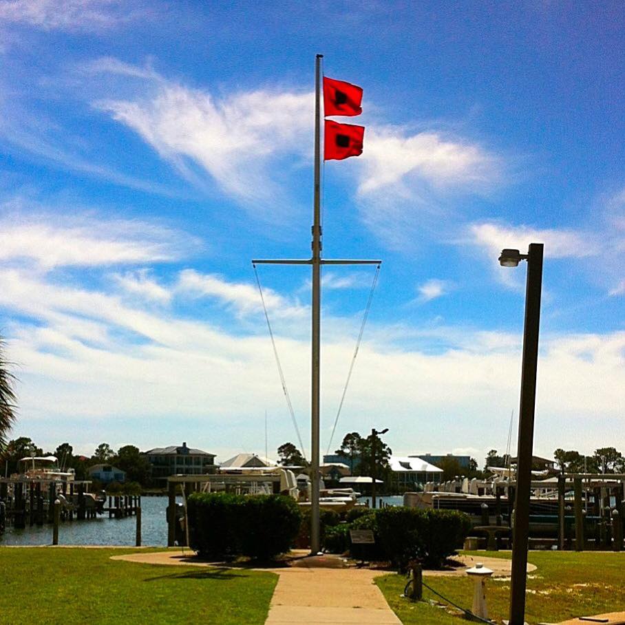
I will have another complete update online before Dawn Saturday morning. Stay up with the latest On Nate. Here’s the Hurricane Warning flag flying this afternoon on the Alabama coast at Orange Beach.