
SPECIAL NATE UPDATE VIDEO (6:30AM 10/7/17) Hurricane Nate is in the Gulf, gaining strength and moving faster. This Special Video and Blog Update will tell you everything you need to know about the expected impacts for us and the time line. As you will see in this video, the action could even begin in the wee hours of the morning. Feel free to share this post.
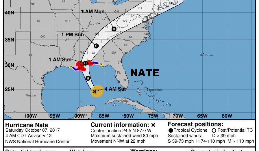
Updated NHC 4AM Cone showing the storm coming shore on the norther gulf coast late tonight as at least a Category 1 hurricane and rapidly moving northeast to NE Alabama Sunday afternoon.
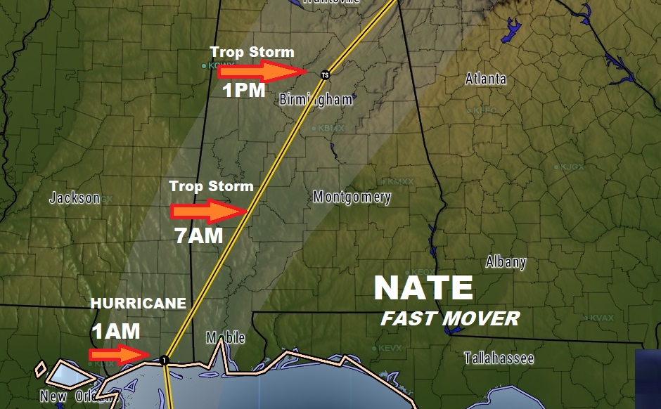
The incredibly fast forward speed will allow Nate to zip through the state rather quickly tomorrow, but tropical storm conditions for many of us could begin before Dawn.
This graphic spells it out. Here’s the bottom line on the most significant impacts for central & south Alabama.

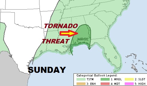
There’s always a tornado threat with landfalling tropical systems, on the eastern side of their track. Our weather app will alert you when you are under a warning.
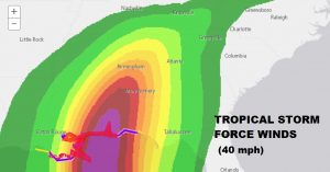
Tropical storm force sustained winds are most likely west of I-65 and south of US 80.
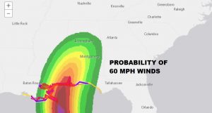
60+ mph winds sustained mainly confined to the coastal counties.
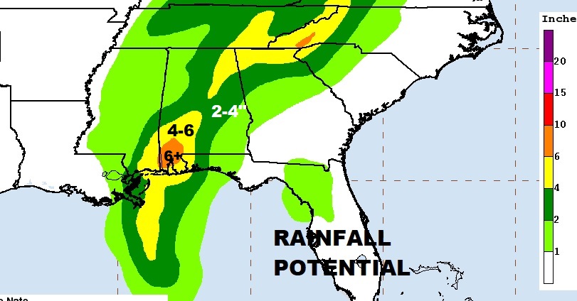
Flash flood watch. The storm is moving so quickly, many of us will see 2-4″ rainfall, with 4-6″ in the southwest counties and over 6″ closer to the coast.
More updates throughout the day. Stay up to date on Nate. I’ll be with you all day Sunday, beginning early, LIVE streaming, and on the radio and online.
–Rich