
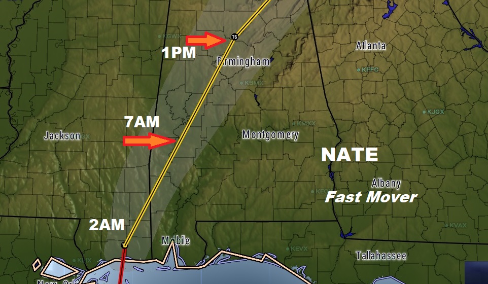
Hurricane Nate came ashore (2nd US landfall) after Midnight near Biloxi, MS, moving directly over Keesler AFB where the Hurricane Hunters reside. Winds on the 1AM update, are still listed as 85 mph. Located 10 miles north of Biloxi at 1AM, moving north at 20.
EXPECTED NATE IMPACTS IN CENTRAL ALABAMA:
NWS: Nate is expected to have possible significant impacts across much of
Central Alabama on Sunday. Sustained winds of 40 to 50 mph may begin
as early as 4 AM Sunday in the southwest counties. Conditions will
worsen through Sunday morning into the afternoon as strong winds 30 to
40 mph and heavy rain spread northward. Wind gusts could reach 45 to
60 mph in a swath encompassing much of Central Alabama with 60 to 70
mph gusts possible in the far southwestern counties. Scattered to
numerous downed trees may cause damage along with a significant number
of power outages. The greatest wind gusts and impacts are expected to
be generally along and east of a line from Pickensville to Lake
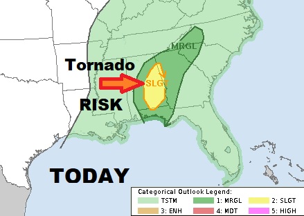
Tuscaloosa to Blountsville. Isolated tornadoes are also possible Sunday
generally along and east of a line from Livingston to Jasper.
Conditions will improve Sunday night into Monday morning as Nate
continues to weaken and move to the northeast.
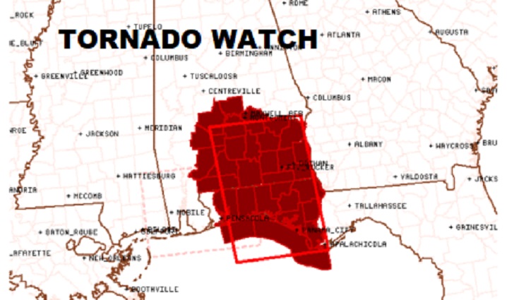
TORNADO RISK: There will be a significant risk of brief tornadoes through much of the day and into evening. This is always the case of the east side of a landfalling tropical system. Be aware! Sometimes even these small tornadoes can cause significant damage and injures. The latest tornado watch is in effect until 10AM.
We will be LIVE streaming today from the Bluewater Weather Center. You can view our LIVE stream on your APP, online at richthomasweathernetwork.com and on You Tube at Rich Thomas Weather.