
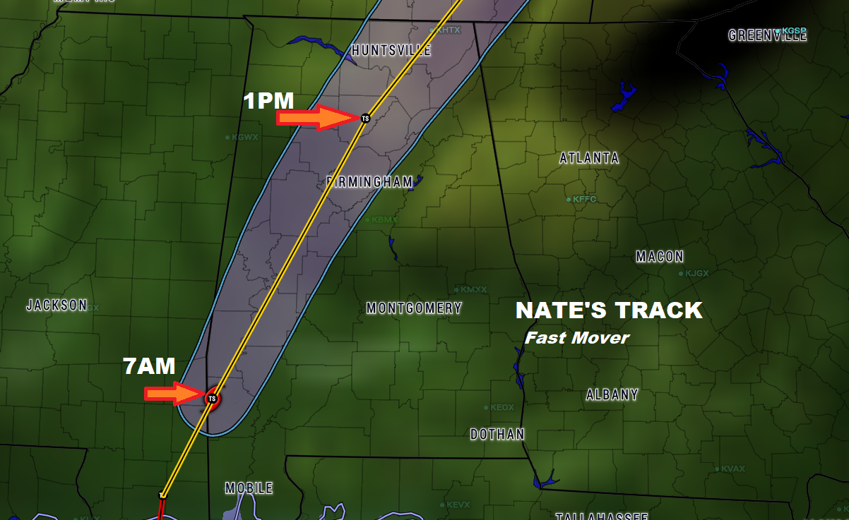
Nate moved onshore after midnight near Biloxi with 85 mph wind gusts. As of 4AM, Nate was downgraded to a tropical storm with 70 mph winds. It will continue to race toward the NNE and then NE at 25-30 mph today. East of the center a significant spin up tornado risk continues.
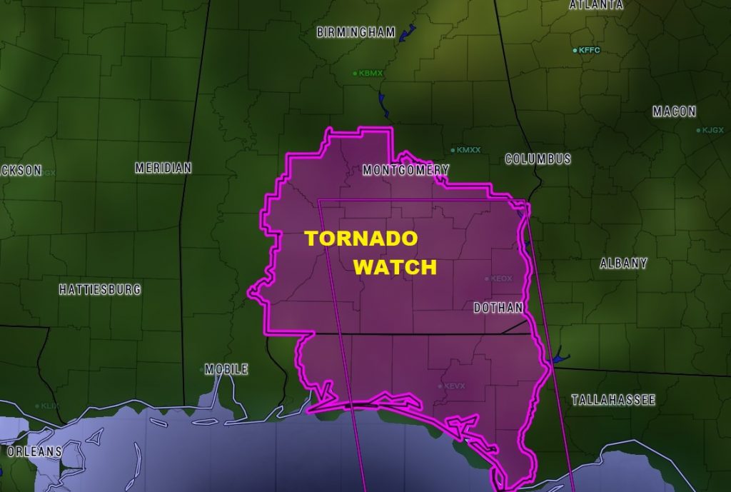
TORNADO THREAT: Tornado watch continues in effect. The current watch goes till 10. There will be others later. Significant spin up tornado threat occurs with every landfalling tropical system east of the track. These tornadoes are sometimes brief but can cause a lot of damage and injuries. Daytime heating will enhance the threat today.
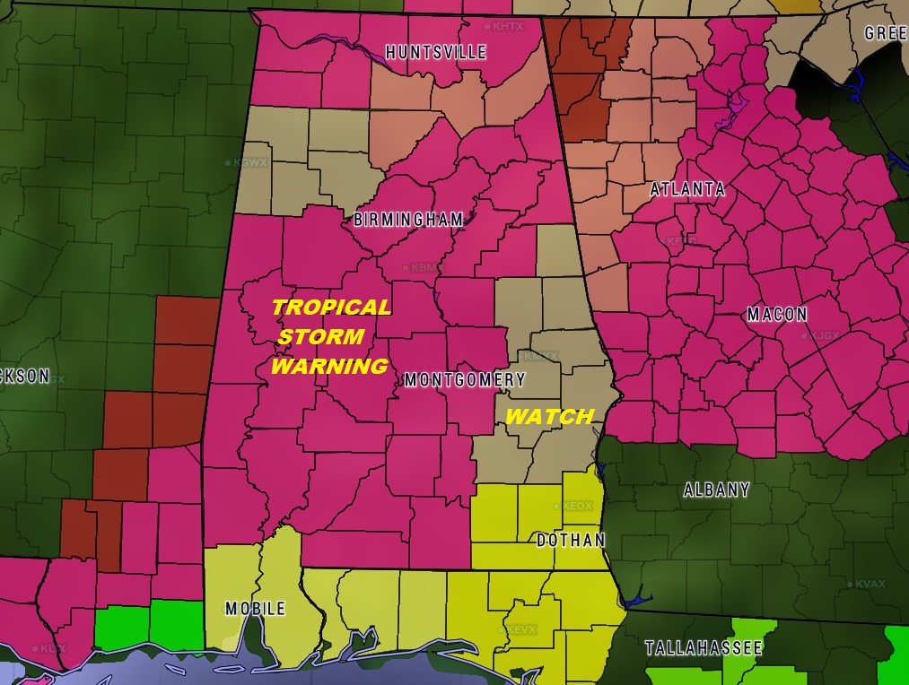
TROPICAL STORM WARNING continues in effect for all but extreme eastern counties.
NATE EXPECTED IMPACT:
Nate is expected to have possible significant impacts across much of
Central Alabama today. Sustained winds of 40 to 50 mph in SW counties first. Conditions will
worsen through Sunday morning into the afternoon as strong winds 30 to
40 mph and heavy rain spread northward. Wind gusts could reach 45 to
55 mph in a swath encompassing much of Central Alabama with 60 to 70
mph gusts possible in the far southwestern counties. Scattered to
numerous downed trees may cause damage along with a significant number
of power outages. The greatest wind gusts and impacts are expected to
be generally along and east of a line from Pickensville to Lake
Tuscaloosa to Blountsville. Isolated tornadoes are also possible Sunday
generally along and east of a line from Livingston to Jasper.
Conditions will improve Sunday night into Monday morning as Nate
continues to weaken and move to the northeast.