
There are 10 days left in October and we should see a kind of a wild ride, with lots of changes. Very warm this weekend, followed by a Monday “soaker”, then sharply cooler, with the chilliest air so far, then a late week recovery, then more showers with a front Halloween weekend. The Euro model captures the drama of the next 10 days.
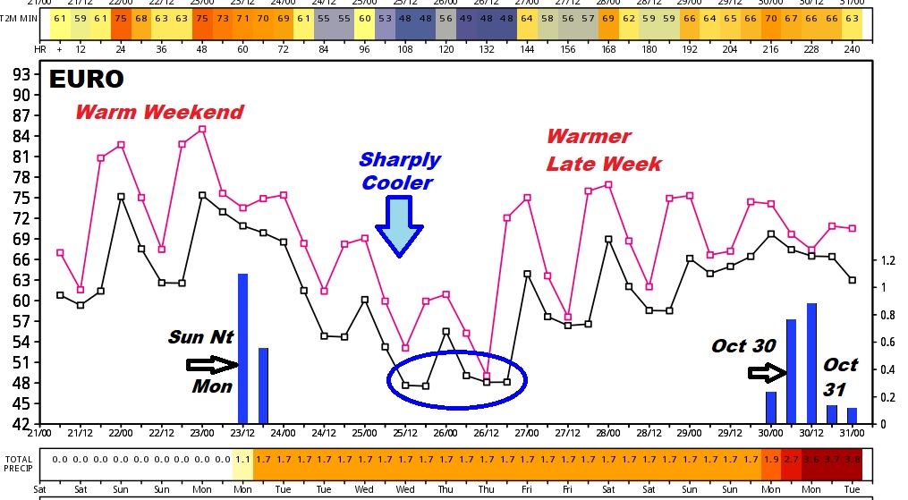
NEXT FEW DAYS: Shorts and teeshirts will be in fashion with close to the mid 80’s at many spots today and Sunday. Most of the weekend is dry, expect for chance of showers late Sunday and Sunday night. The big rains come Monday. More on that below. Keep reading. Sharply cooler air comes in Tuesday & Wednesday. Coldest morning this week will be Thursday.
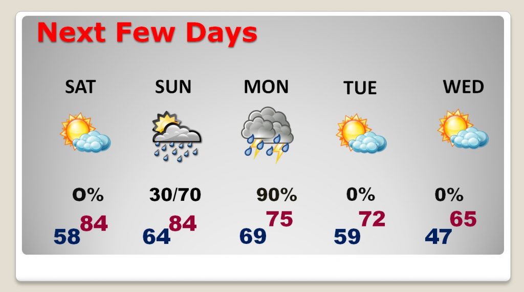
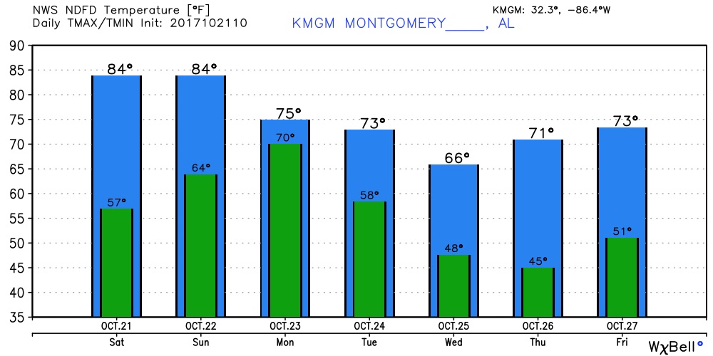
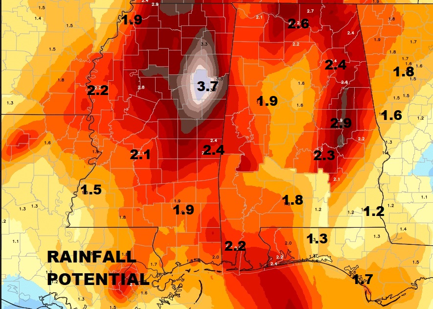
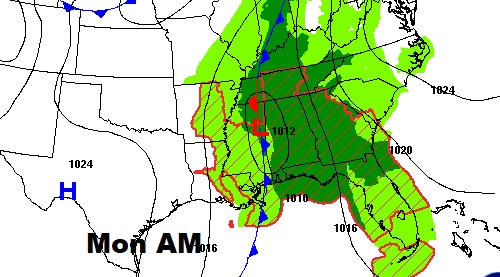
MONDAY SOAKER: We could see significant rainfall amounts Monday. Some places will be over 2”, with locally heavier amounts in spots. Low pressure, attached to a cool front, will slow the front’s progress and pump in lots of Gulf moisture. I don’t think we will see any severe weather with this set-up. Rain will begin to taper off Monday night, followed by sharply cooler air Tuesday, Wednesday and into Thursday, too.
Looks like we will be dealing with another frontal system during the last of this month, which will bring showers to the state. Models disagree on the timing of the front. The GFS is fastest with Oct. 29, and the Euro is slower, bringing in the front Oct. 30/31. It will turn significantly cooler again as the month of November begins.
FOOTBALL WEATHER TODAY/TONIGHT: For the two key games, it looks like perfect football weather for the big Alabama vs. Tennessee game in Tuscaloosa this afternoon. But, the Auburn Tigers will be playing in a soaker in Fayetteville, Arkansas tonight with drenching rains, risk of thunderstorms and gusty winds gusting to 25 mph at times.

Have a nice weekend!
–Rich