
Welcome to the first day of Standard Time!
The new reality today: sunrise was at 6:06 and sunset at 4:51! We will be on standard time till March 11th. Big weather changes are right around the corner. Are you ready for another cool-down? The cool front will enter the state Tuesday and make it to the coast by Wednesday morning. Look for about a 15 degree drop in high temps. by mid week, and some very chilly nights ahead by late week. Also, some rain is in the cards for Wednesday and Thursday, as waves of low pressure ride along the stalled front along the coast.
NEXT FEW DAYS: Today will be another unusually warm early November day. After some foggy spots this morning, there will be a good deal of sunshine, and highs will be back in the lower 80s, with low 60’s tonight. (Normal 73/47). We should be dry today, and I have the rain chances under 20% through Tuesday. Monday and Tuesday’s high will be near 80. Then, the big change. Much cooler on Wednesday and Thursday, with a cool rain a good bet.
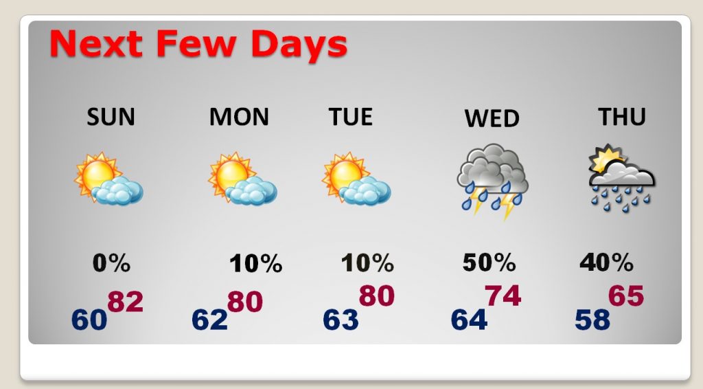

LOOKING AHEAD: Looks like we will be comfortably cool in the daytime and some chilly nights return late week, into next weekend and beyond. Nothing extreme.
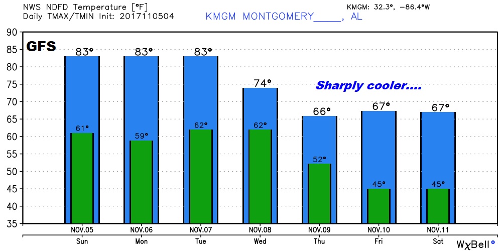
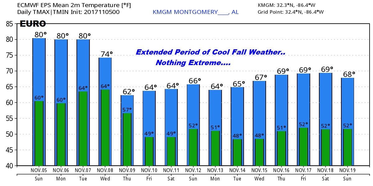
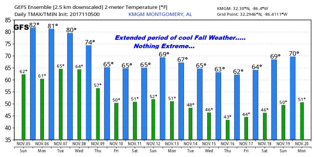
THE MODELS: Both the Euro model and the American GFS advertise and extended period of cool Fall temps, but nothing extreme. No freezing temperatures are anticipated. And, so far, I don’t see any significant storms in the next two weeks. Keep in mind, we are now in tornado season. Some years the November/December season is a bigger deal than in the Spring. So far, I don’t see anything that concerns me. Watching…
—
Have a great day today! It’s the last day of the Fair. If you are out there this afternoon, look for me. I’ll be in the Bluewater booth on the Midway this afternoon.
Your next complete video update will be online bright and early tomorrow morning by about 4:45AM. Now, let me go change a few more clocks…
Rich