
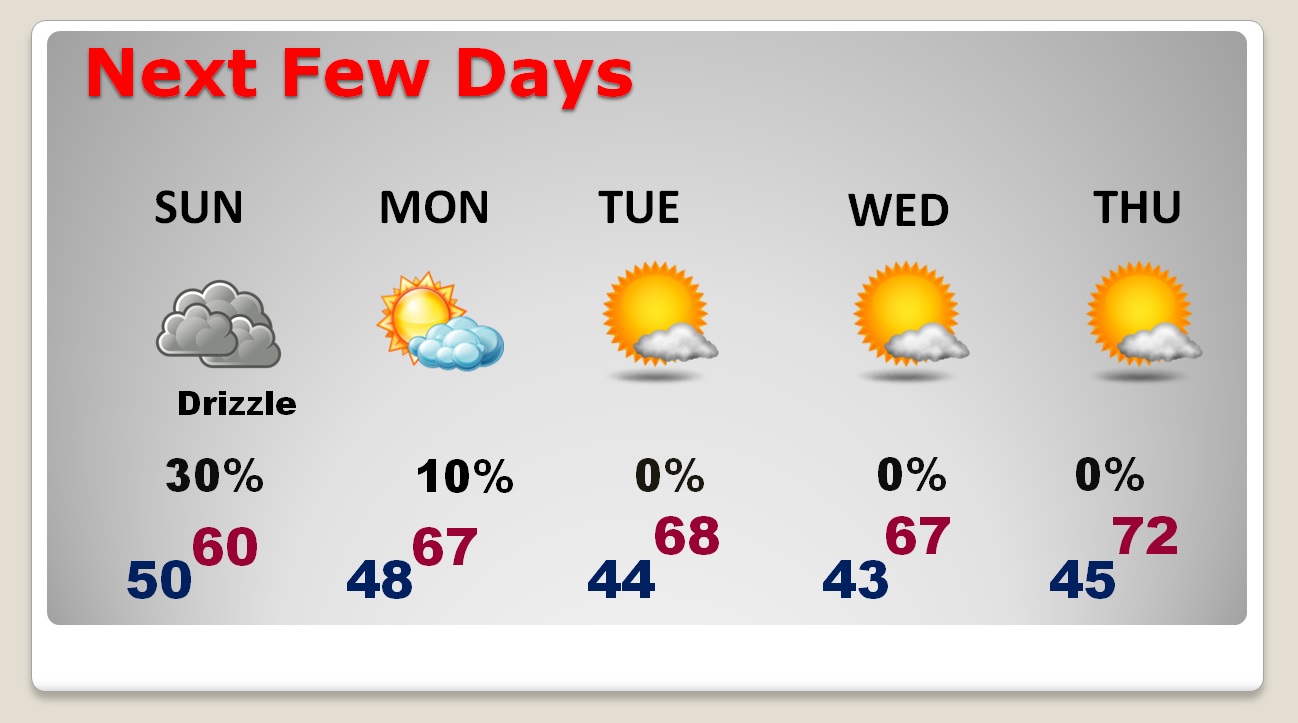
Cool air continues to circulate into the state around a Cold High along the east coast. It will be a cloudy, cool Sunday. Highs will struggle to reach 60. Some places will stay in the 50’s. Patches of light rain or drizzle will be around at times. Early morning radar shows a blips here and there already. The rain will not amount to much. Clouds will hang in tonight and first half of the day Monday. Tonight’s low will reach the upper 40’s After the Monday morning gloom, look for improvement in the afternoon and clear skies Monday night.
NEXT FEW DAYS: Following the clouds and cool Sunday and half of the day Monday, much of the week will feature a lot of sunshine with a gradual warming trend. Nights and mornings will be chilly. Afternoons will be comfortable. The coldest mornings will be Tuesday and Wednesday. The warmest days will be Thursday & Friday as lower 70’s return.
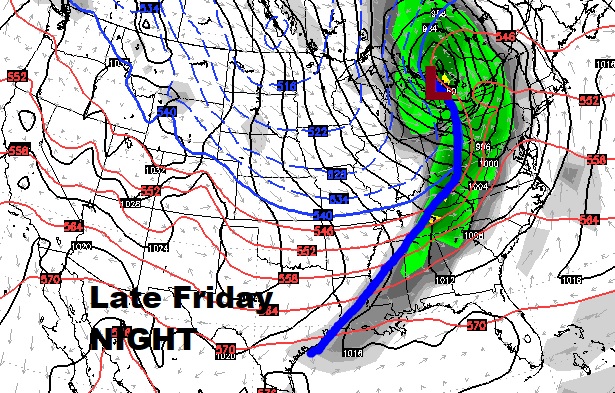
LOOKING AHEAD: Friday daytime will be dry and warm. But, an important cold front will sweep across the state overnight Friday night into Saturday morning. ‘Tis the season for severe weather, however, right now, there’s no strong indication we will see severe weather with this frontal passage.
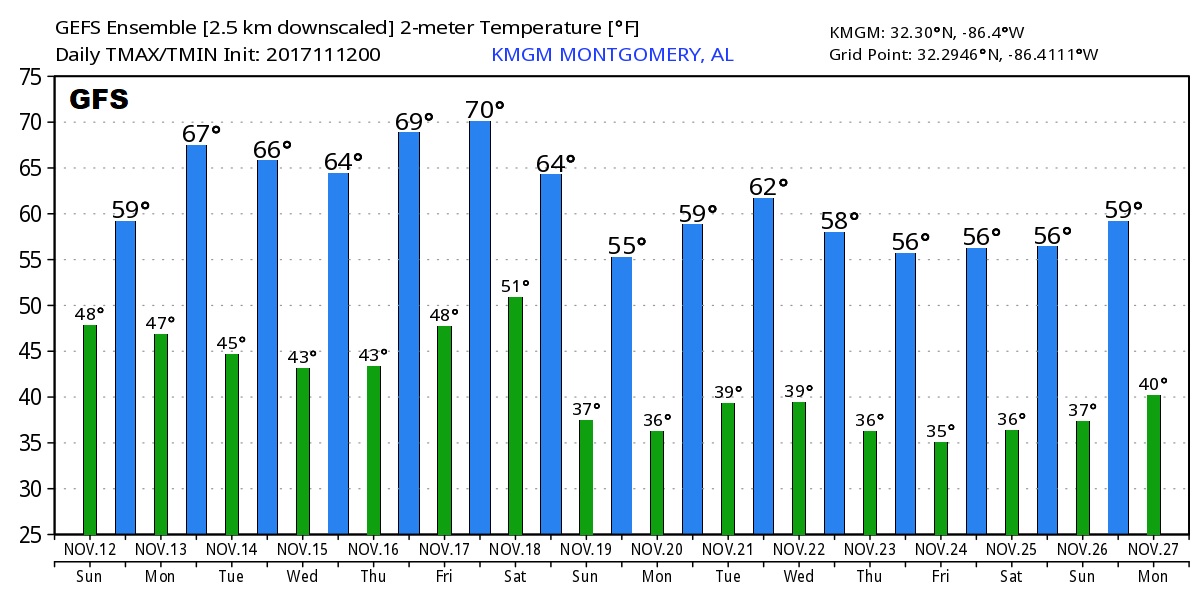
Just to whet your appetite about Thanksgiving and Iron Bowl Week: The raw numbers from the GFS model continues to show “stages of cool” during the week. According to the trends, it should be very chilly around Thanksgiving and through Iron Bowl weekend. I’ll get into more depth and update details for you tomorrow morning when we know more. Don’t take these numbers literally. This is just “guidance”.
I’ll have a complete video briefing for you first thing in the morning, online by 4:45AM. Have a great Sunday!
–Rich