Good Morning! The next 6 days will be very active, and very complicated, right on through Christmas Day. Making matters worse – the major computer models disagree on the details and the timing. I’ll do my BEST to untangle, and make sense of the details. We could even see a couple of bouts with severe weather. It now looks likely that Arctic Air may arrive just in time for Santa’s visit. First, DENSE FOG is the big issue this morning. I hope you have a couple of minutes as I walk you through the details on your Tuesday morning personal weather briefing.
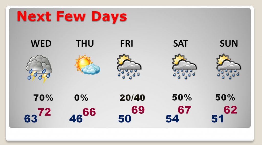
There could be a few showers today, but the best chance of showers and storms enter the state late tonight and Wednesday morning.
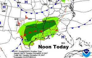
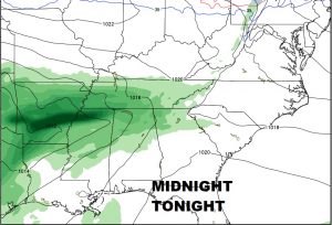
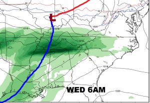
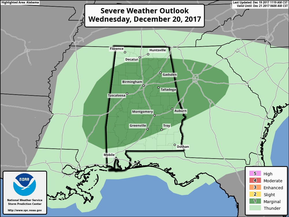
The Storm Prediction Center says some storms could be severe on Wednesday. The primary window would be during the morning and mid-day hours. Damaging thunderstorm winds are possible, and a brief tornado or two can’t be ruled out.
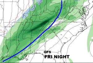
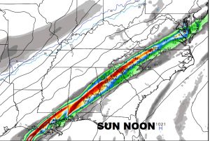
Springtime in December continues next few days. Thursday is the nicest day of the week, on the first day of Winter. Then a stormy period begins Friday night into Christmas weekend. Severe weather is not out of the question with the arctic cold front.
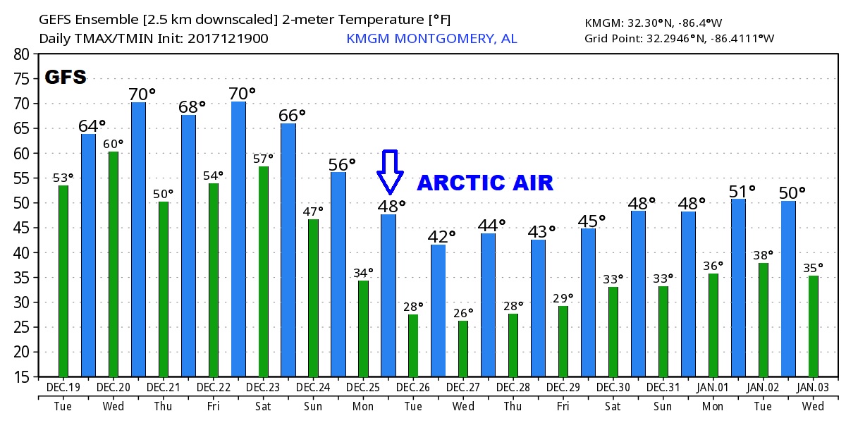
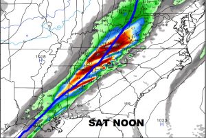
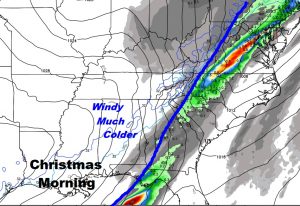
Christmas Weekend is very complicated, especially since the models are in disagreement on the details and timing ion the frontal progress. Stay tuned… It does appear, however that arctic air will start pouring into the state Christmas Day.
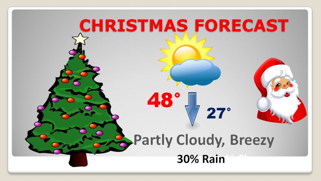
The Christmas Forecast is undergoing a major overhaul and it’s still very much a work in progress.
The GFS model advertises some VERY cold air Christmas week. Could there be some winter mischief sometime Christmas Week. MAYBE… Stay tuned.