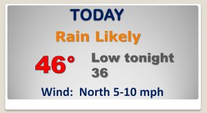
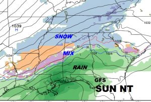
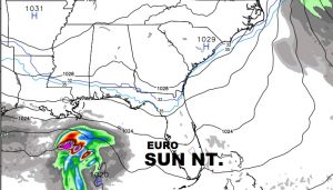
Good Morning, on a cold, wet, nasty Winter’s morning. I’ll show how long the rain could stick around. But, then, our attention shifts to the next big Arctic Blast, which will arrive before the New Year. It’s the coldest batch yet. There’s much drama in the model forecast. Quite a discrepancy. Could we see a winter storm in Alabama by Sunday night, or nothing at all? The US model is the “odd man out”. I’ll try to sort it out for you, on a Holiday week edition of your personal weather briefing.
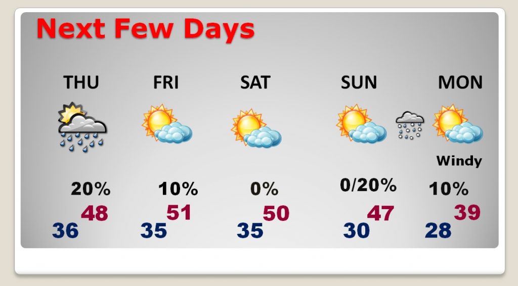
Cold, wet, nasty day today. Best chance of rain morning and mid-day. Highs only in the 40’s.
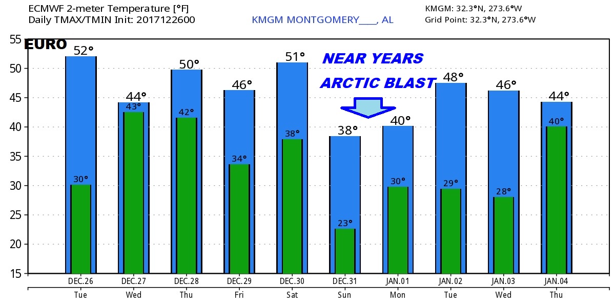
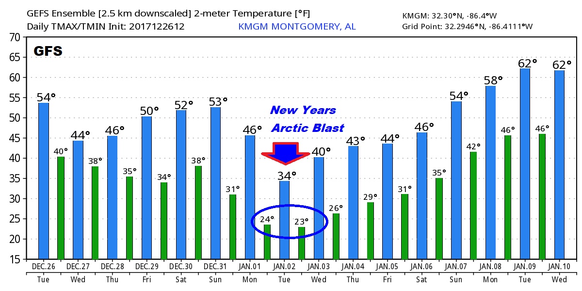
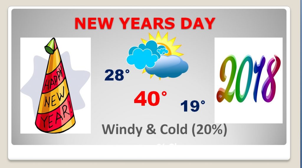
Very cold forecast for the next several days, including yet another Cold Arctic Blast arriving before the New Year arrives.
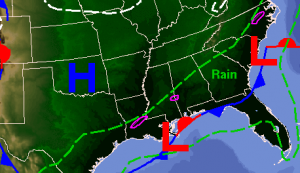
MODEL DRAMA: The US GFS model still likes the idea of a possible winter storm in Alabama New Years Eve and into New Years Day. Two other global models say….NOPE…NOTHING. They keep moisture farther south in the Gulf. The discrepancy continues.
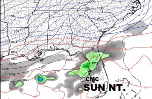
The models do agree that some very, very cold air is headed for Alabama just in time for the New Year.