Good Morning! I hope you get out and enjoy the Spring-like temperatures today, because more Drastic Changes are on the way. On this video, I’ll update you on the Cold front which will bring the rain. We’ll look at the updated timeline for the best rain chances. Plus– an update on the Arctic cold which follows this weekend. And there’s a day next week, which could be the coldest day we have seen ALL season. All that, and a few “interesting” possibilities that need to be watched. It’s all here in a nice neat brief, concise package on your Thursday morning weather briefing.
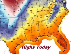
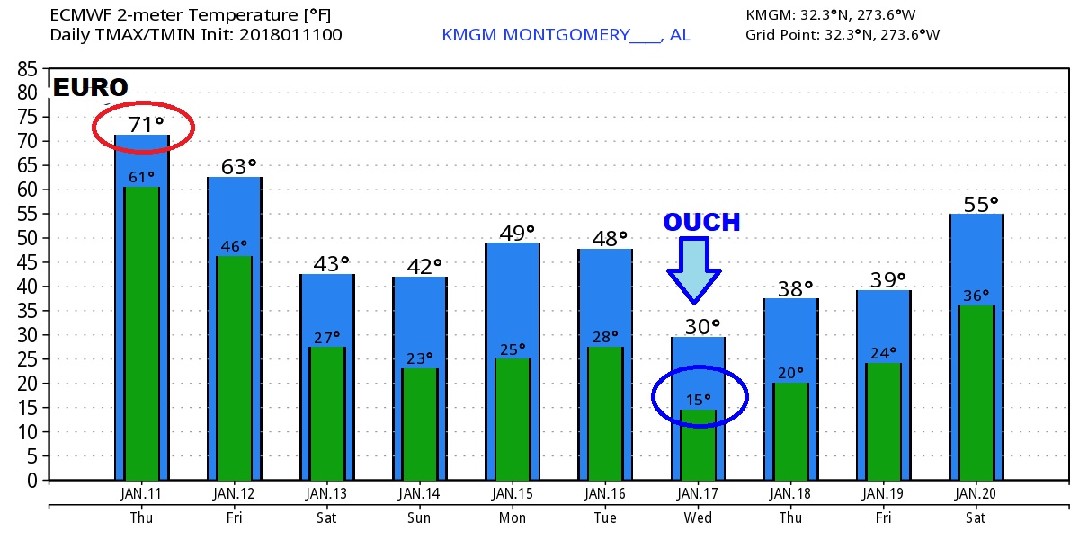
Enjoy the Spring-like high in the 70’s today…because do you see that Cold Front in Missouri. The bottom is about to drop out again this weekend.
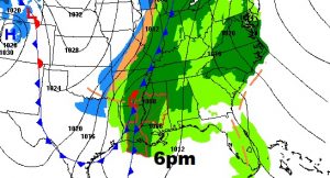
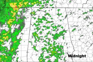
Future Radar (The hi –res NAM) shows the progression of the rain overnight and through Mid Day tomorrow.
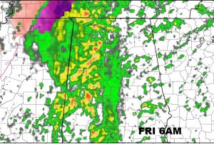
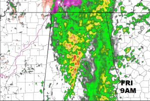
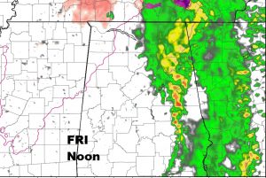
First the rain, and then drastically COLDER… Friday will be a day of falling temperatures.

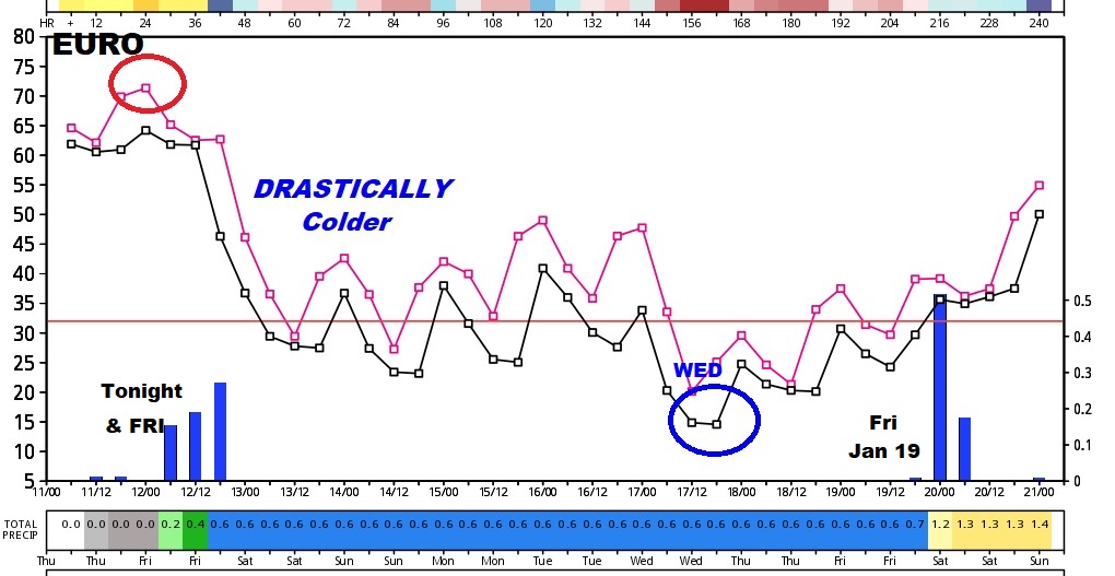
Interesting trends showing up on the Global models. Look at the frigid day the models are advertising for next Wednesday. Ouch…
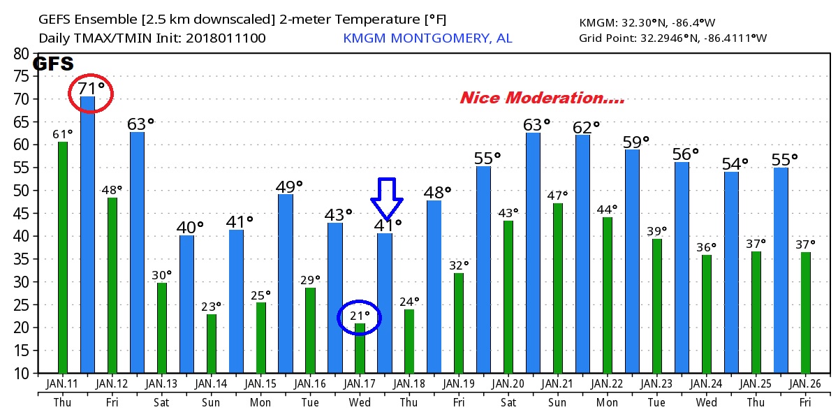
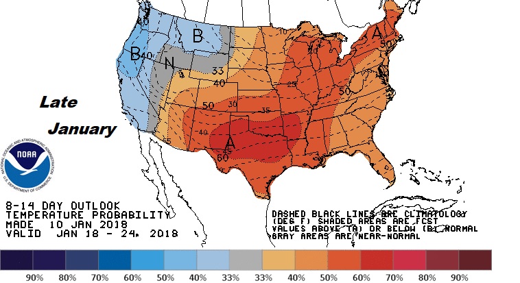
We’ll end the month with a pronounced JANUARY THAW and we sure deserve it!