
ROUGH TRAVEL CONTINUES: Alabama Emergency Management officials, continue to report extremely hazardous road conditions across central Alabama in multiple counties. In many cases, roads are just a sheet of ice. And, with temperatures not expected to climb above freezing today, travel is not likely to improve. In fact, the next time the temperature is likely to be above freezing in Montgomery would be about 11AM Thursday. PLEASE stay off the roads today. That would be 40 hours straight at or below freezing. We’ll be back to the teens tonight.
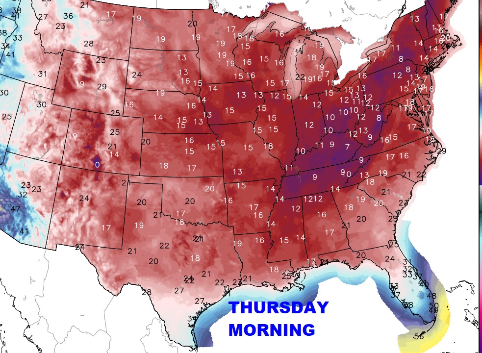
EXTREME WIND CHILLS: Lowest wind chill in Montgomery this morning was -3. With northwest winds at 15 to 24 mph, blowing over a snowpack, wind chills will stay in the teens and single digits much of tonight and Tuesday morning. Here’s a snapshot of early afternoon wind chills. Bundle up. Dress in layers. Take care of your pets.
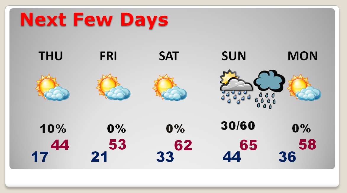
NEXT FEW DAYS: Hang on! A big warm-up is on the way. 60 or above Saturday and mid 60’s Sunday. Risk of showers and storms returning either late Sunday night or more likely Monday.
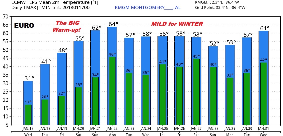
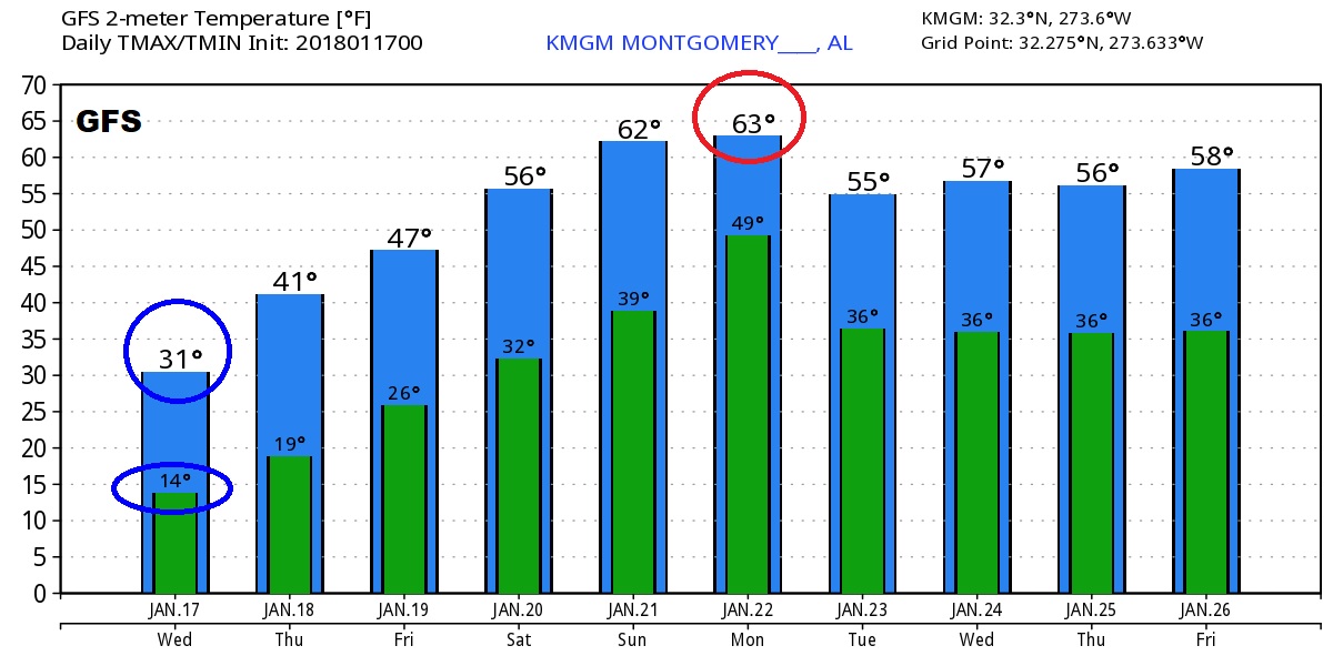
LOOKING AHEAD: The Global Models…the GFS and EURO continue to advertise the January Thaw is not only coming, it may indeed be long-lasting, through the rest of January and maybe even into February.
—
Stay weather aware! You can do that with our weather app. I’ll keep you up to date. Plus: There will be a complete video online Thursday morning at 4:45AM. Thanks!
Stay warm.
Rich