
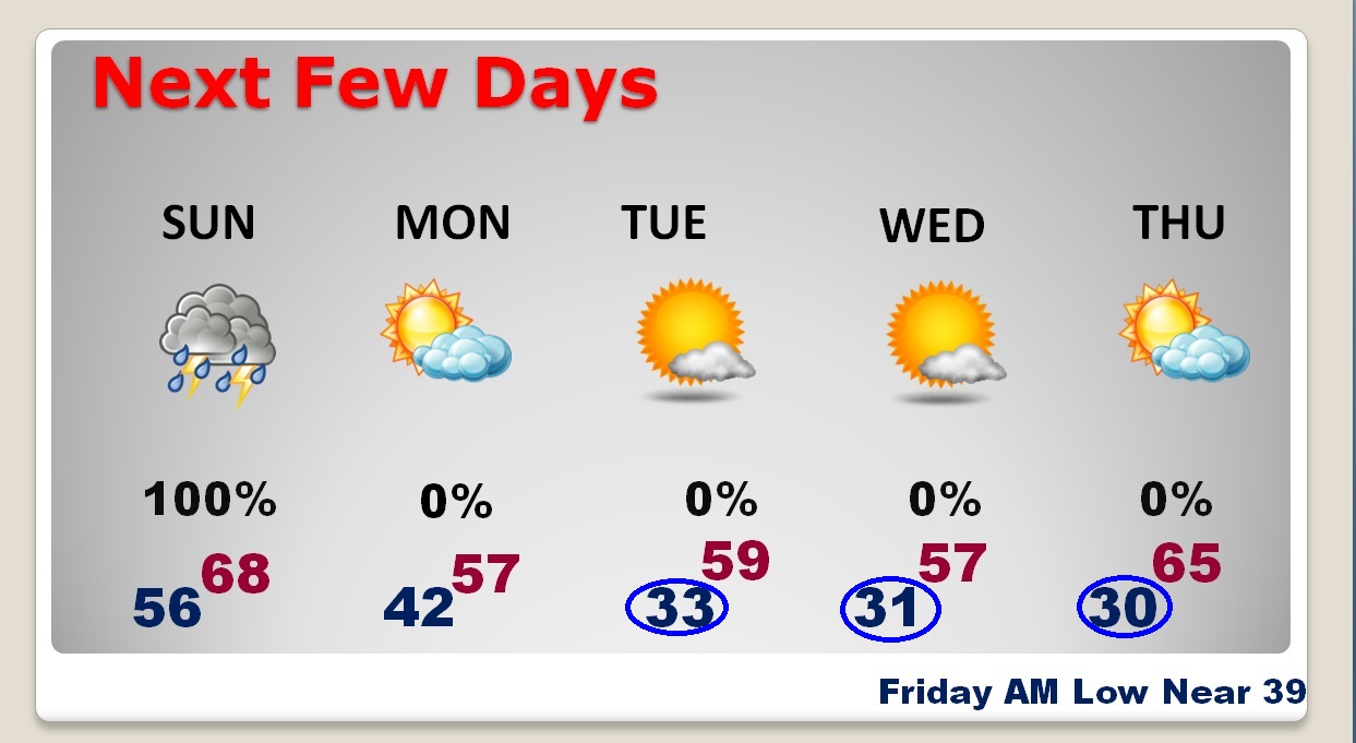
Busy Sunday. The area of rain/storms arrived overnight, right on schedule, and the rain & storms will be around for much of the day. Most of the state, from about Elmore and Autauga county southward is in a Severe Weather Risk. Rainfall amounts could be locally heavy. Then, colder funnels air again. There are three mornings next week when we will be at or close to freezing, again. Details below
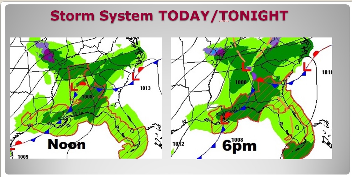
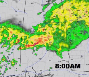
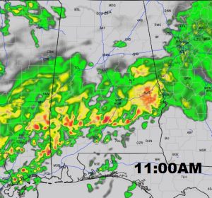
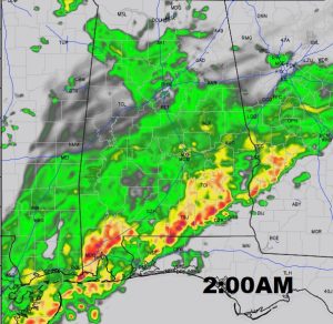
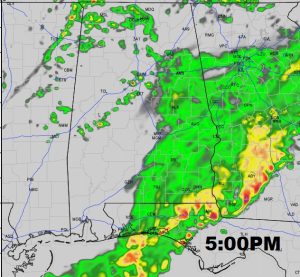
TODAY: Rain and thunderstorms. Locally heavy rain in spots. A few of the storms could be strong, possibly severe. High today will be in the 60’s. Risk of showers, maybe a thunderstorm, will linger in the forecast this evening. Most of the rain should be gone before Midnight. Turning colder. Low 42. Future radar shows the evolution and movement of the area of rain and storms during the day today and into the evening hours tonight.
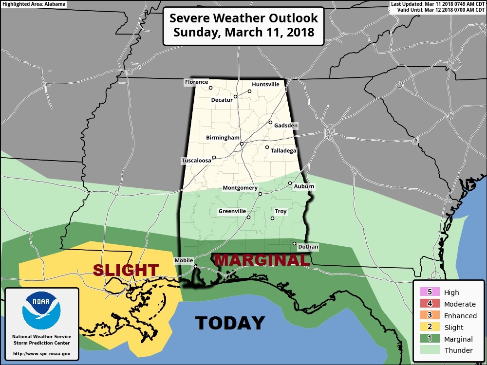
SEVERE THREAT: Better news, now on the 8AM update from The Storm Prediction Center. Most of us have been removed from the Marginal Severe Risk today. Now, only the extreme southern strip of counties are included. The main threat will be damaging wind gusts. Large hail can’t be ruled out in a few storms. The tornado threat is relatively low in this situation, but not zero.
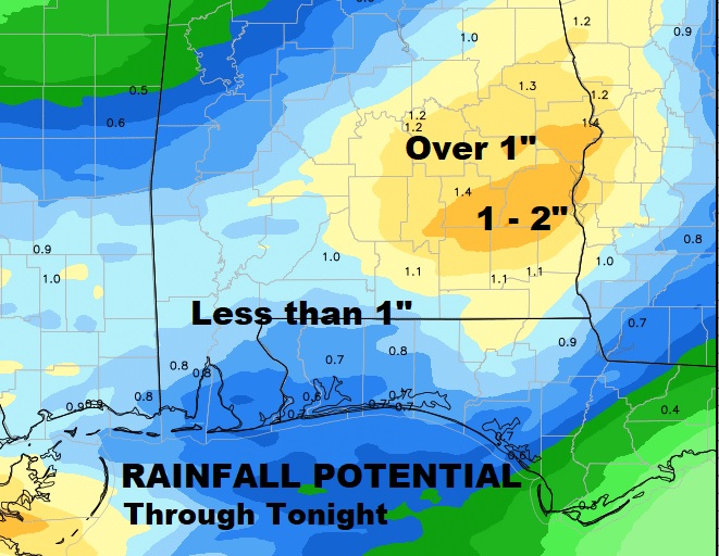
HOW MUCH RAIN?: Many areas in central and south Alabama are likely to see more than 1”. Some spots will be closer to 2”. This will help the pollen problem.
NEXT FEW DAYS: Behind the storm, much cooler/colder air will funnel back into the state. Windy again, with highs in the 50’s and lows in the 30’s. Like last week it appears we will near or close to gfreezing three mornings.. Tuesday, Wednesday and Thursday morning. Alabama growers be ready to protect your sensitive plants again. I truly thing this may indeed be the last freeze. There is no way to know that for sure, though.
—
Stay weather aware today with our weather app. It will alert you instantly to any severe weather alerts for your area. Plus, you can see interactive radar down to the neighborhood level, and future radar. I’ll have a complete video update for you on Monday morning by about 4:45AM.
-Rich