Good Morning! Our big warm-up continues. But, all eyes are on our next storm system tomorrow. A frontal system will bring a squall line across the state. There’s a risk that some storms could be strong to severe. My concern is just a notch higher, due to some better severe weather parameters. I have updated severe weather threat, and I have an update on timing and potential rain amounts. Have you got big plans for the Easter weekend? I have an update on a rather remarkable holiday weekend forecast for here and the Beach. Your Wednesday morning personal weather briefing is packed with some good information.
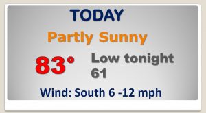
We’re headed for the lower 80’s today, and today’s weather should be dry & tranquil.
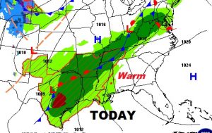
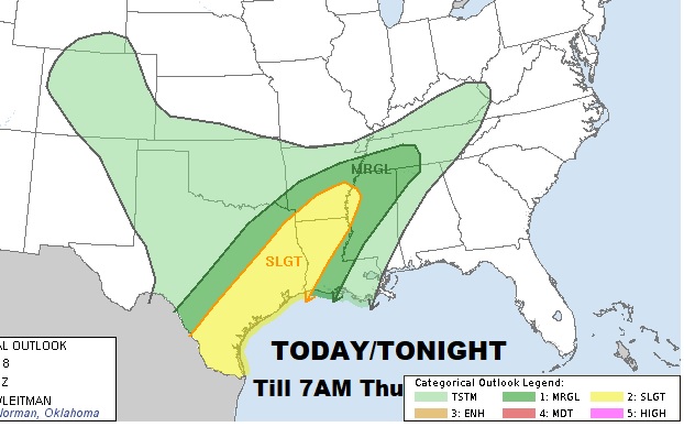
The severe weather threat stays west of Alabama today and tonight.
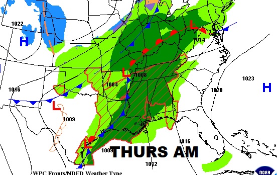
Here’s the set-up for tomorrow, as a front approaches from the west with a Squall line (QLCS) moving across the state during the afternoon.
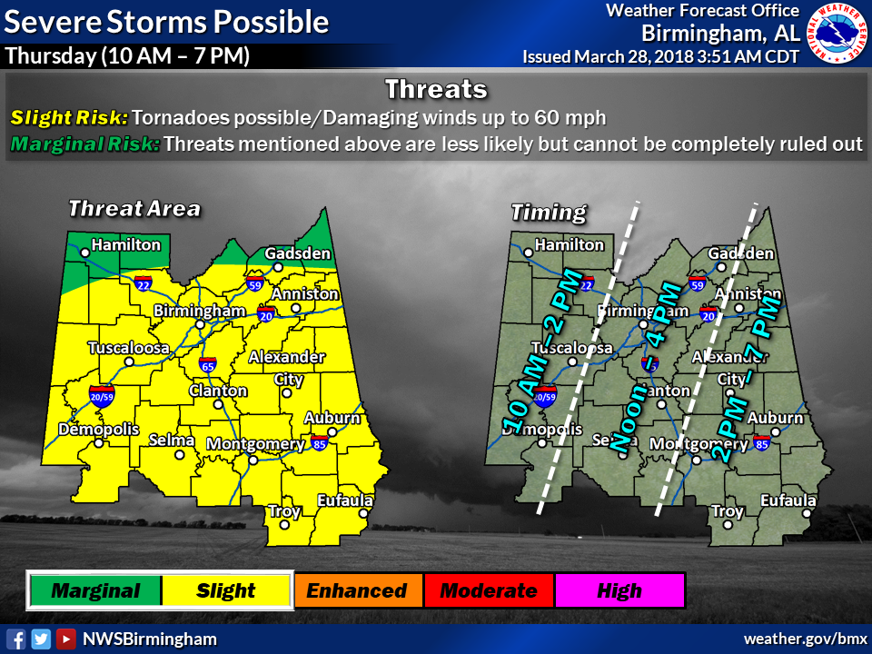
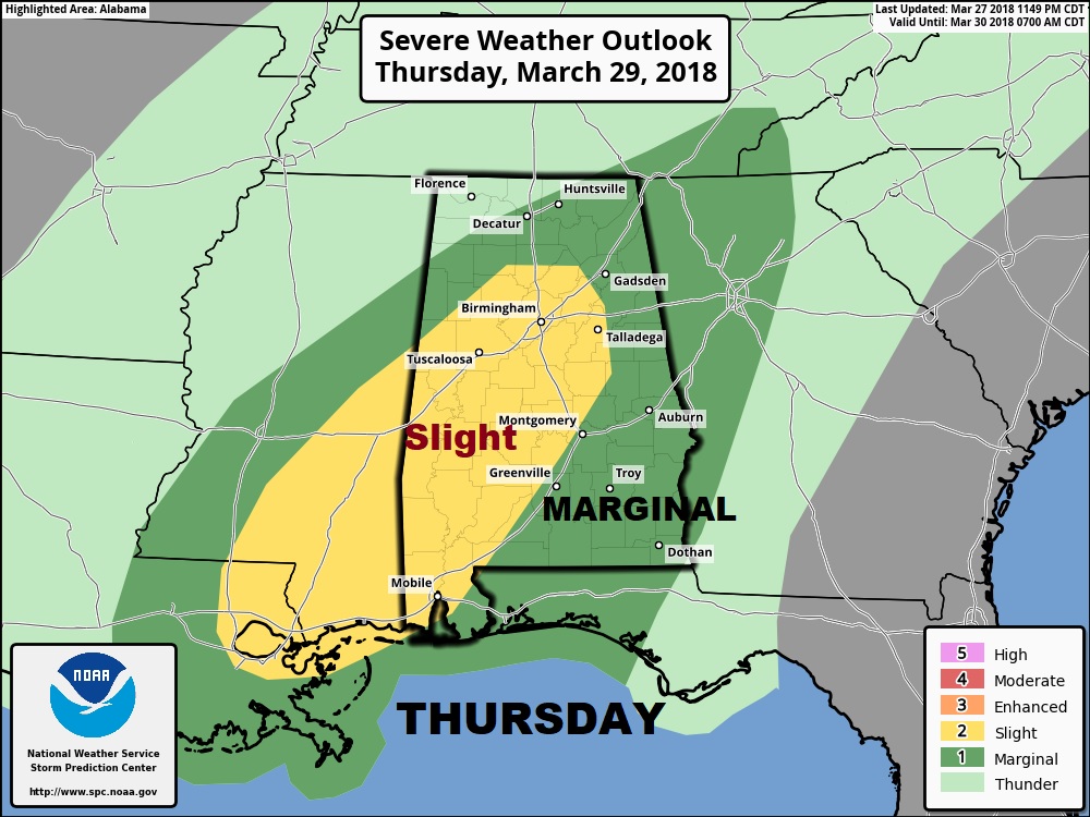
The threat parameters are a little higher tomorrow. All of the area in a “Slight Risk” Damaging wind gusts 60+ in the stronger storms and tornadoes are certainly possible.
Here’s a wider view of the whole state from the Storm Prediction Center…
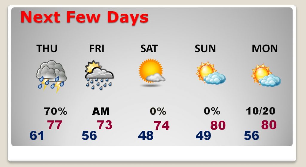
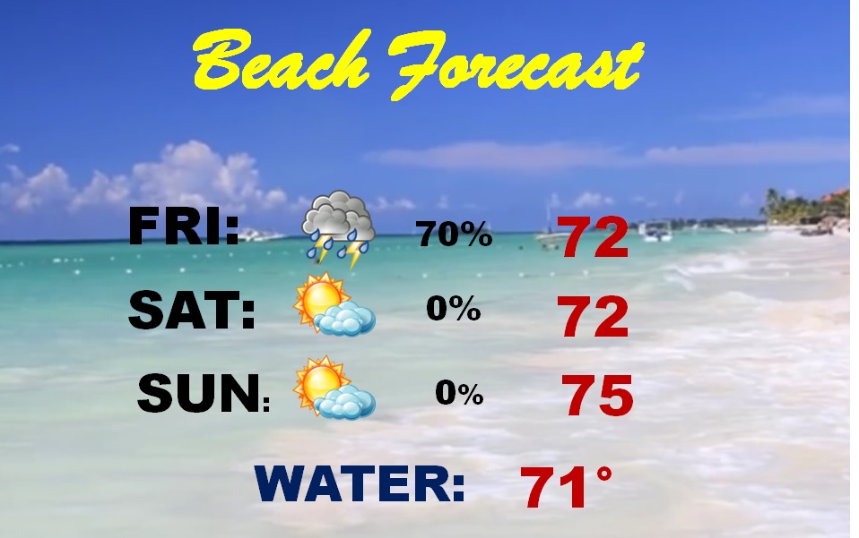
AFTER the storm system…the Easter Weekend looks rather remarkable for here and the Gulf Coast Beaches.