Good Morning! We have much to discuss, as the important Memorial Day Weekend begins. Center stage is the looming tropical threat in the Gulf over the holiday weekend. Will this system become a tropical storm? Where will it go, and when? I’ll do my very best, on this video, to update you on every aspect of this Tropical Threat, as you make decisions and refine your weekend plans. Unfortunately, many weekend plans will be adversely affected. Have a plan “B”. I hope you have a few minutes to watch this important update.
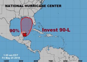
New NHC update increases to 90% the chances that Invest 90-L will develop into a Depression or Tropical Storm over the Memorial Day Weekend.
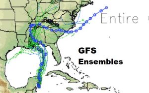
The Global models have several “ensemble runs”. The GFS shows most of it’s ensemble members agreeing with the EURO idea, which would put us on the east side of the track. Only the GFS operational run is farther east and faster than the Euro. The EURO ensembles have not changed much.
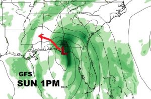
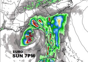
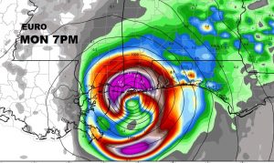
Where could this system come ashore and when? The latest operational GFS run is a little farther east now near Panama City Sunday afternoon. The EURO is stronger with the intensity and slower on the arrive time. It shows what will likely be a tropical storm moving closer to the Mobile Bay Sunday night into memorial day. The Euro certainly raises eyebrows.
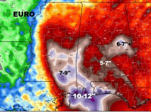
Depending on which model you believe, there could be some potentially reverential rainfall totals in spots. The Euro model is particularly aggressive on rain totals.
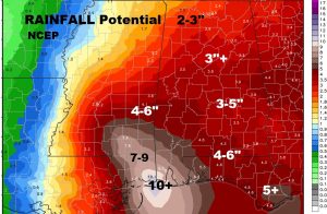
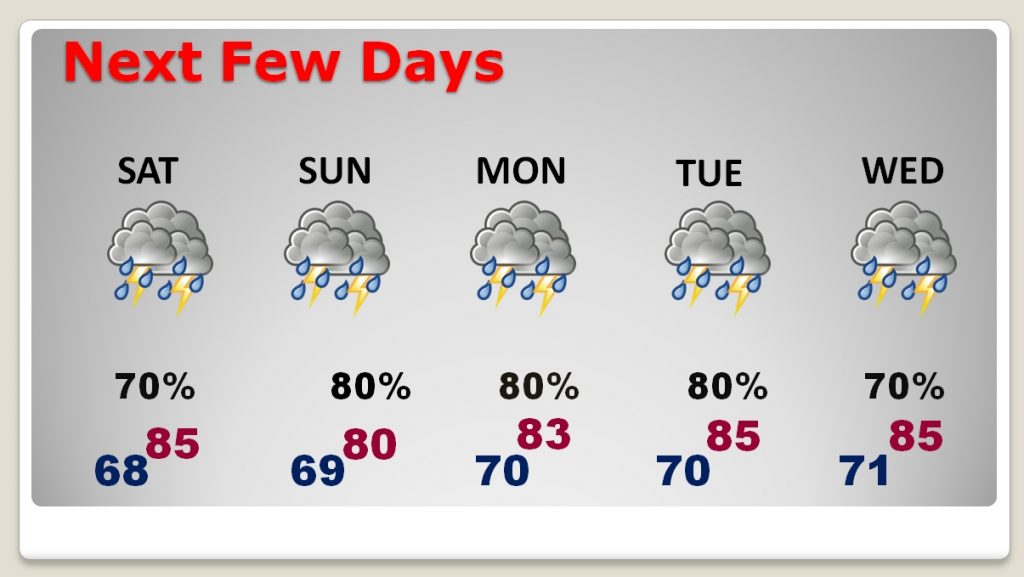
The rain threat is strong not only through the Holiday weekend, but through at least mid week and beyond.
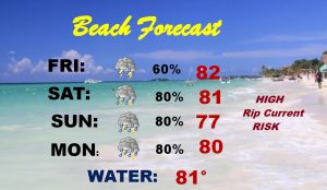
Horrible forecast for all the beaches this weekend. And, it’s not just the heavy rain. A dangerous rip current threat will be around all werekend.