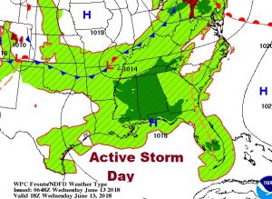
Good Morning! News from the Tropics this morning as the Caribbean “area to watch” becomes Invest 91-L and heads for the Gulf. For us another active thunderstorm day again. Wait until you see Future Radar. How long will we stay in this pattern? I see some subtle changes on the horizon. I have an update on the weekend forecast for here and the Gulf coast beaches. And, more, on your Wednesday morning personal weather briefing.
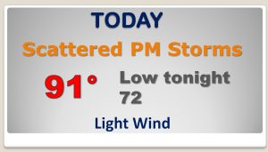
Another very active storm day again. Radar will be busy. Random storms.
Generous supply of storms each day, in the afternoon & evening. but storms may start to thin out a bit by Sunday and Monday.
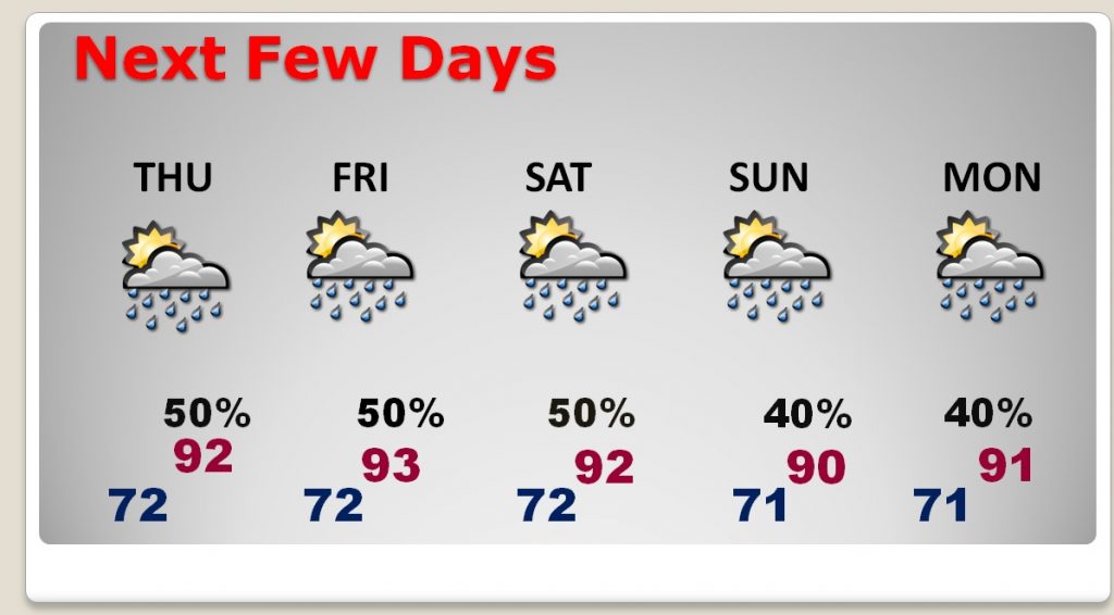
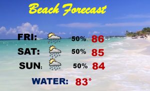
Scattered storms could interrupt your Beach plans at times, but most of the time it will be dry. All in all, this is not a bad Beach forecast. I’m headed that way, too, and this forecast doesn’t concern me at all.
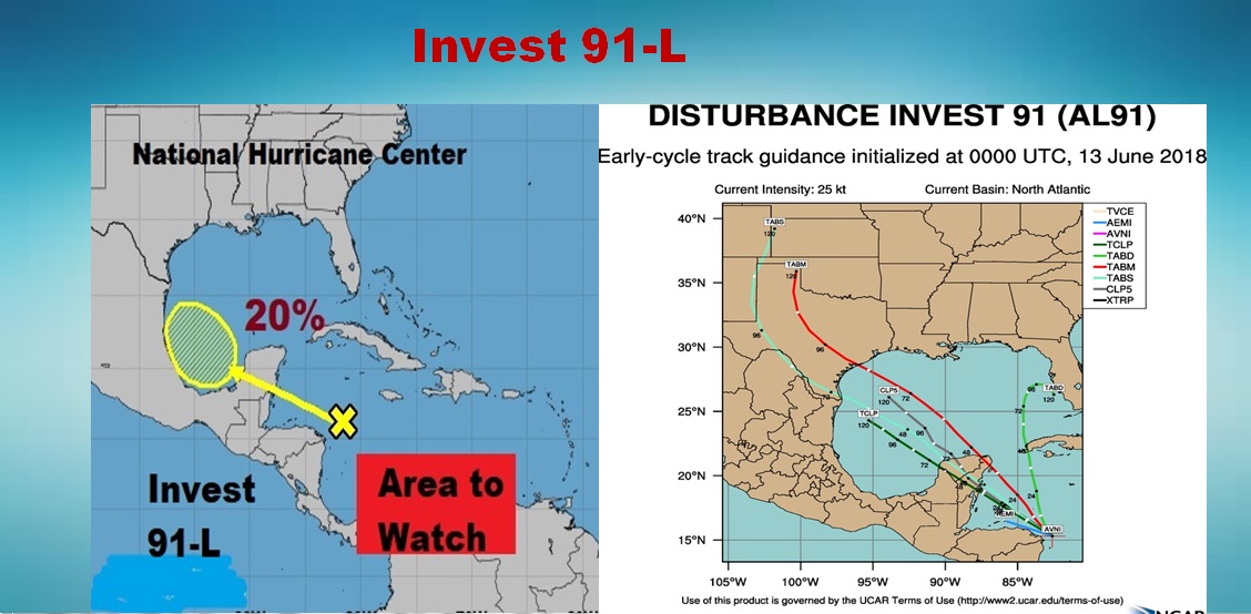
The Area To Watch in the Caribbean has been promoted to Invest 91-L as it heads toward the Gulf, with a low chance of development.
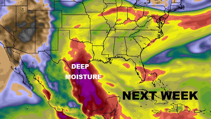
Looks like all that Deep Moisture associated with 91-L will stay west of us next week
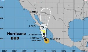
Meanwhile Pacific Hurricane Bud is headed for Baja California. It could still be a depression when it lifts north to AZ and NM with lots of tropical moisture.