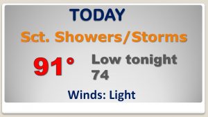
Happy Friday! We’ll be watching radar carefully today, as a cluster of potent storms slides southward through the state. Some of the storms could be severe with damaging winds. On this video, I’ll show you Future Radar, to give you an idea on timing and which parts of the state are most at risk. Plus, I’ll walk you through an updated weekend forecast. Looks like another upper high is on the menu for late weekend and beyond. Could that mean more triple digit heat indices? Some good information for you, on your Friday morning personal weather briefing.
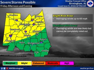
A cluster of storms will slide southeastward across the state today. Some of the storms could be severe weather damaging wind gusts 60+ mph. Make sure you have our weather app on your phone. It will instantly alert you if there is a warning for your area.
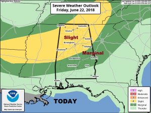
The greater threat exists in the yellow area along and north of an Alex City Clanton line. But a few severe storms are even possible as far south as Troy and Greenville by this afternoon and this evening.
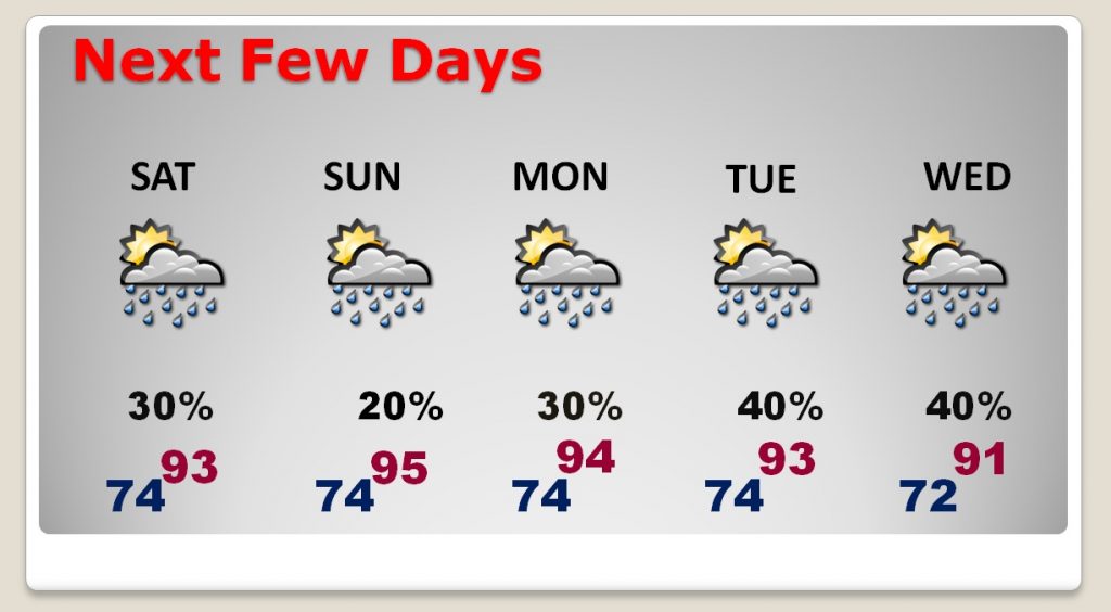
The Weekend forecast is pretty routine with relative small rain chances, especially Sunday. Hot and humid with scattered storms Monday through Wednesday.
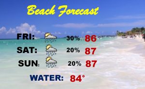
If you are beach bound this weekend this is a pretty good forecast!