
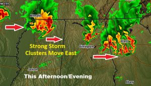
Like yesterday, clusters of strong thunderstorms will roam across part of our state. But, it appears, today, the strongest storm clusters will stay north of the I-85 corridor. Over much of south Alabama storms will be scattered and more widely separated. The trend, starting tomorrow, will be for fewer storms and hotter days, again, as another upper high builds above us.
THE SET-UP TODAY: The most active weather stays north of most of us. Clusters of powerful storms will roam through North Mississippi, North Alabama and north Georgia. Here’s a future radar snapshot this afternoon.
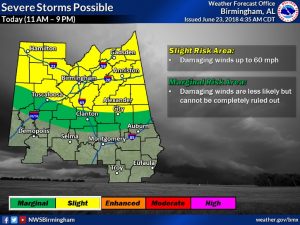
Like yesterday, some of the storms will become severe with damaging wind gusts 60+ mph possible. The Severe Risk covers the northern half of the state.
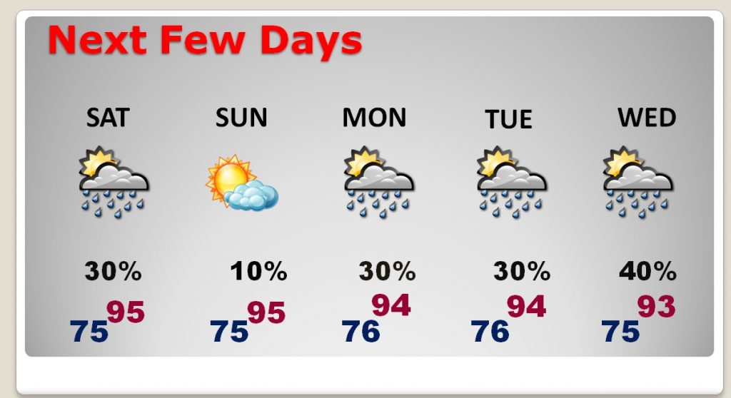
For the rest of us… Today will be partly sunny, with spotty, pop up storms here and there. It will be very hot. High 94. Heat index 100+. Tonight’s low 75.
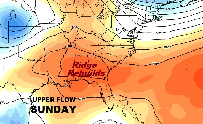
NEXT FEW DAYS – UPPER HIGH RE-BUILDS: The big upper High Pressure Ridge becomes stronger again, tomorrow, into next week. Storms will thin out. Temperatures will soar to the mid 90s daily and the heat index will approach the 105 danger range.
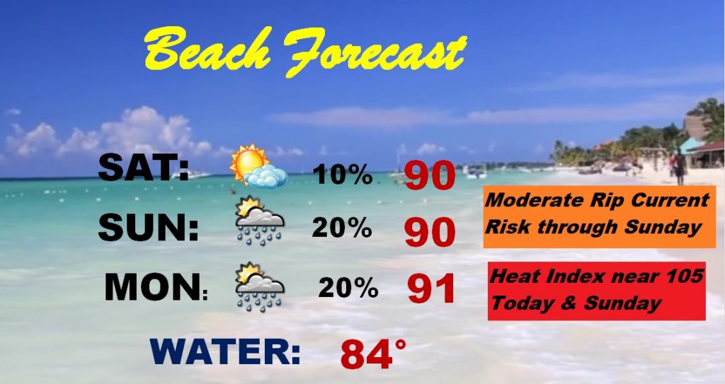
BEACH FORECAST: HOT Beach Forecast, with highs near 90 this weekend and the heat index near the 105 danger range. Moderate rip current risk through tomorrow. Rain chance small but not zero.
—
I’ll have another complete blog update Sunday morning around Dawn. Have a nice Weekend!
Rich