
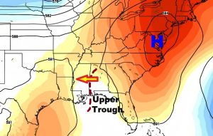
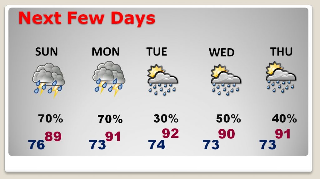
Welcome to July! Your holiday plans could be interrupted from time to time, in the week ahead. We live in the tropics this time of year. A series of “easterly” disturbances will cross the area over the next few days, traveling from east to west. The days with best odds of getting wet are today, tomorrow and Wednesday. The day with the smallest rain threat appears to be Tuesday. High humidity will continue, with no relief in sight.
TODAY: Patchy dense fog has lowered visibility to below ½ mile in spots through 8AM. Any sunshine today will be limited. Showers and storms will be widespread during the afternoon and evening hours. Locally heavy downpours. Temperatures will be held down by clouds and showers. High today upper 80s to near 90. Low tonight in the mid 70’s.
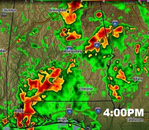
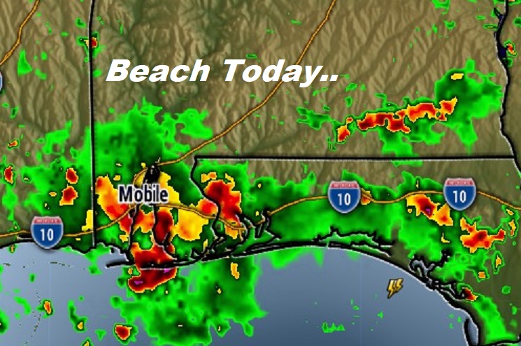
Radar will be active and colorful. As an example, here’s a late afternoon Future Radar snapshot.
NEXT FEW DAYS: Better than normal rain chance continues next several days, through the holiday and beyond. The days with the best rain chances are today, tomorrow and Wednesday. The high humidity will continue with no end in sight.
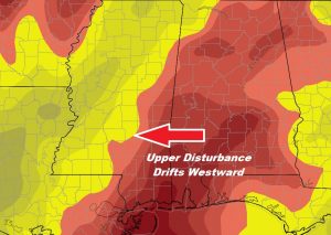
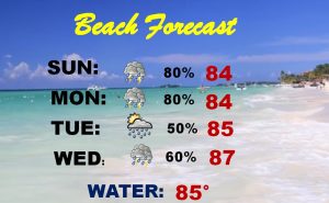
BEACH FORECAST: There’s no way to sugarcoat the Beach forecast. There will be a wealth of showers and storms each day. Radar sill be densely populated. Here’s an example from the afternoon.
The better than normal rain chances continue each day through the holiday week. Be flexible. Have a plan “B”.
—
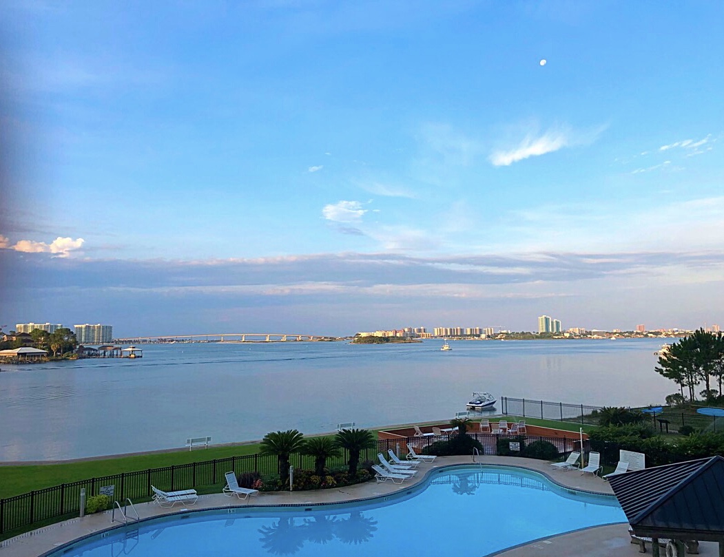
Have a great weekend. I am Homebound later this morning after a few days in New Orleans and Orange Beach. Your next complete video will be Monday morning at 4:45AM. Here’s Orange Beach this morning. Looking toward Orange Beach from the Backbay, Terry Cove.
Rich