
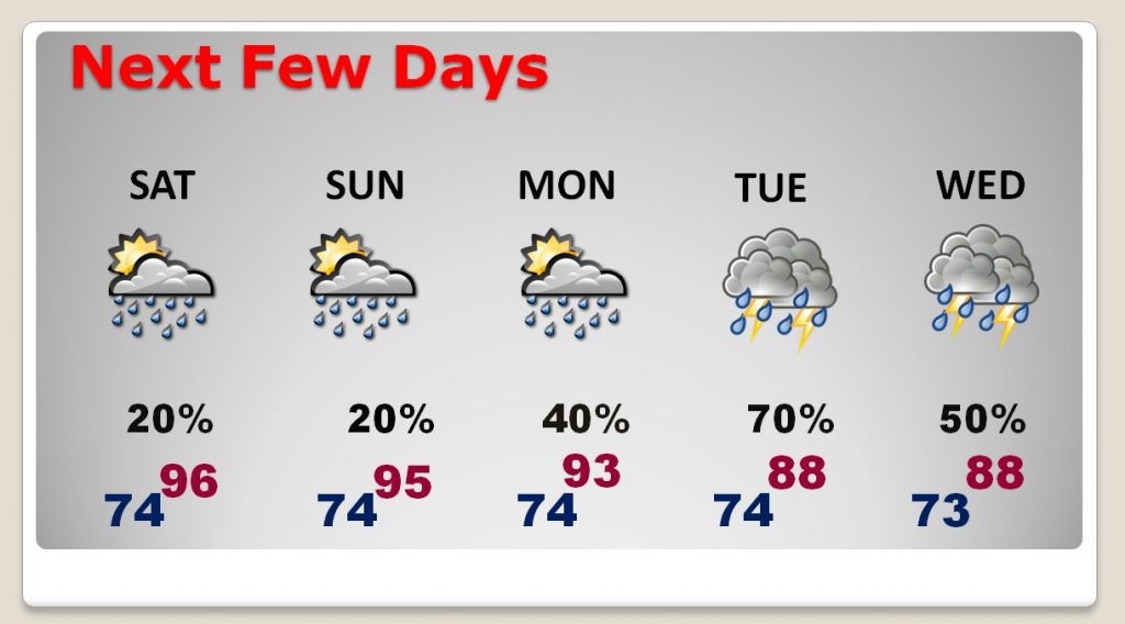
Your chances of seeing a shower today and Sunday depend on where you live. For most of us, the rain chances will be very small. In southeast Alabama, south of a stalled front, the chances are a little better. The bigger story for the weekend is the heat. Highs will soar into the mid 90’s today and Sunday. The heat index will be in the upper 90’s to near 100. Much better rain chances return next week, especially Tuesday through Thursday as a front approaches.
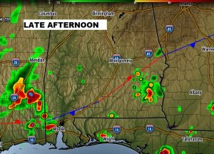
TODAY: Look for a good bit of sunshine, mixed in with some clouds. Highs near 96. Isolated storms are possible. Rain chances range from 20% in Montgomery to about 40% in Dothan. (see map) Tonight’s low 74.
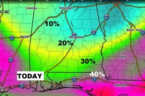
Best rain chances today are along and south of that stalled front in southeast Alabama, mostly south of Troy.
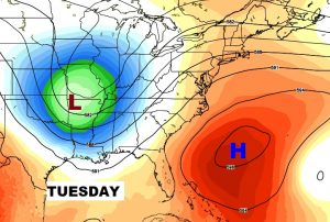
THE WEEK AHEAD: Two keys to the week ahead involve an upper low approaching from the northwest. Rain chances will increase Monday. Showers and storms will become rather numerous Tuesday, Wednesday & Thursday.
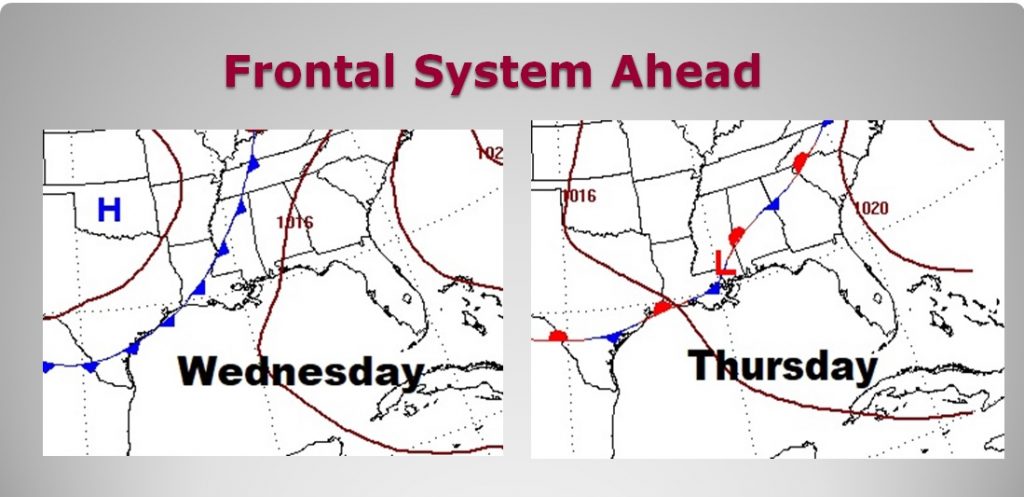
NEXT FEW DAYS: Hot through the weekend, with a small chance of rain. Rain chances increase next week, specially Tuesday through Thursday. Highs may fail to reach 90 by mid week.
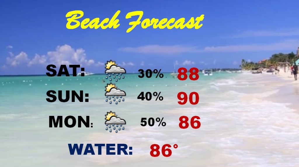
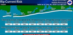
BEACH FORECAST: Rain chances are a bit higher down at the coast this weekend, south of the front. Still, though, showers & storms will be spotty. The rip current risk is listed as low. Gulf water temperature is 86.
—
Have a nice weekend! I’m out of town this weekend, but I’ll do my very best to get you another Blog update first thing Sunday morning.
Rich