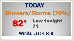
Good Morning! Once again today the stage is set. Showers and storms will drench many communities again. Locally heavy downpours. But, I’ll tell you about a trend to fewer storms on the horizon. I have tweaked the weekend forecast. Get ready for the return of 90+ degree heat and perhaps a more “regular” summer pattern. I’ve adjusted the rain chances. Will the mid 90’s rear it’s ugly head next week? We’ll check the tropics, too on your Thursday morning personal weather briefing.
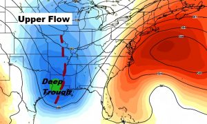
That big trough in the upper atmosphere out to the west of us, in concert with a surface front will set the stage for more scattered to numerous storms today.
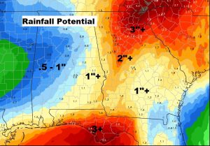
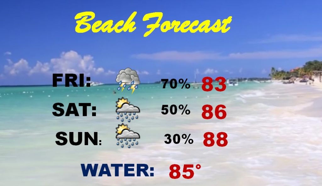
The higher rainfall totals next day or two will be over the eastern third of the state, and heavy rain totals will continue at the beach.
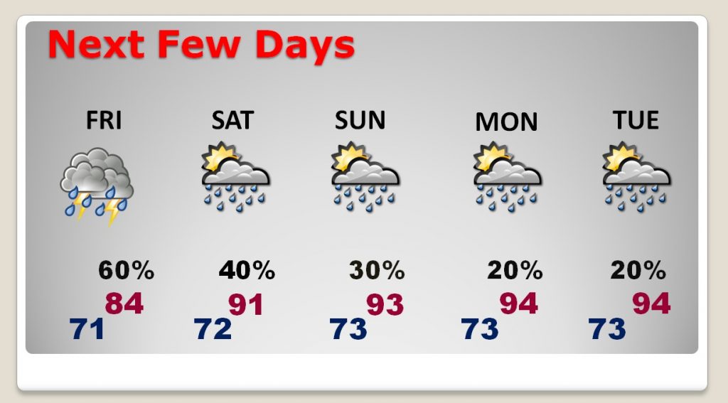
Scattered to numerous storms continue Friday, but over the weekend and into early next week, the number of storms start to decrease. Meanwhile temperatures will soar back well into the 90’s.
The Beach has been extremely wet all week and it’s been a depressing place to be. But, gradually over the weekend, the number of storms will start to thin out, and the forecast becomes much more routine by Sunday.
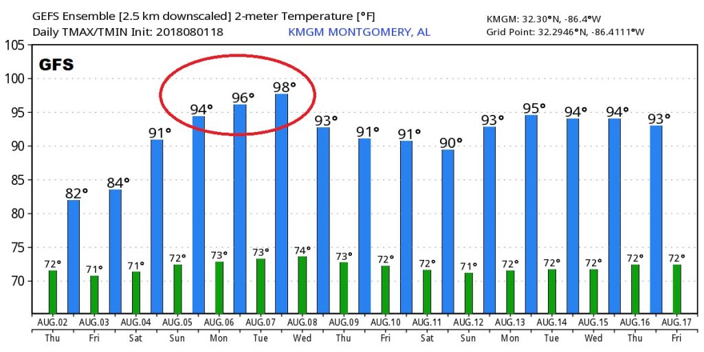
The raw Temperature numbers from the GFS model really illustrate the big changes ahead. From lower 80’s today, we are soon hdeaded back to the 90’s