
Be flexible with your outdoor plans this weekend. Scattered to numerous storms will be roaming around for about the next 4 days. It will be feast or famine. Some towns will get some very heavy downpours. Other towns not as much. But, on the horizon is a mid week front which will bring some brief relief, with lower humidity and a break from the daily storms.
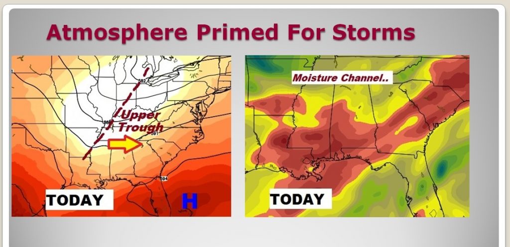
Here’s the set up today… And upper trough of low pressure approaches, and collides with more than ample available moisture, leading to widespread storms.
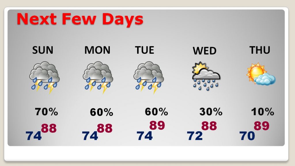
TODAY: Scattered to numerous storms will be roaming around, especially this afternoon and this evening, but the risk will also continue tonight. High today will be in the upper 80’s, held down by clouds and showers. Low tonight 74.
FUTURE RADAR: You should never take Future Radar literally. But, I show these hi-res model snapshots just to give you a sense of the expected coverage on the storms. It’s easy to see it will be an active day. Be aware of the lightning threat today, especially if you are out in the open, or up at the lake. If you are close enough to hear thunder, you are close enough to be struck. Local flooding of low lying areas is possible.

NEXT FEW DAYS: Scattered to numerous showers and storms will be around through Tuesday at least. A mid week front will deliver some drier air by late Wednesday, and through the later part of the week. Few if any storms will be around by Thursday, and the humidity will be a little bit lower. You will feel a difference.
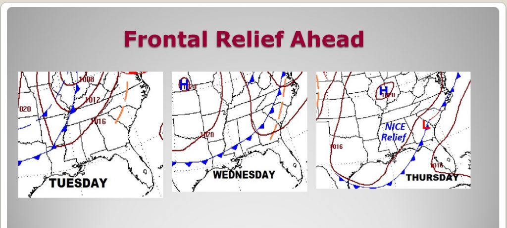
FRONTAL SYSTEM WILL BRING RELIEF: The big news…the exciting news this week, involves a rare summer front which will make it all the way through the state by about Wednesday, and delivering a shot of “nicer air”. You will feel a difference by Thursday. A nice change. Storms will be almost non-existent by late in the week. Nights will be a little more tolerable, too.
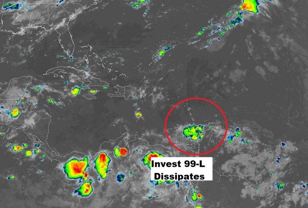
THE TROPICS: Invest 99-L is no longer a system being monitored by the National Hurricane Center. It’s just a weak tropical wave moving through the islands. The rest of the tropics are quiet as a mouse, which is quite unusual for mid August. One year ago today, Tropical Storm Harvey was moving through the Islands on its way into the Caribbean.
—
I’m have another Blog update first thing Sunday morning. The next complete video will be Monday morning. Have a nice weekend!
Rich