
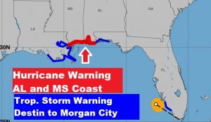
The Hurricane Watch has been replaced with a hurricane WARNING on the Alabama and Mississippi Gulf coast. Storm surge warning extended east to Dauphin Island. Tropical Storm Warning from the Okaloosa/Walton county line westward to Morgan City, La.
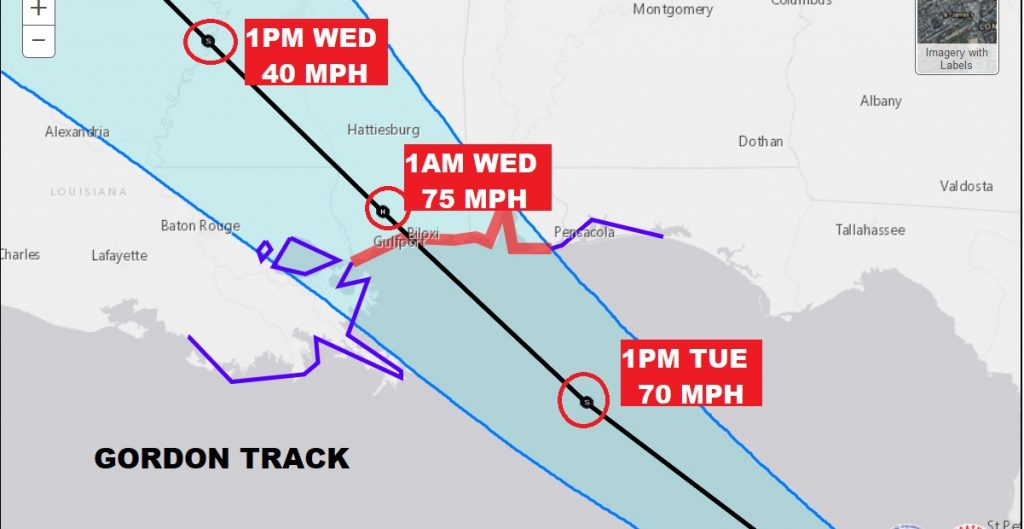
Tropical Storm Gordon is located 50 miles WNW of Fort Myers moving WNW at 17. Winds remain at 50 mph. Pressure 1006 mbs. NHC: The center of Gordon will approach the central Gulf Coast within the warning area late Tuesday or Tuesday night, and move inland over the lower Mississippi Valley on Wednesday.\
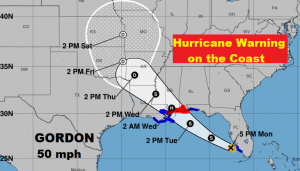
Close up of the Gordon cone shows a strong 70 mph Tropical Storm well south of Pensacola Tuesday afternoon just after lunch. It should be onshore, inland over south Mississippi as a minimal Hurricane Wednesday morning, and a minimal tropical storm in central MS Wednesday afternoon. Extremely heavy rain will accompany the system, especially on the east side of the track. A few tornadoes may occur along and well east of the track after landfall.
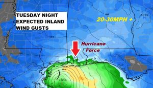
NWS: At this time, it appears that Gordon will have little impact for
Central Alabama. We are currently not even in the error cone for
this tropical system and the model output has been consistent on
the track. The latest guidance suggest the potential of a CAT 1
hurricane impacted the Mississippi Coast. The overall wind field
associated with this storm is rather small. Will not introduce any
wind threat at this time, but will monitor locations from
Montgomery to Aliceville for a small chance that Wind Advisory
Criteria may become possible (Sustained winds 20-25 with gusts
30-35 mph).
The next significant update (full advisory from NHC at 10). Intermediate advisory at 7. I will will have a complete video update early tomorrow morning. My alarm goes off at 1:15. Your video online by 4:45AM. Stay weather aware.
–Rich